28th International Conference on the History of Cartography
28ste Internationale Conferentie voor de Geschiedenis van de Kartografie
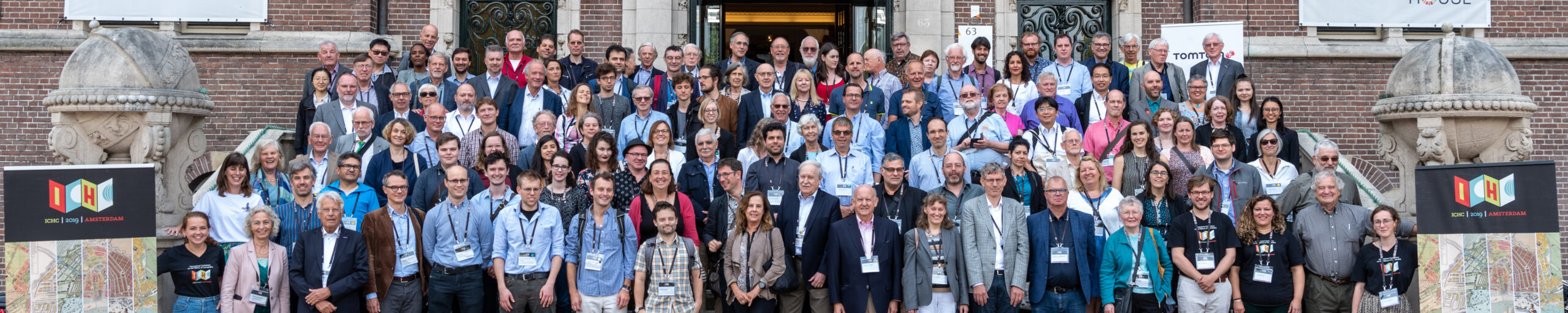
14-19 July 2019 Amsterdam
ICHC 2019 was organized by the Special Collections of University Library of Amsterdam – since 1 January 2019 named ‘Allard Pierson, the Collections of the University of Amsterdam – and the Explokart Research Group. Other institutions in and beyond Amsterdam, such as the University Libraries of Leiden and Utrecht, the National Archives, the Royal Library, the Amsterdam City Archives, Het Scheepvaartmuseum, the Royal Palace Amsterdam and the Zuiderzeemuseum.
The conference was held in the KIT (Koninklijk Instituut voor de Tropen), and the theme of the conference was Early Maps, Modern Perspectives. Understanding Early Maps in the Twenty-First Century. The opening ceremony was held in the auditorium of the University of Amsterdam on Sunday 14 July with two key-notes: Context is everything.. by Peter Barber and Reading maps in Golden Age Amsterdam and beyond by Djoeke van Netten. At the closing session a final key-note was presented by Günter Schilder, Early Dutch Sailing across the World’s Oceans. A Chapter in Dutch Maritime Cartography.
From the ‘Welcome’ by conference director Bram Vannieuwenhuyze:
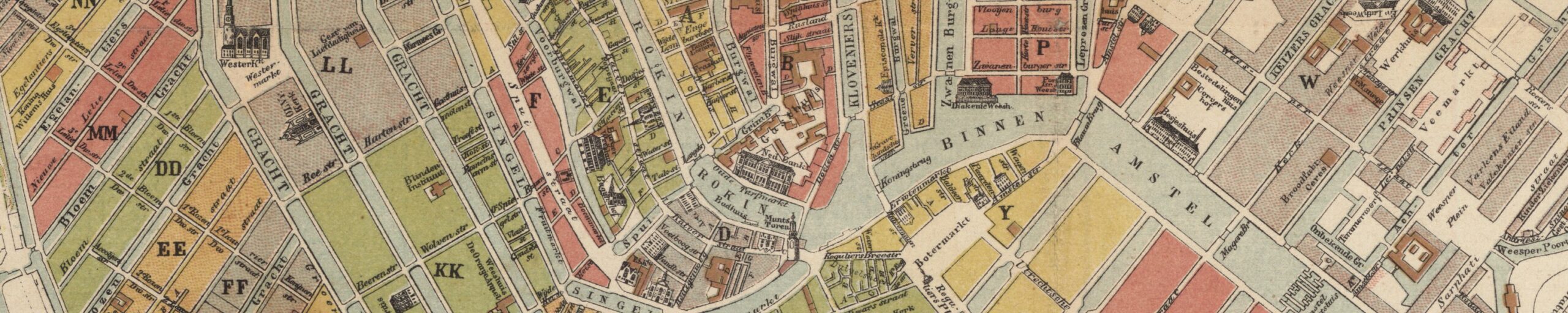
“This Conference takes its place in the long and vivid tradition of cartographic activities in Amsterdam and of past ICHCs, which have been organised since 1964. As Geert ten Dam and Günther Schilder have noted in their forewords, Amsterdam was not only the seventeenth-century mapping capital of the world but also the venue of the 13th ICHC, which took place exactly thirty years ago, in 1989. Hence the return of the ICHC to Amsterdam is an ideal occasion to reflect upon changes and continuities in the field, to investigate new opportunities and directions in research and conservation practices, and thus to reconsider the position and value of early maps in the twenty-first century. The title of this year’s Conference, Early Maps, Modern Perspectives. Understanding Early Maps in the Twenty-First Century, emphasises this important link between the old and the new, between tradition and innovation, which in our opinion are crucial aspects of our field of study and expertise.
“The week’s schedule presents that same combination of tradition and innovation. On the one hand, ICHC 2019 follows the path of previous occasions in offering pre-Conference events (the ICA Workshop Controlling the Waters in Utrecht and the ISCEM Meeting in Leiden); an opening ceremony on Sunday; a five-day scientific programme with a range of paper sessions; the Poster Session on Wednesday (an initiative introduced in Amsterdam in 1989!); a closing ceremony and Conference Dinner on Friday; a social programme with receptions and exhibitions on five evenings, and a post-Conference tour on Saturday. But the Amsterdam Conference team also proposes some innovations. We are happy to announce that no fewer than 128 speakers have the opportunity to present their paper or poster – and yet, the scientific committee still had to refuse a large number of proposals. The majority of them have been assigned to a range of thematic parallel sessions. In addition, a plenary paper session is scheduled each day just before lunch, which offers the opportunity to those scholars whose proposals received the highest marks from the committee to present their work to the entire audience.
“A second innovation is the organisation of a handful of interactive workshops. Technical workshops were introduced at the Budapest ICHC in 2005, yet this initiative was not continued. These workshops are intended for small audiences of about 20 people and focus on digital tools for studying and contextualising maps, launch round table discussions, shed a light on the editorial process of a map or book, or take people outside to discover how cartographers mapped the city or the sites where the Amsterdam map publishers had their workshops. The ultimate goal of this part of these workshops is to incite the participants to leave their seats and interact more actively with colleagues, tools and sources.
“Parallel to the preparation of ICHC, some institutions and publishers have made plans for exhibitions and publications related to specific aspects and themes within the history of cartography. Together with Lannoo Publishers, Marieke van Delft and Reinder Storm have edited the book De geschiedenis van Nederland in 100 kaarten (‘The history of the Netherlands in 100 maps’). On that occasion an exhibition has been set up in the Royal Library in The Hague, presenting 40 themes of the book covered by maps taken from its rich cartographic collection. In partnership with Allard Pierson, the Royal Palace Amsterdam (on the Dam Square), has organised the exhibition The Universe of Amsterdam. Treasures from the Golden Age of cartography, with its impressive floor maps of the world and the night sky – each measuring 624 cm in diameter and hence the largest maps in the world – as eye-catchers.
In the Amsterdam City Archives, a selection of beautiful manuscript estate atlases, commissioned by some urban charitable institutions in the course of the sixteenth and seventeenth centuries, are presented to the public through the exhibition Kaartboeken van Amsterdam 1559 – 1703. A book with the same title, by curator Marc Hameleers, is published by the THOTH company. In Spring 2019 Het Scheepvaartmuseum opened an entirely new presentation of its rich collections through two main themes, The Republic at Sea and Maps & Marvels, the second focussing on how Dutch seafarers in the Golden Age found their way, and how these voyages defined the way Europeans saw the world. During ICHC the Conference participants have the occasion to discover all these splendid initiatives. In addition, both the National Archives and Allard Pierson will exclusively welcome the participants and present a representative sample of maps and atlases taken from their large collections. (for an on-line version of the Allard Pierson pop-up exhibition, click here). Finally, as was the case with the 26th ICHC in 2015 in Antwerp, the journal Caert-Thresoor devotes a bilingual special issue to this 2019 ICHC; in parallel the Dutch journals De Boekenwereld and Simulacrum also publishing thematic issues on maps and cartography.”
There were seven exhibitions, as can be read above, in chronological order of the visit by the conference participants:
- Pop-up exhibition Muller’s maps of the continents in the Allard Pierson, the Collections of the University of Amsterdam, organized by Peter van der Krogt (Sunday 14 July, with on-line version.
- The Universe of Amsterdam, Amsterdam, Royal Palace.
- De geschiedenis van Nederland in 100 kaarten, Den Haag, Royal Library.
- Pop-up exhibition in the Royal Library, The Hague, organized by Marieke van Delft and Reinder Storm (Wednesday 17 July).
- Pop-up exhibition in the National Archives, The Hague, organized by Gijs Boink (Wednesday 17 July).
- Kaartboeken van Amsterdam 1559 – 1703, Amsterdam City Archives.
- The Republic at Sea and Maps & Marvels, Amsterdam, Het Scheepvaartmuseum (permanent exhibition since April 2019).
The closing dinner on 19 July took place in Het Scheepvaartmuseum, and the post conference tour was on Saturday 20 July to the Zuiderzeemuseum in Enkhuizen with a buffet diner on board the MS Friesland sailing on the IJsselmeer.
Conference team
- Bram Vannieuwenhuyze, Chair, Conference director.
- Marleen Smit, Conference manager.
- Paula van Gestel-van het Schip, Treasurer and Editor.
- Reinder Storm, Communication officer.
- Marissa Griffioen, Desk Manager.
Organising committee
- Bram Vannieuwenhuyze, University of Amsterdam.
- Marleen Smit, University of Amsterdam.
- Paula van Gestel-van het Schip, University of Amsterdam.
- Reinder Storm, University of Amsterdam.
- Peter van der Krogt, University of Amsterdam.
- Marissa Griffioen, University of Amsterdam.
- Marco van Egmond, University of Utrecht. ICA Meeting.
- Martijn Storms, University of Leiden. ISCEM Meeting.
- Marieke van Delft, Royal Library, The Hague. Welcome and Exhibition.
- Alice Taatgen, Royal Palace, Amsterdam. Welcome and Exhibition.
- Gijs Boink, National Archives, The Hague. Welcome and Exhibition.
- Marc Hameleers, City Archives, Amsterdam. Welcome and Exhibition.
- Diederick Wildemann, Maritime Museum, Amsterdam. Welcome, exhibition and diner.
- Erik Walsmit, Zuiderzeemuseum, Enkhuizen. Guided Conference tour.
Editorial support: Francis Herbert, London
Papers
* = not read, abstract in program book.
Key-note lectures
- Peter Barber (GB). Context is everything..
- Djoeke van Netten (NL). Reading maps in Golden Age Amsterdam and beyond
Session S1: Maps and Water – Part 1. Chairs: Sjoerd de Meer and Diederick Wildeman)
- Bruno Almeida (PT). Through his “Wright” eyes: Analysing nautical chart problems in the sixteenth century.
- Tom Harper (GB). Additional uses for Henricus Hondius’s map of the English Fenland (1632).
- Victoria Morse (US). Meanings of Rivers on Late Medieval Maps.
Session S2: Colour and Decoration. Chair: Francis Herbert)
- Ad Stijnman (NL). Maps and Plans Printed in Colour before 1820.
- Karen Severud Cook (US). The Technological Migration of Emerging Design Concepts: Symbolising Geology on Maps by Combining Colors, Tints and Patterns, 1790-1970.
- Chet Van Duzer (US). Print in a Manuscript Realm: The Use of Hand-Stamps in the Decoration of Renaissance Nautical Charts.
Session S3 (Special Session 1): Between the Map and the Landscape: ‘Drawing’ Borders as an Act of Translation, organisers: Catherine Gibson, Verena Bunkus and Louis le Douarin. (chair: Martin Vailly) (NB was read on Tuesday).
- Catherine Gibson (IT). Moving Between Scales: Uses of Cartographical Knowledge in the Delimitation of the Estonian-Latvian Border in 1920.
- Verena Bunkus (DE). Borders on the Map, Borders on the Ground. Materialisation and Visualisation of Marienwerder Boundary Area, 1920-1930s.
- Louis Le Douarin (IT). Charting the desert boundaries of the Levant States: the French Topographic Bureau;s move towards the east.
Session S4. Chair: Marco van Egmond)
- Joaquim Alves Gaspar (PT). Maps and nautical charts historically: two of a kind or different cartographic paradigms?.
- Marian Coman (RO). Turkey in Europe. The Versatility of a Cartographic Template.
- *Jean-Baptiste Piggin (DE). Map Orientation in the World of the Tabula Peutingeriana (mr. Piggin died a few weeks before the conference).
Session S5: Maps and Water. Part 2. Chairs: Sjoerd de Meer and Diederick Wildeman)
- *Ansari Taha (DZ). Mapping living heritage: the foggara of Adrar, Algeria.
- Weichung Cheng (TW). Sailing along the Riverbanks and Shores: Re-constructing the Visual Representation of a 17th-century Dutch Itinerary Map of Taipei Basin.
- Linda Rui Feng (CA). Sources of the Yellow River on Ming Dynasty Maps: Hydrography, Cosmography, and Geographical Knowledge.
- Charlotta Forss (GB). From New Sweden to Pennsylvania: Early modern maps of the Delaware River.
Session S6a: Historiography. Chair: Josef Konvitz)
- Eleanor Coulter (US). Mapping History: Time and Place in the Historical Geography of Jean-Baptiste Bourguignon d’Anville.
- Jörn Seemann (US). Searching for Cartographic Arguments: Historical Maps in J.B. Harley’s Writings
Session S6b: Nineteenth-Century Map Publishers. Chair: Zef Segal)
- Alexander Sievers (DE). Acting globally. German Map Publishers and the International Map Trade during the 19th Century.
- Ronald E. Grim (US). ‘Compiled from Official Sources’: Using Official Government Surveys to Promote Land Sales and Partisan Politics in Pre-Civil War Kansas and Nebraska.
Session S7 (Special Session 2): Mapping the Northern Pacific: transnational knowledge, instruments, representations, organisers: Katherine Parker and Edward Boyle. Chair: Felix Driver)
- Edward Boyle (JP). Knowledge, Security and ‘Cartographic Anxiety’: Creating and utilising cartographic knowledge in nineteenth-century Japan.
- Katherine Parker (US). Looking Northward: A Comparative Analysis of Two Maps Showing the North Pacific Before Cook.
- Vasilii Shchepkin (RU). Perception, exploration, representation and mapping of Ainu lands in Russia and Japan in 18th century.
- Yuto Ishibashi (JP). British connections in the early Japanese hydrographic surveying, c. 1860-1880.
Session S8: Maps and Water. Part 3. Chairs: Sjoerd de Meer and Diederick Wildeman)
- Henrique Leitão (PT). Ptolemaic cartographic prescription versus nautical charting: A forgotten sixteenth century scientific debate.
- Benjamin Khoo Jun Qi (NL). Navigation, Competition, Representation: Mapping the Straits of Melaka, 1502. 1688.
- Isabelle Delumeau (FR). Charting the north Atlantic waters in the 19th Century: an innovative cooperation between navy officers and fishermen.
Session S9: Colonial Cartography. Part 1. Chair: Kees Zandvliet)
- Danielle Gravon (GB). ‘Kandy is new Flanders’: Cartographic propaganda in the mapping of Dutch Ceylon.
- Gloria Kuzur and Swagata Basu (IN). Colonial Cartographies of Violence, Drama and Tradition: French Regional Mapping in India during the eighteenth century.
- Wolbert Smidt (DE). Lazarist maps of Ethiopia between local knowledge and imperialistic claims.
Session S10 (Special Session 3): Imaging the World: New Views, New Interpretations, organiser: Jana Moser. (chair: Nick Baron)
- Jana Moser (DE). Goode’s School Atlases and the idea of an ecological worldview around 1920.
- *Laura Pflug (DE). Ordering the World: The Concept of the Five Continents on Maps from Late Qing China.
- Matthew H. Edney (US). Cosmography, Geopolitics, and the Terraqueous Globe: Competing World Views in Eighteenth- and Nineteenth-Century Europe.
Session S11. Chair: Martijn Storms)
- Mario Cams (MO). The Martini-Blaeu Atlas of China (1655): Origins and Supporting Networks.
- André Reyes Novaes (BR). Exploration maps as hybrid documents in Jaime Cortesão’s historical narratives.
- Lin Hong (CN). The Cartographic Method of Martino Martini’s Novus Atlas Sinensis.
Session S12 (Special Session 4): Seizing the Islamicate World: Map Composition and Use in Islamicate Societies (10th-17th c.), organiser: Nadja Danilenko. (chair: Jean-Charles Ducène)
- Nadja Danilenko (DE). The Islamicate World in Pieces: Envisioning the Tenth-Century Abbasid Realm Through al-I??akhr?’s Maps .
- Yossef Rapoport (GB). Coordinates on medieval maps. Mathematical cartography in Islam.
- Pınar Emiralioğlu (US). Cartographic Knowledge and Imperial Power in the Seventeenth Century Ottoman Empire.
Session S13: Colonial Cartography. Part 2. Chair Kees Zandvliet)
- Bertie Mandelblatt (US). The Secret Voices of Maps: Independent Economic Activity on Colonial Maps of the Caribbean, 1500-1800.
- Lucía Rodríguez Arrillaga (UY). Mapping and territorialisation processes in transimperial spaces: the Río de la Plata region in the crossing of the Iberian empires (XVIII-XIX centuries).
- Valquiria Ferreira da Silva (BR). Father Cocleo’s geographical map: Dutch and Portuguese cartography in the representation of the American occupation.
Session S14: Colonial Cartography. Part 3. (chair: Kees Zandvliet)
- Guillaume Gaudin (FR). Maps and demarcation between Spain and Portugal after the first return voyage from the Philippines through the Pacific Ocean (1564-1568).
- Joy Slappnig and Felix Driver (GB). Between the Indigenous map and colonial cartography: a Tibetan map of Sikkim at the Royal Geographical Society.
Session S15: Urban Cartography. Chair: Colin Dupont)
- Lucia Nuti (IT). The issue of city mapping in the Ottoman sixteenth century.
- Minna Vuohelainen (GB). Mapping the ‘Nether World’: Charles Booth, George Gissing and Contemporary Journalists in Late-Nineteenth-Century Clerkenwell.
Session S16: Maps and Education. Chair: Ferjan Ormeling)
- Carla Lois (AR). Learning with maps, learning through making maps. The epistemological value of map drawing skills promoted in school texts between late 19th and mid 20th centuries.
- Zef Segal (IL). Putting the World on Paper: maps and enlightenment in early Hebrew journals.
Session S17: Atlases. Chair: Peter van der Krogt)
- Dirk Imhof (BE). The problematic sale of Abraham Ortelius’s Spanish atlas in the seventeenth century.
- Marijn Rang and Martijn Storms (NL). A quantitative analysis of 175 years of atlas production in the Netherlands.
- Gilles Palsky (FR). An Atlas at the Time of National Disenchantment: The Atlas de France of the French National Committee of Geography (1921-1946).
Session S18: Country Maps. Chair: Joost Depuydt)
- Andrew Cookson (FR). The origins of the earliest printed maps of France; leads and links.
- Antti Jakobsson (FI). The first general map of Finland 1:400 000 1863-1963. The most detailed map of the country for 100 years.
- Hieu Phung (US). One Land in Two Maps: Where Traditional Chinese and Vietnamese Map Users Diverged.
Session S19 (Special Session 5): From the Captain’s Cabin to the Scientist’s Desk: Genealogies of Cartographic Knowledge about the Oceans, c.1850s-1940s, organiser: Wolfgang Struck. (chair: Wolfgang Struck)
- Iris Schröder (DE). Mapping Oceans in the Age of Connectivity: Herrmann Berghaus’ “Chart of the World” (1863-1924).
- Felix Schürmann (DE). Forming Oceanic Space: Sailing, Mapping, and Imagining the Mid-nineteenth Century Pacific.
- Frederic Theis (DE). From Sketches to Charts. Information Transfer between navigators and the German Hydrographic Agencies in the 19th and early 20th Centuries.
Session S20a: Maps and Health. Chair: Kären Wigen)
- Kris Butler (US). English Drink Maps Created to Change Licensing Laws.
- Lauren Killingsworth (GB). ‘With Maps Illustrative of the Disease’: Medical Cartography in Late Nineteenth-Century Colonial India.
Session S20b Maps and Surveys. Chair: Jan Trachet)
- Martin Hendriks (NL). The analysis of old manuscript maps of Isaac van Geelkercken, based on the method of Delano-Smith and the paramap concept of Wood and Fels.
- Luca Berardi (IT). An experiment of property mapping in the Ottoman Empire: the survey of Hüdavedigar province (1858).
Session S21: Medieval Maps. Chair: Evelyn Edson)
- Christopher Rouse (GB). When in the World are Gog and Magog? Ideology, Temporalities and the Apocalypse on the Hereford Mappa Mundi.
- Jaakko Tahkokallio (FI). The Date, Origin and Context of Production of the Twelfth-Century Uppsala Map of the Holy Land (UUB MS C.691).
- Tobias Hrynick (US). The Many Britains of Matthew Paris: Re-Examining Paris’s Map of Britain in Relation to his Oxford Map of the Holy Land.
- Helen Davies (US). The Vercelli Mappa Mundi: Recovery and Context.
Session S22: Maps and War. Chair: Quentin Morcrette)
- Junia Furtado (BR). The War of Salvador city (1624-25) in a new cartographical perspective: The Dutch and the Luso-Spanish disputes in maps.
- Andrew Doll (GB). The Siege of Jasna Góra, 1655. Confessional and Theological Cartography.
- Thomas Horst (PT). Cartographic Cimelia destroyed ‘with Fire and Sword’? The Unwritten Story of the unique Map Collection of the former Bavarian Army Library.
- Stig Roar Svenningsen, Mads Linnet Perner and Thomas Theis Nielsen (DK). Cartographic exchange among Warsaw-pact countries: The case of the topographic mapping of Denmark.
Session S23: World Maps. Part 1. Chair: Matthew Edney)
- Evelyn Edson (US). A Map for Prester John.
- Gregory C. McIntosh (PT). The ‘Aberrant and Puzzling’ Pesaro (Oliveriana) Manuscript Planisphere: A Copy of a Copy of a Copy?
- Toshiyuki Shimazu (JP). Learning Mercator through Arrowsmith: The Earliest Printed Japanese World Map on the Mercator Projection.
Session S24 (Special Session 6): The end of the Road, organisers: Quentin Morcrette, Jordana Dym and James R. Akerman. (chair: Mary Pedley)
- Quentin Morcrette (FR). From one to multiple and back: Automobile routes and maps from paper to screen.
- Jordana Dym (US). Grounding Pricked Lines: Roads, Routes and Early European Travelers’ Maps, ca. 1450-1700.
- James R. Akerman (US). Prescribed Routes and Prescribed Vision in 19th and 20th Century Travel Cartography.
Session S25: Missionary cartography. Chair: Mario Cams)
- Eloi Ficquet (DE). Jesuit model, revised spellings and Ethiopian itineraries: exposing the layers of the map of Ethiopia co-written by Hiob Ludolf and Abba Gorgoryos (1683).
- Marco Caboara (HK). Jesuit networks of Cartographic knowledge of China in the Seventeenth Century as seen in two previously unknown maps produced in Rome.
- Xue Zhang (US). Measuring the World: The Use of Longitude and Latitude in Early Modern China.
Session S26. Chair: Gijs Boink)
- Angelo Cattaneo (PT). A Forgotten Mutual Heritage: Cosimo III de’ Medici’s Collection of Dutch and Portuguese Maps. Science and Knowledge in Seventeenth-Century Global Contexts.
- Martin Vailly (FR). The map outside the map. François Le Large, Coronelli’s great terrestrial globe and the French geographical culture (1704-1714).
- Nick Baron (GB). Soviet School Maps: Concepts of Visual Learning and the Construction of Stalinist Space.
Session S27 (Special Session 7): Historic Route Maps in East Asia, organisers: Richard A. Pegg, Elke Papelitzky, Max Moerman. (chair: Jordana Dym)
- Elke Papelitzky (CN). Shi Shibiao’s map of Southeast Asia.
- Max Moerman (US). From Pilgrimage Routes to Trade Routes: The Altered Itineraries of 18th-century Japanese Buddhist World Maps.
- Richard A. Pegg (US). Route Maps and Ships: Chinese Tribute from Fuzhou to Naha.
Session S28: Maps in the Digital World. Chair: Rombert Stapel)
- Johanna Skurnik and Henrikki Tenkanen (GB). Novel approaches to study the circulation of cartographic knowledge using machine learning.
- Jan Trachet (BE). Pourbus Troubadour. Cycling, mapping and communicating a 16th C. map of the landscape around Bruges.
- Heather Victoria Hill (GB). Searching for Paganland: The difficulties of digital medieval mapping.
Session S29: Miscellaneous. Chair: Reinder Storm)
- Silviu Anghel (RO). ‘Between the River and the Water’. The Ethnographic Cartography of Dobroudja.
- Pierre Ange Salvadori (FR). Dis-Orienting the Map: Sacred Cartography and the Placement of the North at the Top of Maps in the Renaissance.
- Petra Svatek (AT). Cartography in political context. The Department of Geography of Friedrich Wilhelm University Berlin 1933-1945.
Session S30 World Maps. Part 2. Chair: Matthew Edney)
- Ian Fowler (US). Kosmographiya: A re-examination of the influence of Cosmas Indicopleustes through an eighteenth century Russian mappa mundi.
- David Weimer (US). Tracing Cartographic Circulation in the Euler and Rhode’s Composite Map of a Bulging Earth.
Session S31: British Maps Through the Times. Chair: Peter Barber)
- Karen Rann (GB). A line drawn: the tortuous progress of contours onto British Maps.
- John W. Mackey (US). Capitalism Comes to Cymru: Mapping Industrialisation in Nineteenth-Century Wales.
Session S32: Maps and Texts. Chair: Jörn Seemann)
- Carolina Martinez (AR). Hic sunt gigantes? Patagonia in the Golden Age of Dutch Cartography.
- Zur Shalev (IL). Sacred Geography and the Enlightenment: The Case of Adrian Reland (1676-1718).
- *Tom Conley (US). Cartographic Fictions: Béroalde de Verville and his Voyage des princes fortunez (1610).
Session S33 (Special Session 8): New Techniques for Old Maps? Two Medieval Examples, organiser: Catherine Delano-Smith. (chair: Paul D. A. Harvey)
- Catherine Delano-Smith (GB). The Historians’ Questions: the Gough Map of Britain (c.1400?).
- Emmanuelle Vagnon (FR). New researches on the Albi Map (8th century): Manuscript and Context.
- David Messinger (US). The Scientist’s Approach: Pigment Mapping of the Gough Map Using Hyperspectral Imaging.
Session S34: Twenty-century U.S. cartography. Chair: Jim Akerman)
- Patrick Ellis (US). Motion-Picture Mappaemundi: Pictorial Cartography and Film Locations in California, 1928-1940.
- Stephen McFarland (US). Putting Workers on the Map: Contours of 20th Century U.S. Labor Cartography.
- Stephen J. Hornsby (US). Hippie Maps and City Views: California’s Counterculture Cartography.
Session S35. Chair: Marc Hameleers)
- Martijn Storms (NL). Maps under the hammer: a reconstruction of the auction of Cornelis Krayenhoff’s map collection.
- Philip Jagessar (GB). ‘Showing definitely a state of things which is in essence indefinite’: The Linguistic Survey’s mapping of languages in late colonial India, 1898. 1928.
Final key-note.
- Günter Schilder (NL). Early Dutch Sailing across the World’s Oceans. A Chapter in Dutch Maritime Cartography.
Posters
- Göran Bäärnhielm (SE). Transformation of a chartbook. Piri Reis’ sailing handbook reused for a survey of Mediterranean vegetation and architecture.
- Peter Barber (GB). with assistance from Daniel Soukoup (CZ). Mapping prejudice: the Moravian Segregation Plans of 1727-1728.
- Jesús Burgueño and Montse Guerrero (ES). The Maps of Julius Caesar’s battles in Hispania: A commission made by Napoleon III to Queen Isabella II of Spain (1865).
- Enali De Biaggi (FR). Planning the expansion of Lyon in the XIXth century. the maps from L. Dignoscyo for the Hospices Civils de Lyon.
- Brenda Yasmin Degger (BR). The four parts of the world: the continents as women in the sixteenth and early seventeenth centuries.
- Joost Depuydt (BE). New light on the Utopia map of Abraham Ortelius.
- Vera Dorofeeva-Lichtmann (FR). A Manuscript Japanese World Map (1886) in the Banco Santos Collection (São Paulo, Brazil): a Japanese Map-maker in Latin America?
- *João Carlos Garcia and Luís Miguel Moreira (PT). Discussing and drawing borders on different continents: the Portuguese experience.
- Sabrina Guerra Moscoso (EC). Humboldt and the Geographical Album of the Americas.
- Olof Karsvall (SE). The first large-scale maps of Sweden 1630-1700 as a digital resource.
- Diana Lange (DE). Considerations about a Chinese ‘Map of the World’ at the Museum am Rothenbaum in Hamburg.
- Carme Montaner and Francesc Nadal (ES). Catalonia as a test field of the Carte de l’État-Major of France: the beginnings in the use of contour lines (1823-1827).
- Magdalena Peszko (GB). Mapping of the Levant: A Carto-bibliography of Printed Maps of the Levant from 1477 to 1850.
- Bárbara Polo Martín (ES). The cartographer of the Spanish 20th Century: Antonio Revenga Carbonell.
- Ekaterina Simonova Gudzenko (RU). A Pictorial Quiz Map of Japan (1843-1846).
- Maria Luisa Sturani and Paola Pressenda (IT). River mapping in the Sabaudian States (16th-18th centuries): how to fix a mobile landscape feature.
- Benjamin van der Linde and Peter Zietlow (DE). Hand coloured maps. The Development of European and Asian colouring techniques and the meaning of colour (17th to 19th century).
- Nataliya Vinogradova (RU). The Vienna method of pictorial statistics and Soviet cartography in 1930s.
- Wei-Ting Yang 楊偉婷 (TW). Study of Japanese Cartography: the case of Nansenbushu 南瞻部洲 Map.
- *Jiajing Zhang (CN). Yellow River Maps in Chinese Local Gazetteer.
- Sam An Sethykar (KH). Cambodian Hydrography according to pre-modern Western maps: The case of Tongle Sap Lake.
- Alexei Volkov (TW). On the origin of two maps of Vietnam by Alexandre de Rhodes.
Workshops
- Roeland Emaus. Map deconstruction: an informed use of historical maps in GIS.
- Arie van Steensel, Roos van Oosten and Ellen Gehring. From Old Maps to Digital Tools: Mapping Historical Leiden
- Marissa Griffioen and Bram Vannieuwenhuyze. Maps in Context. A new online database linking textual records to old maps.
- Madelon Simons. A walk with the painter and mapmaker Cornelis Anthonisz.
- Reinder Storm and Marieke van Delft. ‘History of the Netherlands in 100 Maps’. How a book comes to be.
- Djoeke van Netten (with Chet van Duzer, Isabel Casteels, Thomas Horst, Erling Sandmo, Martijn Storms, Weixuan Li, Edward MacGillavry, Rombert Stapel and Marlies Vermeulen). Mapmakers and Uncertainty. (Early) Modern Discussions.
- Jan Werner, City centre (‘cartographic’ addresses) walk.
- IJsbrand van Dijk, City walk Westelijke Eilanden
Pre-conferences
ICA Workshop Controlling the Waters, Utrecht Friday 12 July
Papers:
- Bram Vannieuwenhuyze (NL). The display of waterways on sixteenth century town plans of the Netherlands (keynote).
- Ferjan Ormeling (NL). Charting tropical waters. The organisation of the Dutch hydrographic surveys in the 19th century.
- Imre Demhardt (US). Water as a scarce and contested commodity. Case studies from Namibia (German South West Africa) in the 19th and 20th centuries.
- Vera Dorofeeva-Lichtmann and Yulei Yang (FR). Mapping the Chinese Empire through a Network of Communicating Waterways: Two Late Qing Dynasty Maps in the collection of the MPIWG (Berlin) and Their Origins.
- Frank Gelaude (BE). Looking for hydraulic engineering works in the city of Ghent between 1100 and 1300.
- Wolfgang Crom (DE). Fossa Eugeniana or Catholic Spain’s attempt to run the rivers of the reformed Netherlands dry.
- Bas van der Meulen (NL). Insights into fluvial morphological processes from historic maps of Rhine river branches.
- Wolfram Dolz (DE). The Official Map Series of the Elbe River in the Kingdom of Saxony in the 19th century.
- Martin Rickenbacher (CH). Mapping the unknown. Depth soundings of Swiss lakes in the 19th century.
ISCEM Meeting, Leiden, Saturday 13 July
Papers:
- Martijn Storms (NL). Let’s Keep (Maps) Together: ISCEM in Leiden 1989-2019.
- Gijs Boink (NL). How Not to Take Care of Maps: Experiences from the Dutch National Archives.
- Thomas Horst, Charlotta Forss and Colin Dupont (PT, US & BE). Bringing Map History into the History of Science: A collaborative bibliographic project between IM and ISIS CB using the ZOTERO database.
- Colin Dupont (BE). The ABC Method: A risk management approach for a patrimonial collection.
- Ed Dahl (CA). Living with Your Conscience at the End of the Day: Ethical issues and the archivist [and sometimes the map curator].
- Marcy Bidney (US). Organizations for map curators: ISCEM & MAGIC.
Mapfair Dealers 17 July 2019:
- Antiquariaat Forum, ’t Goy-Houten, The Netherlands.
- Daniel Crouch, London, UK.
- Antiquariaat Paul Bremmers, Maastricht, The Netherlands.
- MappaMaps, Utrecht, The Netherlands.
- Antiquariaat Plantijn, Breda, The Netherlands.
- Antiquariaat de Roo, Zwijndrecht, The Netherlands.
- Antiquariat Clemens Lehmann-Dronke, Euskirchen, Germany.
- Paulus Swaen, London, UK.
- Iris Antique Globes, Eerbeek, The Netherlands.
- Sanderus Antique Maps, Gent, Belgium.
Partners and Sponsors
- TomTom International.
- Koninklijk Instituut voor de Tropen.
- Brill Publishers.
- GIN Geo Informatie Nederland.
- Antiquariaat Forum.
- Allard Pierson }| The Collections of the University of Amsterdam.
- Amsterdam Universiteitsfonds / Jansonius Fonds.
- American Friends of the J.B. Harley Research Fellowships.
- Stichting Explokart.
- Imago Mundi Limited.