9th International Conference on the History of Cartography
IX Conferenza Internazionale di Storia della Cartografia
30 May – 5 June 1981 — Pisa, Firenze & Roma
 Dedicated to the memory of Roberto Almagia. Held at the Teatro Verdi and the Aula Magna dell’Università in Pisa (31 May-2 June), the Biblioteca Laurenziana and the Istituto e Museo di Storia della Scienza in Florence (3-4 June) and a session in honor of Roberto Almagià in the Accademia dei Lincei at Rome (5 June). Principal coordinator was Vincenzo Cappelletti.Attendance of almost 200, from 28 countries.Conference languages were English, French and Italian, with simultaneous translation provided.
The thematic sections were “European Cartography,” “Regional Cartography and Military Cartography,” “Italian Cartographers, and Art in Cartography,” “Techniques and Symbols, and the Cartography of Primitive Peoples,” “Cartographic Collections, and Cartography of Exploration and Colonies,” “Cartography of the World, and Cartography of the Seas.”
There were two exhibitions
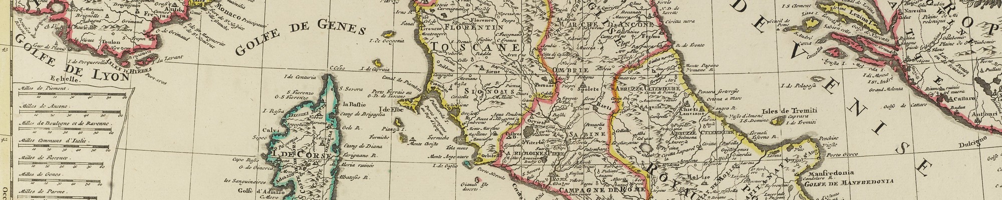
- cartographic rarities of the Biblioteca Laurenziana, Florence (catalog:Monumenti di cartografia a Firenze (secc. X-XVII) (Firenze, 1981)(vi,113pp)(see review in La Bibliofilia, 83(1981), 187-88)); and
- cartographic manuscripts and instruments in the Vatican Library (catalog:Manoscritti cartografici e strumenti scientifici nella Biblioteca Vaticana secc. 14-17.Mostra organizzata in occasione della 9. Conferenza internazionale di storia della cartografia. (guigno-dicembre 1981) (Roma, 1981) (64pp)).
There were 71 papers, of most of which full texts were provided, as well as a book of abstracts (See Bibliographia Cartographica, 9(1982), no. 830).All but eleven of the papers were published in full in Imago et mensura mundi:Atti del IX Congresso Internazionale di Storia della Cartografia, ed. Carla Clivio Marzoli, et al.3 vols. (Acta Encyclopædica, 3) (Firenze, 1985).The papers not published here were:Babicz, Brancaccio, Ghallab, Guedes, Guthorn, Jarcho, Jones, Marshall, Pansini, Seta, Stylianou.
Papers 9th ICHC
- Alexandrowicz, Stanislaw. Contribution des cartographes polonais à l’evolution de la cartographie de l’Europe centrale et orientale au XVIème at au XVIIème siècle.
- Aliprandi, Laura, and Aliprandi, Giorgio. La cartografia alpina nell’opera di Tommaso Borgonio:la Carta di Madama Reale del 1680 e la sua riedizione del 1772.
- Aujac, Germaine. La symbolique des représentations du monde en Grèce ancienne.
- Babicz, J. Le manuscrit cracovien de la Géographie de Ptolemée et ses affinités avec les autres manuscrits latins.
- Bevilacqua, Eugenia. La lenta formazione del passaggio agricolo nella terraferma veneziana.
- Brancaccio, T. Situazione della principale viabilita pre-unitaria del Granducato di Toscana.
- Brandis, Pasquale. Sulle caratteristiche formali e techniche di una carta anonima seicentesca della Sardegna.
- Capelletti, Vincenzo. Per un’ Imago Mundi. (Title from published proceedings. This was evidently the closing address(?)
- Clutton, Elizabeth. The Manuscript Maps of Crete 1612-1629, by Francesco Basilicata:A Source for Marco Boschini.
- Conti, Simonetta. Portolano a carta nautica:confronto toponomastico.
- Cook, Andrew S. More Manuscript Charts by John Thornton for the Oriental Navigation, The English Pilot, The Third Book. (11pp)
- Coppola, Antonio. Un contributo per la storia della tecnica cartografica:Inquadramento geodetico per la Gran Carta del Regno di Napoli.
- Danckaert, Lisette. La carte topographique de la Belgique per Philippe Vandermaelen:variantes conservées à Bruxelles.
- Danforth, Susan L. Benjamin Franklin:An Unlocated French Map of the Gulf Stream.
- Debergh, Minako. Deux anciennes cartes hollandaises du XVIIème siècle conservées au Musee National de Tokio:La carte murale de J. Blaeu (1648) et celle de J. Blaeu-N. Visscher (1678).
- Delano-Smith, Catherine. A Prehistoric Preoccupation with Place:The Emergence of “Maps” in European Rock Art.
- Desreumaux, Roger. Cartographie et places centrales au XVIIIème siècle.
- Dilke, Oswald A. W., and Dilke, Margaret S. Italy in Ptolemy’s Geographie.
- Dixon-Gough, Robert W. An Examination of the Technological Developments Influencing the Portrayal of Terrain Representation on Maps up to the Nineteenth Century.
- Dörflinger, Johannes. Time and Cost of Copperplate Engraving Illustrated by Early Nineteenth Century Maps from the Viennese Firm Artaria & Co.
- Fancelli, Paolo. Grafica per la conservazione del paesaggio.
- Foss, Theodore Nicholas. The Editing of an Atlas of China:A Comparison of the Work of J. B. d’Anville and the “Improvements” of John Green on the Jesuit/K’ang-hsi-atlas.
- Frabetti, Pietro. Saggio di una illustrazione del planisfero portoghese detto “del Cantino.” (Title from published proceedings)
- Ganado, Albert. Italy’s Sixteenth Century Contribution to the Cartography of the Maltese Islands.
- Geymonat, Ludovico. Perché un filosofo della scienza si interessa di cartografia.
- Ghallab, M. S. Egyptian Contributions to the Cartography of Eastern Africa in the Nineteenth Century.
- Gralak, Adam; Odlanicki-Poczobutt, Michał; Traczewska-Białek, Zofia; and Walocha, Kazimierz. Historical Maps in the Restoration of Monumental Structures and Complexes on the Example of the City of Cracow.
- Guedes, M. J. Brazil in Italian Maps and Charts, 1502-1550.
- Guthorn, P. J. An Eighteenth Century American Manuscript Shore Chart.
- Harley, J. Brian. The Iconography of English Mapping in the Late Renaissance.
- Harvey, Paul D. A. The Spread of Mapping to Scale in Europe, 1500-1550.
- Jarcho, S. Early Italian Maps of Medical Significance, 1513-1717.
- Jones, I. E. D’Argentré’s Historie de Bretagne and its Maps.
- Kinniburgh, Ian A. G. The History of the Recent Past.
- Kish, George. Roberto Almagià:An Appreciation. (Title from published proceedings)
- Kish, Susan. The Cartography of Leonardo da Vinci.
- Kleinn, Hans. Various Prime Meridians of Old Maps in Northwest Germany. (7pp)
- Kupčík, Ivan. Die Sammlungen alter Landkarten, Atlanten und Globen in der Tschechoslowakei. (17pp) (in published proceedings in English:Collections of Old Maps, Atlases and Globes in Bohemia.)
- Lafrenz, Juergen. The Metrological Analysis of Historical Town Plans. (11pp)
- Laureti, Lamberto. Origini e sviluppo del tematismo nella cartografia italiana (secc. XVIII e XIX) con particolare riferimento al Mezzogiorno.
- Mangani, Giorgio. La cartografia storica come fonte per la ricostruzione della “idea” di una regione.
- Manzi, Elio. William Henry Smyth, l’atlante coro-idrografico siciliano e i rapporti con la cartografia ufficiale della Due Sicilie.
- Marshall, Douglas W. Historiography and Map Collections of the Nineteenth Century. (9pp)
- Ozanne, Henriette. Etude d’une carte inédite sur les préliminaires de la bataille d’Austerlitz.
- Pansini, G. Le piante dei “populi” e strade eseguite in Toscana alla fine del secolo XVI.
- Pellegrini, Giacomo Corna. Cartography and Geography:An Evolving Relationship. (6pp)
- Pelletier, Monique. Le sejour de Coronelli à Paris (Published proceedings has:L’Amerique Septentrionale du Globe de Louis XIV.–same paper?)
- Pinchemwel, Genevieve, and Pinchemel, Philippe. Histoire de la cartographie et histoire de la géographie.
- Polo Saibanti, Claudio de. Un manoscritto inedito italiano datato 1464:”Arte del navigare.” (10pp)
- Rainero, Romain H. L’arte della vera navigazione di Giovanni Francesco Monno, codice inedite, e la sua importanza.
- Salgaro, Silvino. Profilo e importanza di Cristoforo Sorte nella cartografia veneta (In published proceedings as:Christophorus de Sortis, pictor et chorographus veronensis.)
- Schilder, Günter. TheCartographical Relationships between Italy and the Low Countries in the Sixteenth Century.
- Sechi, Marina. Sul simbolismo di una carta anonima seicentesca della Sardegna.
- Sereno, Paola. Le origini della topografia militare in Piemonte.
- Seta, C. de. Topografia urbana a vedutismo dal XVI al XVII secolo.
- Solnick, Bruce B., and Klein, Christopher M. Cartography and Colonization:The British in the West Indies after 1763.
- Stochdorph, Otto. Equidistant Cylindrical Projection as a Blend of “Cosmographic” and “Perspective” Mapping on Sixteenth Century Maps.
- Stylianou, A. Italian Maps of Cyprus of the 15th and 16th Centuries.
- Tardy, János. The Magna Hungaria Problem in Relation to Old Maps.
- Teixeira da Mota, Avelino. The Last Century of Portuguese Overseas Cartography (1875-1975).
- Unno, Kazutaka. The Asian Lake “Chiamay” in the Early European Cartography. (7pp)
- Valerio, Vladimiro. Sulla struttura geometrica di alcune carte di G. A. Rizzi Zannoni.
- Vázquez-Maure, Francisco. Analyse et evaluation de l’Atlas de l’Escorial.
- Viola, Tullio; Manzoni, Silvio; and Navale, Maria Teresa. Su taluni metodidi rilievo topografico e di rappresentazione grafica di terreni e opere nelle civilta arcaiche (In published proceedings:Problemi geometrici applicati alle techniche costruttive e rappresentative. L’esempio del tunnel di Samo e un’ipotesi di triangolazione topografica nel VI secolo a. C.–same work?)
- Vries, Dirk de. Atlases and Maps from the Library of Isaac Vossius (1618-1689). (Title from published proceedings)
- Wallis, Helen. The Role of the “Painter” in Renaissance Marine Cartography [The Dieppe School].
- Wawrik, Franz. The Johannes Schöner Collection of Cartographic Works in Austrian National Library.
- Welu, James A. Cartographic Self-Portraits.
- Wolf, Eric W. Beltrami’s Unpublished Manuscript Maps of the Sources of the Mississippi.
- Wolter, John A. The Manuscript Maps of Carl Ritter in the Hauslab-Liechtenstein Collection of the Library of Congress. (10pp)
- Woodward, David. A New Objective Method of Analyzing Watermarks on Sixteenth Century Italian Printed Maps. (12pp) (In published proceedings as:New Tools for the Study of Watermarks on Sixteenth Century Italian Printed Maps:Beta Radiography and Scanning Densitometry.)
References
Imago Mundi 33(1981): 97-98 (E. Campbell)
Österreichische Gesellschaft zur Geschichte der Naturwissenschaften, Mitteilungen 1(1981) 3/4: 43-44 (Dörflinger)
Kartographische Nachrichten 31(1981): 155-56 (Scharfe)
地図 Chizu [Map] 19(1981) 4: 23-26 (Watanabe) (in Japanese)
The Map Collector 16 (1981): 38-39 (anon.)
Comité français de cartographie, Bulletin 88 (1981) 2: 68 (Pelletier)
Mapline Sept. 1981: [7] (Buisseret)
Società Geografica Italiana. Bollettino 118 (1981): 598-600 (Mussilli).