21th International Conference on the History of Cartography
21. Nemzetközi Kartográfiatörténeti Konferencia
17-22 July 2005 — Budapest
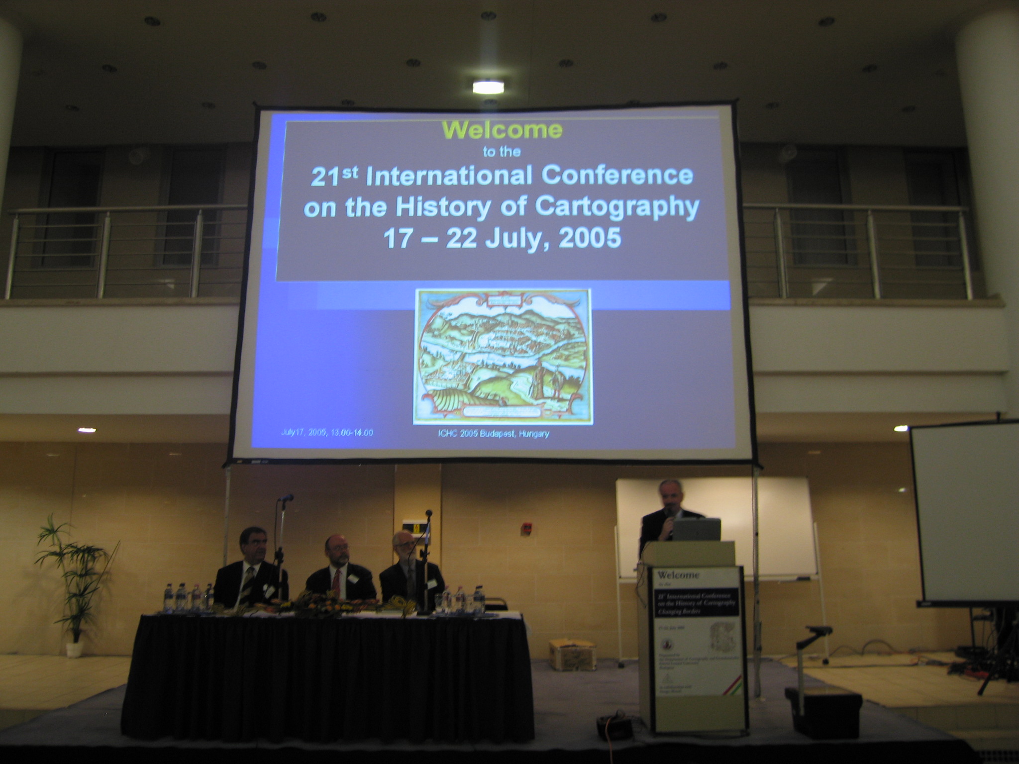
 The conference was held in the Northern Building on the Lágymányos campus of the Eötvös Loránd University. The main coordinator was Zsolt Török, assisted by Krisztina Irás as secretary. A total of 196 people attended the conference, with 39 accompanying persons (numbers from the program, the actual number can be different).
ICHC 2005 co-ordinator was Dr. Zsolt Török, assisted by Ms. Krisztina Irás as secretary of the ICHC 2005 Academic Secretariat. The academic programme was organized with the support of the Academic Programme Committee, headed by Prof. István Klinghammer, Rector of the Eötvös University. Registration, accomodation, travel and logistics was arranged by the Mrs. Ilona Módli and her Conference Secretariat staff at Aktiv Tours Kft.
A total of 60 papers and 37 posters were presented. Biographical statements for each presenter, and abstracts of all papers in English were provided in a printed program.
The overriding conference theme was Changing Borders, other conference themes were (1) mapping the Habsburg Empire, (2) the history of military mapping, (3) Old World – New Worlds, and (4) any other aspect of the history of cartography.
Three exhibitions were prepared in conjunction with the conference:
- “Margaritae Cartographicae: Treasures of the National Library” at the National Széchényi Library..
- “Earth and Sky: Astronomy and Geography at the University” at the Eötvös University Library..
- “Military maps in Hungary from the 16th to the 20th century” at the Military Historical Institute and Museum.
On Saturday, 23 July, 2005 there was a tour to Pannonhalma Benedictine Archabbey, to vist the exhibition “Sacred Places on Maps”.
On Saturday, July 16, the International Society of Curators of Early Maps held its biennial meeting during a special tour in the town of Kalocsa, combined with a tour and visit of the Archdiocesan Library.
The standing commission on the History of Cartography of the International Cartographic Association (ICA) was held on 19 July.
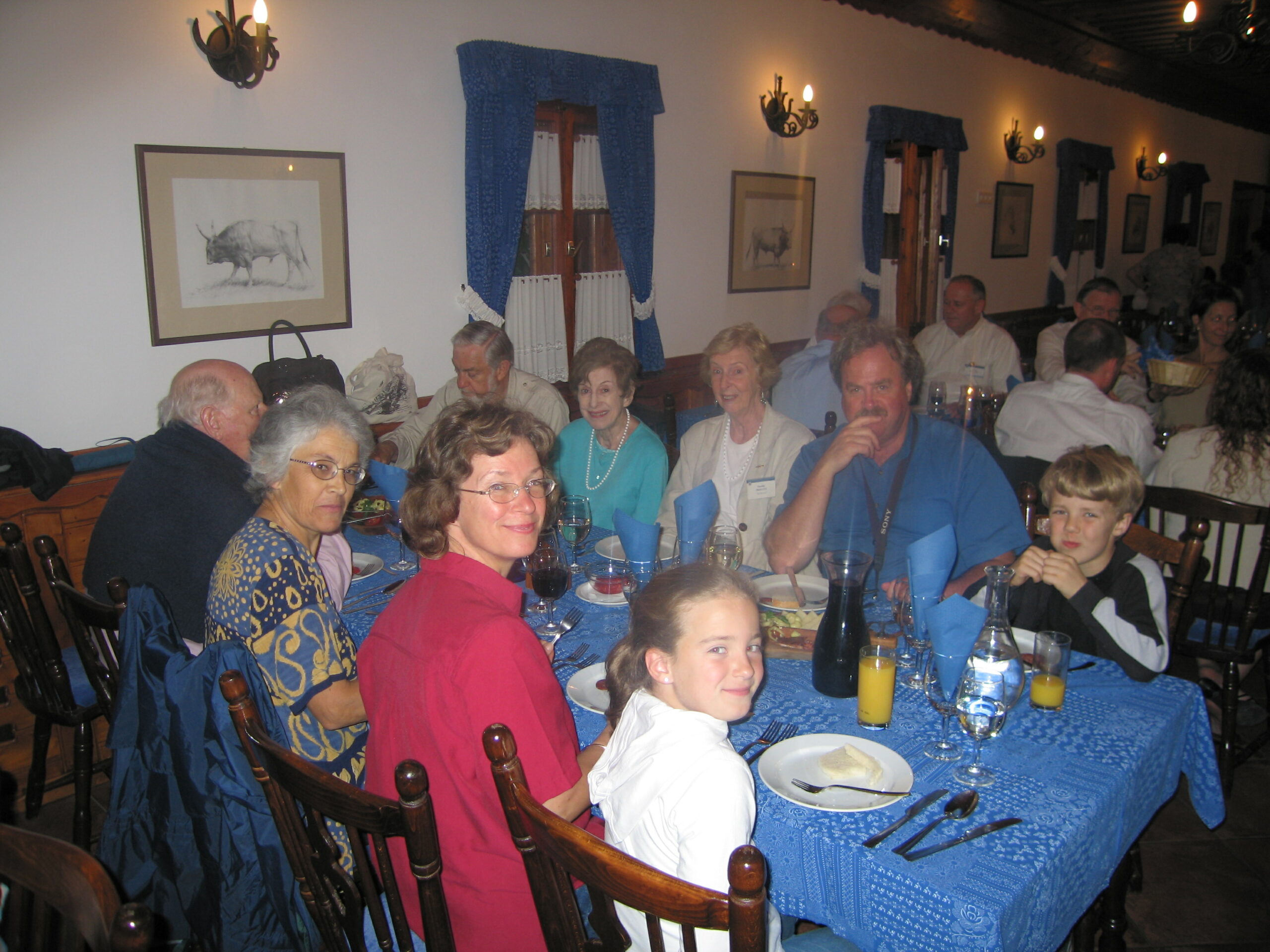
The Farewell dinner was at Lazar Horse Park, Gödöllő.
The conference website is still on-line with hundreds of photos (checked 25 April 2020).

Papers
Session I: Medieval Maps. Chair: Paul D. Harvey
- Florian Mittenhuber, The New Edition of Ptolemy’s Geography.
- David J. Wrisley, Lebanon Mapping Space and Power in Jean Germain’s Mappemonde Spirituelle (1449).
- Alfred Hiatt, UK The world map of Macrobius before 1200.
Session II: From Stars to Mars: Celestial Cartography in the Telescopic Era, organized by Anna Felicity Herlihy. Chair: Uta Lindgren.
- Anna Felicity Herlihy, Johannes Hevelius and the Value of Celestial Representation in Astronomical Observation.
- Robert H. van Gent, The Netherlands Mapping the Lunar Shadow: The Earliest Maps of Solar Eclipse Paths (not read).
- K. Maria D. Lane, The Lost Planet: Maps of the Planet Mars, 1877-1910.
Session III: Changing Borders, Chair: István Klinghammer .
- Ariel Salzmann, Frontiers of Sovereignty: Ambiguous Boundaries of the Ottoman Empire.
- Kirsten Butler, Exploring Legal Boundaries and Resource Rights: Cartography of US Appalachian Lumber, Coal & Mining Rights.
- Sylvia Schraut, European and World History Conveyed by Historical School Atlases (Germany and Great Britain, 1870-1960).
Session IV: Maps of the Holy Land. Chair: Kenneth Nebenzahl.
- Paul D.A. Harvey, Maps of the Holy Land, circa 1200: Europe’s oldest sheet map.
- Alessandro Scafi, Mapping Eden in the Holy Land: The Changing Borders of a Never-Ending Cartographical Enterprise.
- Rehav Rubin, Stephan Illes and his 3D map of Jerusalem (1873).
Session V: The History of Cartography Project: An Update and Overview of Current Work, organized by Matthew Edney. Chair: Catherine Delano-Smith.
- Jude Leimer, Introduction: Current Status of The History of Cartography.
- Matthew H. Edney, Designing the Structure for Cartography in the European Enlightenment.
- Mary S. Pedley, The Nature of Cartography in the European Enlightenment.
- Mark Monmonier, Cartography after 1900 and the Design of Cartography in the Twentieth Century.
Session VI: David Woodward Memorial Session, organized by Catherine Delano-Smith. Chair: Matthew Edney.
- Catherine Delano-Smith & Alessandro Scafi, “Painted Surface to Bounded Line” (Woodward, 2001): Cartographical Representation in Manuscript and Print.
- Jessica Maier, An Important Moment in the History of City Atlases and a Quagmire in Renaissance Map Publishing: The Venetian Town Books of the 1560s.
- Adele J. Haft, Maps in Twentieth-Century Poetry: Another of Legacy of Brian Harley and David Woodward.
Session VII: Round Table Discussion: Promoting the Use of Historic Maps in Schools, co-organized by James Akerman and Yolanda Theunissen. Chair: Ed Dahl.
James R. Akerman, George S. Carhart, Ronald E. Grim, Yolanda Theunissen.
Session VIII: Map Tales. Chair: David Cobb.
- Rose Mitchell, The case of the crafty prior and other tales from early English legal maps.
- Evelyn Edson, The Case of the Missing Map: reconstruction and recreaction of lost maps.
- Dennis Reinhartz, Ephemeral Cartography?
Dennis Reinhartz Session IX: Coordinates, Projections and Spherical Harmonics, Chair: Mark Monmonier.
- Ruth Watson, Reclassifying the heart: Johannes Stabius and the invention of the cordiform projection.
- Kurt Brunner & Gustav Forstner. Errors of Longitude and Prime Meridians in Old Maps and Geographical Tables.
- John Hessler, Perturbing the Globe: Spherical Harmonics, the Three-Body Problem and the Search for Conformality in Satellite Mapping.
Session X: Verbal and Textual Maps, organized by Daniele Dueck. Chair: Adele Haft.
- Daniela Dueck, Roman Verbal Cartography through the Prism of Giovanni Boccacio.
- Ekaterina Simonova-Gudzenko, A 9th century Textual Map of Japan.
- Vera V. Dorofeeva-Lichtmann, Reconsidering Reconsidered Loss of Ancient Chinese Maps.
Session XI: Asia Mapped: Historical Dynamics and the Power of Cartography, organized by Caverlee Cary. Chair: Palmira Brummett..
- Dawn Rooney, The European Mapping of Southeast Asia.
- Caverlee Cary & Surat Lerltum. Cartographic Encounter: A Comparison of Tradition and European-style Historic Map in Pre-modern Thailand.
- Caverlee Cary, Exploring Edo : Urban dynamics and GIS in Japanese Historic Maps.
Session XII: Habsburg Cartography. Chair: Ingrid Kretschmer.
- Ron E. Hassner, Maps of the Turkish Sieges of Vienna, 1529 and 1683.
- Charles van den Heuvel, Lines and links. Changing borders between military and urban cartography in the Low Countries in the 16th and 17th centuries.
- Steven J. Seegel, Some Parallels in 19th Century Habsburg and Russian Imperial Cartography vis-à-vis Poland-Lithuania.
Session XIII: Ottoman Cartography, organized by Palmira Brummett. Chair: Peter Barber.
- Karen Pinto, Maps and Exaggeration: Fatih’s Territorial Ambitions Revealed (presented digitally).
- Kathryn A. Ebel, To Buda and Beyond: Mapping the European Frontiers of the Ottoman Empire in the Reign of Süleyman the Magnificent.
- Palmira Brummett, Severed Heads, Fortresses, and the Iconography of Submission in Marking the Ottoman-Hapsburg Frontiers.
Session XIV: New Worlds, Chair: Elri Liebenberg.
- Júnia Ferreira Furtado, Portuguese Cartography in Eighteenth-Century Brazil: Paradise Lost.
- Lindsay Frederick Braun, Native Space in the Cartography of the Transvaal, 1830-1910.
- Martin Warnke, EbsKart: A Digital Reproduction of the Ebstorf World Map.
Session XV: Map, Text, Images, Chair: Joseph H. Fitzgerald.
- René Tebel, Austria Ship images on early modern maps from the 10th to the 16th centuries as a tool to help dating and arranging the regional origin of anonymous maps.
- Angelo Cattaneo, From Texts to Images: Asia in Fra Mauro’s Mappamundi (c. 1450) and the Narrative of Marco Polo (c. 1300) and Niccolò de’ Conti (1444).
- Zoltán Krasznai, The Rhetoric of Maps. Reconsidering Maps in the Decision-making Process at the Paris Peace Conference After World War I.
Session XVI: Military Cartography, Chair: László Zentai.
- John Cloud, The Cartographic Route Paved by the Charts of the Pathfinder.
- Wang Zilan and Wang Kelin, Military Elements of Ma Wang Dui Maps 2100 years ago: Discussion of Cartographic Generalization according to Archaeological Materials and
Classical Literatures. - Balázs Mihályi, Hungary The role of maps in the Battle of Budapest 1944-45.
Session XVII: Reconnaissance Maps, Chair: Alexey V. Postnikov.
- Mitia Frumin, Road to war: Colonel Lvov’s reconnaissance mission in Syria (1834-1835).
- Ralph E. Ehrenberg, Aerial Navigation Strip Maps in the United States, 1918-1923 A Military Response to the Emergence of Cross-country Flying.
- Peter Collier, The Air Survey Committee and the development of military mapping in Britain between the 1st and 2nd World Wars.
Session XVIII: Atlases, Chair: Peter van der Krogt.
- Ferjan Ormeling, Bosatlas 1877-2005: 52 consecutive editions of a school atlas.
- Gyuri Danku, Establishing the time of publication of the Danckerts Atlas’s maps. Epitome of a research relating to the Danckerts Atlas.
- Patrick McGlamery, Building a Globally Distributed Historical Sheet Map Set (belonging to session XXI).
Gyuri Danku Session XIX: Thematic Maps, Chair: Ferjan Ormeling.
- Diana Webster, Across Borders: Some Examples of 19th Century Scottish-German Cartographic Collaboration, Held in the Bartholomew Archives.
- Antal András Deák, Unsurpassed level river mappation: Hydrographic surveys and maps of rivers in the Carpathian Basin in the first half of the 19th century.
- Philippe Forêt, The discovery of climate change: The mapping of the Edsin-Gol River (Inner Mongolia) and the political significance of the work done by the Sino-Swedish Expedition (1927-1935).
Session XX: Towns and Cities, Chair: Günter Schilder.
- Peter van der Krogt, Joan Blaeu and his Town Atlases.
- Andréa Doré, The Habsburgs’s plans of the Portuguese fortifications in India: a cartography with military and urbanistic interest.
- Kory Olson, Transforming Paris and Mapping the Republic: Atlas des travaux de Paris 1789-1889
Session XXI: Old Maps Digital, Chair: Hans-Uli Feldmann (see also Session XVIII).
- Martin Rickenbacher, DigiMeyer – a digitizing project for the large-size map of the Basel territory from the 1680s.
- Elger Heere & Martijn Storms, Dutch estate atlases and historical GIS. Functions, use and digital cataloguing of manuscript property mapping (16th-19th century).
Workshops
I. Early Map Printing Workshop, organized by Zsolt Török and George Carhart.
Ramusio Workshop
George Carhart demonstrates his special woodcut and makes prints during the workshop, he also shows the transfer of on image onto the woodblock. Participants were able to follow the procedure on a video screen.
The temporary intaglio printing workshop could not accomodate the large number of interested participants. The only possibility is to operate the workshop during the conference sessions and accept one apprentice in every thirty minutes.
Gastaldi Workshop
Apprentices were able to print their own map from the original copper plate specially made by Zsolt Török for ICHC 2005.
II. Plane Table Topographic Survey, organized by Zsolt Török, Alexey Postnikov with Peter Collier
Poster Presentations
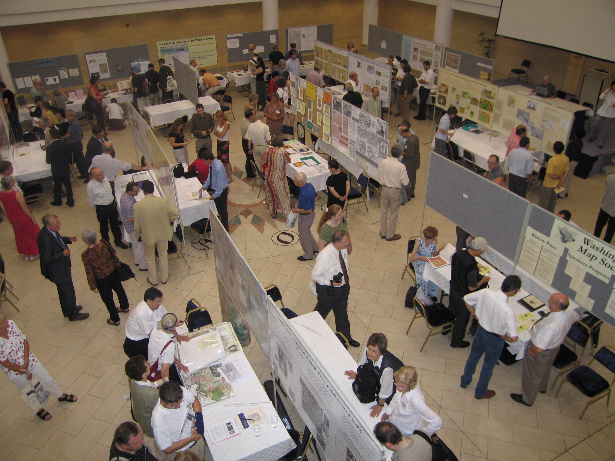 Listed are the posters with a summary in the program book.
- Zsombor Bartos-Elekes, Changing Toponyms and the Attitude of Maps (Transylvania, 1849–1940).
- Richard L. Betz, The Mapping of Africa: A Cartobibliography of Printed Maps of the African Continent from 1508 to 1700.
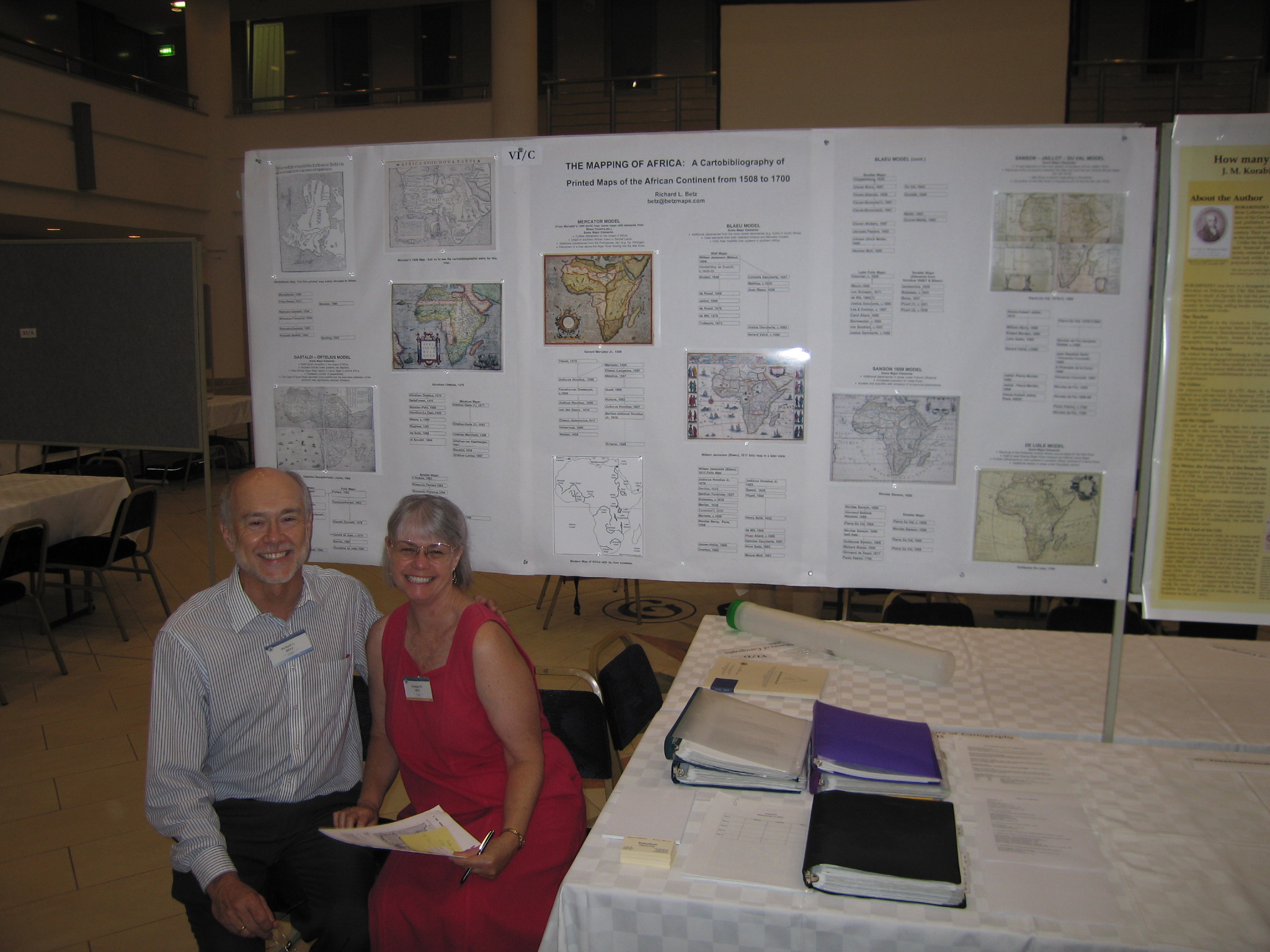
Richard and Penelope Betz, see also their publication in the Explokart series - Wouter Bracke, Jacob of Deventer’ s first map of the Duchy of Brabant rediscovered.
- Hans Brunner, presenter Jana Moser. Germany First topographic survey with previous triangulation in Germany prior to 1800.
- Jadwiga Bzinkowska, Maps printed in Cracow in the 16th century.
- Michele Castelnovi, Verrazzano’s heritage in World’s representation by Bartolomeo Crescenzio (1579).
- Szabolcs Czigány, István Horváth, László Nagyváradi, and Ervin Pirkhoffer. Cartography of the Archbishop of Pécs’ Lands between 1735 and 1875.
- Michael F. Davie and Mitia Frumin. Veni, vide, delineavi: Beirut cityscape in the late 18th century through Russian Navy maps.
- Jürgen Espenhorst, Across the Borders – Export and Import of German School Atlases 1800-1950.
- Maria Dulce de Faria, Maps of Portugal’s Empire from the Barbosa Machado Collection.
- Hans-Uli Feldmann, The Correction of the Lakes of Biel, Neuchâtel and Murten, 1868–1891: An example of large land acquisition.
- Mário Gonçalves Fernandes, Manoel de Azevedo Fortes (1660-1749): renovator of Portuguese Cartography.
- André Ferrand de Almeida, Disputed boundaries: the Luso-Spanish conflict and the mapping of South America in the late Eighteenth-Century.
- Csilla Galambos, Overview of the geological maps and their colour sign systems: some Hungarian examples.
- Joao Carlos Garcia and István Rákóczi. Boundaries in South America and Jesuit cartographers from Central Europe (c. 1750).
- Regine Gerhardt, Henry IV in the Cartography of his Capital: Paris as Projection Screen of the King.
- Antal Guszlev, Processing the 1528 map of Lazarus in GI environment.
- Koji Hasegawa, Mapping the changing borders with China, Russia and India during the Japanese Empire.
- Krisztina Irás, Settlements of the Kingdom of Hungary on portolan charts.
- David L. Jones, Habsburg Empire/Successor States Maps at the University of Alberta.
- Wolf Günther Koch, The Graphic Design of the District Maps of the German Geographer and Cartographer Adam Friedrich Zürner (1679-1742).
- Andreas Kunz and Joachim Robert Moeschl, Mapping the Habsburg Empire 1789-1918: A Digital Perspective.
- Lada L. Lekai, Mapping of Kamchatka: the First Quarter of Twentieth Century.
- Elri Liebenberg, Mapping South Africa in the 1830s: the cartography of James Centlivres Chase.
- Lilla Lukács, Naming of geographical regions on maps of Hungary in the 20th century.
- Jorge Macle Cruz, José María de la Torre : a notable Cuban cartographer.
- Mira Miletić Drder and Renata Šolar, Mapping the Austrian-Hungarian Empire: Contribution of Croatian and Slovenian Cartographers in the 19th century.
- Veselin Miskovic, A Set of Handdrawn Ptolemaic Maps in the National and University Library in Ljubljana.
- Zsombor Nemerkényi, The Discoveries and the Maps of László Magyar : A Comparison to the Reports of Contemporary Travellers.
- Drago Novak, The portolans of Vincentius Demetrius Volcius (1563-1607) – A portolan maker from Dubrovnik.
- Alexey V. Postnikov, New data on Russian Geographical and Cartographical Materials which had been carried out from Russia to France by J. N. Delisle.
- T. Csaba Reisz, How many data can be crowded in a pocket-atlas? J. M. Korabinszky’s Atlas regni Hungariae portatilis (1804).
- José Jesús Reyes Nuñez, Erwin Raisz’ influence in the Cuban cartography from 1929 to 1959.
- Sturani, Maria Luisa. Cartography as a Tool for Fixing Borders at Local and National Scale: A. Durieu, Cadastral and Border Maps in 18th Century Savoy.
- Washington Map Society represented by Thomas F. Sander, The Washington Map Society, Washington DC, USA.
- Jan Werner, Three remarkable Dutch atlases: by Gerard van Schagen, Abraham Ortelius and Joan Blaeu (Recent major acquisitions in the Universiteitsbibliotheek Amsterdam).
- Liudmila N. Zinchuk, The scientific value of lettering and textual inscriptions on the maps of The Drawing book of Siberia by S. Remezov
ISCEM (International Society of Curators of Early Maps) Kalocsa tour
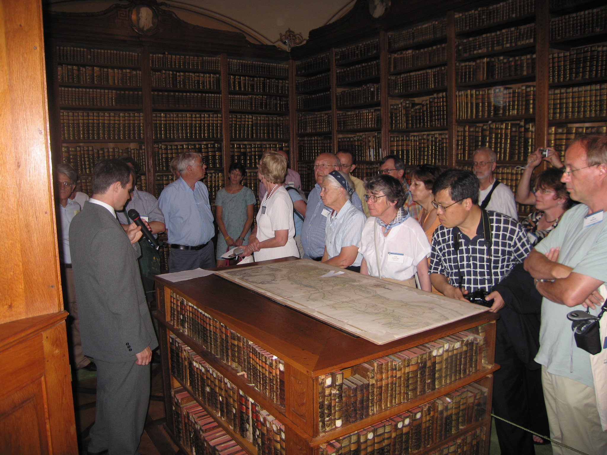
On Saturday, July 16, the International Society of Curators of Early Maps held its biennial meeting during a special tour in the town of Kalocsa. The thousand year old Kalocsa is a small town in the south part of Hungary. In the morning, the Archdiocesan Library was visited. The Archdiocesan Library’s map collection is one of the largest private collections in Hungary. The some 26 000 volumes, the cartography related collection of the library includes rare printed and manuscript material, starting with Isidorus’ 1472 Etymologiarum. The history of the library goes back to the 15 th century. The building was constructed and the collection enlarged by the influential archbishops of Kalocsa. They obtained valuable additions to their
collection through their agents in Europe. The Baroque library has been recently renovated and its contemporary bound, sometimes untouched volumes, as well as the splendid interior
decoration offers the original atmosphere of the 18 th century map library, a unique experience for every map enthusiast.
After the meeting the touristic program started with a lunch in a typical Hungarian atmosphere. Afterwards first the Kalocsa folklore museum was visited. Then a special organ concert in the baroque main cathedral. Finaly, one could visit the Paprika House, where the procedure of the cultivation and the processing of the world famous spice, the paprika (red pepper) of Kalocsa, could be seen.
Note
Three publications are relevant to the 21st International Conference on the History of Cartography (biographical descriptions by Francis Herbert, sent to MapHist, 1 August 2005):
- Magyarországi hadi térképek a XVI. századtól a II. világháborúig = Hungarian military maps from the 16th century to the Second World War / felelös kiadó: Dr. Holló József vezérörnagy, . . . – Budapest Hadtörténeti Intézet és Múzeum [, 2005]. – 23p. : ill., maps (chiefly col., including on front cover) ; 17 x 24 cm. – In E & Hu. – Transl. of title from E transl. (p.[13] onwards). – “A kiállítás anyagát válogatta, a katalógust készítette: Dr. Jankó Annamária és a Hadtörténeti Térképtár munkatársai . . . = Choosing of maps of the exhibition and elaboration of the catalogue by: Dr. Jankó Annamária and colleagues of the Maproom . . .”. – Lists and describes 42 MS & printed items (including aerial photogr.) – some photogr. copies of originals in Kriegsarchiv, Vienna – from that of W. Lazius (Vienna, 1556/57) to 25 – 27.12.1944 (situation of operations marked on 1:500 000-scale aeronautical map).
- The summaries of the articles published in Cartographica Hungarica (1992-2004) = Cartographica Hungarica (1992-2004) : a tanulmányok összefoglalói / Zsolt Török. – In Cartographica Hungarica : térképtörténeti magazin = Cartographica Hungarica : magazine for map history (Balatonkenese : Szathmáry Tibor), 2005 július = July 2005, 9, 5-21. – Includes ‘Indexes = Név-, és tárgymutató’ (i.e. of personal names and of subjects [& geogr. names]) compiled by Zsombor Nemerkényi (et al.) to the previous 8 volumes : p.20-21. – The summ. here are in E & Hu only, although the originals were chiefly in D or E and a few in F or Hu. – NB: all the original articles (with note on presence, and languages, of summ.) were recorded (with annotations on their contents) in the annual, or semi-annual, compilations of the ‘Imago Mundi Bibliography’. – Special issue on occasion of 21st Internat. Conf. on the Hist. of Cartogr., Budapest, 17-22.7.2005.
- Szent helyek a térképeken : térkérptörténeti kiállítás a Pannonhalmi Föapátság és a Schottenstift (Bécs) anyagából / [szerkesztette: Dr. Török Zsolt ; fordítók: Lengyel Péter, Szöni Péter] = Sacred places on maps : a cartographic exhibition from the collections of Pannonhalma (Hungary) and Schottenstift (Vienna) / [edited by Dr. Zsolt Török ; English translation: Péter Lengyel, Péter Szöni]. – Pannonhalma : Pannonhalma Föapátság, 2005. – 202 [i.e. 309]p. : ill., maps (some col.) ; 24 cm. – Statements of authority taken from prelims (other than recto of t.p.). – Pages [203]-[309] are unnumbered. – In E & Hu. – ISBN 963-90-5367-8. – Contents:
- Szent helyek a térképeken / Török Zs. (p.7-18).
- Sacred places on maps (p.19-31).
- Szent földrajz / C. Delano Smith & A. Scafi (p.33-54) [NB: this Hu transl. contains 3 various ill. that are not in E original text (vide infra); refs to these ill. are on p.42 (129), 46 (133), & 48 (135) respectively].
- Szent helyek Palesztina középkori térképein / P.D.A. Harvey (p.55-69).
- ‘Helytelen’ nevek : hogyan ‘találták fel’ a szent helyeket a zarándokok és a térképészek / R.E. Hassner (p.71-93).
- Ego sum via : keresztény utak a modern európai térképészet kialakulásában / Török Zs. (p.95-119).
- Sacred geography / C. Delano Smith & A. Scafi (p.121-140).
- Holy places on medieval maps of Palestine / P.D.A. Harvey (p.141-154).
- Names without places : how pilgrims and mapmakers invent sacred places / R.E. Hassner (p.155-176).
- Ego sum via : Christian itineraries in the evolution of modern European cartography / Zs. Török (p.177-202).
- Katalógus = Catalogue (p.[207]-[309]) [from anon. ‘Tabula Peutingeriana’ of 4th century AD in ed. of F.C. Scheyb (Vienna : Trattner, 1753) and ‘Secu[n]da etas mundi’ (etc.) in Liber cronicarum . . . of H. Schedel (Augsburg : J. Schönsperger, 1497) to ‘Palesztina : a biblai események színhelye’ of M. Kogutowicz at scale 1:200 000 (Budapest : Magyar Földrajzi Intézet [, 1901]).

References
BIMCC Newsletter 23 (September 2005: 22-23 (Lisette Danckaert).
Cartographica Helvetica 32 (Juli 2005): 42-43 (Wolfgang Lierz).
Geo-Info: Tijdschrift voor Geo-informatie Nederland 2,9 (2005): 394-395 (Marco van Egmond).
Imago Mundi No. 58, pt. 1 (2006): 90-94 (Marco van Egmond).
The Portolan No. 64 (2005-2006): 57-61 (Hubert O. Johnson).