20th International Conference on the History of Cartography
15-20 June 2003 — Cambridge, Mass., and Portland, Maine
 The conference was held in Memorial Hall, Harvard University (15-17 June) and in the Holiday Inn by the Bay, Portland (18-20 June). Pre-conference meetings of the International Society of Curators of Early Maps (ISCEM) and of the standing commissions on Education and the History of Cartography of the International Cartographic Association (ICA) were held at Memorial Hall on 14 June. The main coordinators were David Cobb (Harvard Map Collection, Harvard University), and Yolanda Theunissen and Matthew Edney (both of the Osher Map Library and Smith Center for Cartographic Education, University of Southern Maine). A total of 321 people attended the conference, with 63 accompanying persons.
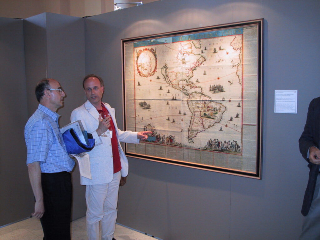
Six exhibitions were prepared in conjunction with the conference:
- “Cartographic Treasures at Harvard,” at Harvard Map Collection and Houghton Library, Harvard College Library, Harvard University.
- “Treasures of the Boston Public Library Map Center,” at Boston Public Library.
- “Mapping the Republic: Conflicting Concepts of the Territory and Character of the USA, 1790-1900,” at the Osher Map Library and Smith Center for Cartographic Education, University of Southern Maine (no longer on-line – link to archived version).
- “Heavens on Earth,” at the Southworth Planetarium, University of Southern Maine.
- “The Shape of Maine: Drawing Boundaries, Mapping History,” at the Gallery of Maine History, Maine Historical Society.
- “Mapping Maine: Four Contemporary Views,” at the Portland Museum of Art.
Papers and entire sessions were solicited under five themes: a) cartography, states, and empires; b) cartographic literacy and culture; c) cartography and commerce; d) mapping the Americas; and, e) any other topic in the history of cartography. However, many papers fell under more than one theme, so the program committee did not organize sessions by theme.
A total of 41 (42?) posters and 80 (88?) papers were presented. Biographical statements for each presenter, and abstracts of all papers (in both English and French), were provided in a printed program. Seven of the paper sessions were specially organized sessions, and there were three workshops.
Papers 20th ICHC
BOSTON
Session 1. Missing Elements: Mapping the Americas, 1500-1900, organized by Jordana Dym; chair: James Akerman
- Foroughi, Andrea. A Partial Picture: (Mis)Representations on Colonial North American Maps.
- Kimaid, Michael. ‘The Mississippi was never designed as the western boundary of the American empire’: Cartographic Challenges to Imperial Authority in North America.
- Dym, Jordana. ‘Imperfectly Known’ or ‘More Calculated to Mislead than Inform’? Travelers’ Cartography of Central America, 1821-1900.
Session 2: Cultures of Engineering and Military Surveying. Chair: Zsolt Török
- Watelet, Marcel. Cartographie et culture technique: l’univers graphique des ingénieurs hydrauliciens en Europe (1804-1830).
- Johnson, Ann. Engineering the Nation: The Role of Surveying in Nineteenth-Century Engineering Culture.
- McElfresh, Earl B. Knowing Their Place: Military Maps, Slaveocracy, and the American Civil War.
- Csaba, Reisz T. Colleagues, Contributors, Sponsors, and Supporters: How Many People Took Part in the Making of John Lipszky’s General Map of Hungary (1804-1810)? (read by Török in the absence of the author).
Session 5a: The Reception of Printed Map Production. Chair: Peter van der Krogt
- York, Laura. Interpreting Early Modern Cartographic Texts: Comparing French and Dutch Cultural Understandings of the Map.
- Carhart, George S. The Significance of Craft Practices for Early Modern Map Production.
- Barber, Peter. Old Mentalities in a New World: The Printed Map Collection of Ferdinand Columbus.
Session 5b: Paper Landscapes: Cartography, Capital, and the State, organized by Ryan J. Carey; chair: Marcel Watelet
- Carey, Ryan J. From Paper Landscapes to Property Rights: Geographic Information and the Vocabulary of Capital.
- Epstein, Earl. Concepts of Land and of Land Information.
- Crampton, Jeremy W. The ‘Double’ Invention of Thematic Mapping and Governmental Rationality.
Session 6a: The Business of Map Maping. Chair: G&ünter Schilder
- Phillips, A. D. M. The Local Market for the Late Seventeenth-Century Printed County Map in England: The Subscribers to Gregory King’s Map of Staffordshire, 1679-81.
- Camino, Mercedes Maroto. War Souvenirs: Maps from Bosnia-Herzegovina and the Old Yugoslavia (1992-1997).
- Cain, Mead T. Economic Aspects of Map Production and Publishing in Early Victorian England: Evidence from the Society for the Diffusion of Useful Knowledge (not read).
- Ehrenberg, Ralph E. Rand McNally and Aviation Cartography: Changing Markets and Marketing Strategies.
Session 6b: Space, Place, and Ethnic Identity. Chair: Tony Campbell
- Carrera, Magali M. Mapping Citizenship in Nineteenth-Century Mexico: Antonio Garcías Cubas’s Carta etnográfica.
- Culp, Robert. Maps, Metaphors, and Historical Projection: Imagining China’s Nation-Space during the Republican Period.
- Sen, Arijit. Mapping Immigrant Homeland in America: Cartographic and Cognitive Imaginations of the Indian Nation in Diaspora in the 1920s.
- Azaryahu, Maoz, and Arnon Golan. Renaming the Landscape: The Formation of the Hebrew Map of Israel (paper read by Arnon Golan).
Session 7: Ideology and Mapping. Chair: Ed Dahl
- Sills, Adam. Daniel Defoe and the Limits to the Market.
- Brückner, Martin. The National Map as Logo and Constitutive Logos in the United States.
- Dorvidal, Jérôme. Simples, simplistes … mais terriblement convaincantes: représentations spatiales et cartographiques de la menace atomique dans la propagande antinucléaire australienne (paper read by Jean-François Palomino in the absence of the author).
Session 8: Reading Ottoman Maps: Text, Context, and Cultural Understanding, organized by Palmira Brummett. Chair: Dov Gavish
- Goodrich, Thomas. Melding Text and Maps: The Innovative ‘Kitab-2 Bahriye’ of Piri Reis.
- Fortna, Benjamin C. Good News and Bad News: Change in the School Maps of the Late Ottoman Empire.
- Brummett, Palmira. Ottoman Cartoon Maps: Imagining Space, Identity, and Nation in the Istanbul Popular Press, 1908-1911.
Session 9a: Cartography and Pictorial Representation of Topography in Art History, organized by Elizabeth Ross. Chair: Kenneth Nebenzahl
- Ross, Elizabeth. Tradition and Experience in Erhard Reuwich’s ‘Map of the Holy Land with View of Jerusalem’.
- Roxburgh, David J. Visualizations of Holy Places in Sixteenth-Century Ottoman Manuscript Sources.
- Kelsey, Robin. Mapping Rhetoric in American Survey Report Illustration, 1838-1861.
Session 9b: Colonial Cartography. Chair: Mary Sponberg Pedley
- Alexander, Karen. William Blathwayt versus the Puritans: The Controversies over New England Boundaries in the 1670s.
- Donovan, William M. The Missing Maps of Colonial Brazil.
- Appelt, Ursula. Map, Manual, and Merchant: Plancius, Blundeville, and the Anglo-Dutch Race for the Spice Islands.
Session 10a: Mapping Colonial Urban Spaces. Chair: Patricia Seed
- Rupert, Linda M. The Phantom Walls of Charlestown, 1739.
- Palomino, Jean-François. Jean-Baptiste Franquelin, géographe du roi en Nouvelle-France.
- Pedley, Mary Sponberg. Two Maps of Boston Harbour on the Eve of Revolution (1775-1776): A French Connection.
Session 10b: Projection and Overlay. Chair: Karen Severud Cook
- Monmonier, Mark. Practical and Emblematic Roles of the American Polyconic Projection.
- Cloud, John. Layered Truths: The Political Evolution of Geographic Integration by Overlay.
- Hessler, John W. John Snyder and the Development of the Mercator Space Oblique Projection (paper read by Ron Grim in the absence of the author).
PORTLAND
Session 11: Negotiations of Power in State Mapping. Chair: Mark Monmonier - Pramono, Albertus Hadi. The Search for Emptiable Spaces: The History of Mapping and Resource Politics in Indonesia.
- Craib, Raymond B. Mapping Mexico From Below (or, peasants are also protagonists in the history of cartography).
- Fletcher, David. The Cartographic Subjugation of the Local State? The Ordnance Survey in Nineteenth-Century England.
Session 12: Sources and Influences in Early Modern Mapping. Chair: Dennis Reinhartz
- Ferrand de Almeida, André, and João Carlos Garcia. Jesuit Cartography of the Amazon Basin in the Eighteenth Century (paper read by Ferrand de Almeida in session 18a).
- Komedchikov, Nikolay N. The Language of Russian Geographical Drawings of the Period Before 1700.
- Zinchuk, Liudmila. Foreign Sources of Russian Scientific Cartography.
- Espenhorst, Jürgen. A German Contribution to Globalization in the Nineteenth and Early Twentieth Centuries.
Keynote Lecture
- Cosgrove, Denis. Local Landscape, Global Visions: Popular Mapping and Mass Culture in Twentieth-Century America.
Session 13a: Pilgrimage, Mapping, and Sacred Space. Chair: Evelyn Edson
- Terkla, Dan. Eloquent Stones near the Saint’s Bones: The Placement and Purpose of the Hereford Mappa Mundi (title of summary in program: Patronage, Translatio, and Curiositas: The Hereford Mappa Mundi as Pilgrimage Attraction).
- García-Zambrano, Angel Julián. Replacement of Native Mesoamerican Ritualized Perceptions of the Landscape by Colonial Cartographic Conventions (paper withdrawn)
- Goren, Haim. Pilgrimage, Tapestries, and Cartography: Sixteenth-Century Gobelins Commemorating a Pilgrimage to the Holy Land (*).
- Hassner, Ron E. Names Without Places: How Map makers and Pilgrims Invent Sacred Space.
Session 13b: Art and Cartography: Three Contemporary Perspectives, organized by Wystan Curnow and Ruth Watson. Chair: Dennis Cosgrove
- Watson, Ruth. Material Projections: Another Map of the World.
- Curnow, Wystan. The World as a Singular System: Globalization and the Margins of Discourse.
- Mogel, Lize. Genius Loci: Interpreting Los Angeles Through Conceptual Maps.
 Session 14a: Medieval and Renaissance Mapping. Chair: Mary Sponberg Pedley i.s.o. Corradino Astengo
 - Mittman, Asa Simon. Mapping the Outer Edges of the World: The Marvels of the East and ’the Farthest Islands of the West’.
- Cattaneo, Angelo. A Forgotten Mid-Fifteenth Century Venetian Manuscript Codex with 62 Maps: The First Vernacular Adaptation of Ptolemy’s Geography.
- Ramírez, Marcelo. The Aristotelian-Ptolemaic Concept of Place in the Cartographic Construction of the New World (paper withdrawn).
- Schnall, Uwe. The Early Cartae marinae and Practical Navigation (*).
Session 14b: Mapping in the Nineteenth Century. Chair: Agustin Hernando
- Gavish, Dov. Did the Ottomans Map Palestine?.
- Selwood, Jan. Cartography and the Modern State in Meiji Japan.
- Nadal, Francesc, José Ignacio Muro, and Luis Urteaga. Local Structures and Cadastral Cartography in Spain: A Case Study of the Province of Barcelona, Catalonia (1848-1870) (read by Nadal).
Session 15a: Mapping in Early National U.S.A. Chair: David Buisseret
- McNamara, Martha J. ‘For want of a view of the towns and villages’: Massachusetts Town Surveys (1794 & 1830) and New England Landscape Representation.
- Jaffee, David. James Wilson and the Village Enlightenment: Cartography and Culture in the Rural United States, 1790-1840.
- Kanas, Nick. Early American Contributions to Celestial Cartography.
Session 15b: Maps, States, and Empires in Early Modern Eurasia, organized by Valerie A. Kivelson. Chair: David Woodward
- Yonemoto, Marcia. Power and Politics in the Administrative Mapping of Early Modern Japan.
- Lee, Jee Sun E. Belated Seduction: Cartographic Production and the Great Han Empire (not read).
- Kivelson, Valerie A. ‘Myriad, Countless Foreigners’: Siberia’s Human Geography and Maps of the Russian Empire.
Session 16a: Mapping with Words: Cartography and Verbal Discourse in Early Modern Europe organized by Ricardo Padrón. Chair: Mercedes Maroto Camino
- Woodward, David. Did John Donne Have a Map in Mind in Hymn to God, My God, in My Sickness?.
- Padrón, Ricardo. Mapping Barcelona in Don Quixote, Part II.
- Sanford, Rhonda Lemke. Cartographic Fantasies: The Body and the Map in Literature.
- Steward, Harry. The Literary Surveyor: Verne and Meridiana.
Session 16b: Mapping and Boundary Formation in Asia. Chair: Palmira Brummett
- Park, Sunyoung. Representation of Nationalism and Cartography: A Study of the Kanto (Jiandao) Dominium Problem in East Asia.
- Shin, Leo K. Mapping the Frontier in Late Imperial China.
- Michael, Bernardo A. Writing Spatial Histories of the Colonial State in South Asia: The Anglo-Gorkha War of 1814-16 and Revenue Surveys of the Nineteenth Century.
- Chester, Lucy. Cartographic Competition: Indo-Pakistani Maps of Kashmir.
Session 17a: Mapping, Mobilities, and American Identity. Chair: Robert Karrow
- McFarland, Brian J. Pocketing the Republic: The Cartographic Deconstruction of Samuel Augustus Mitchell’s Pocket Maps for Travelers to Investigate the Social Order of the United States in the 1830s.
- Akerman, James. Mapping a Nation on Rails: Railroad Cartography and American Identity, 1865-1941.
- Dando, Christina. ‘Happy Motoring!’: Selling Maps and Geographic Information to Twentieth-Century American Women.
Session 17b: Literature and Maps. Chair: Catherine Delano Smith
- Doherty, J. Keith. Narrative, Map Making, and Roman Landscape Painting.
- Castner, Catherine J. Picturing Italy in Words: Latin Geographical Treatises of the Late Medieval and Early Modern Periods.
- Cook, Karen Severud. Daniel Defoe’s The Consolidator (1705): An Eyewitness Account of Early Thematic Mapping.
Session 18a: Urban Mapping in the Sixteenth Century. Chair: Peter Barber
- Stroffolino, Daniela. Theory and Practice of Urban Surveying in the Sixteenth Century (not read?)
- Gresle-Pouligny, Dominique. L’image cartographiée de Mexico-Tenochtitlan, lieu d’ici, lieu de nulle part. Pour en finir avec l’utopie.
- Bernal-García, María Elena. The 1581 Map of Cholula: A Conflation of Indigenous and European Conceptions of Time and Space (paper withdrawn).
Session 18b: Societies, Imnperialism, and Mapping. Chair: Ivan Kupcik
- Zizi, Zehor. The Royal Society and the Mapping of Eighteenth-Century Barbary: Thomas Shaw (1692?-1751) D.D., M.R.S. (withdrawn).
- Borges, Maria Eliza Linhares. L’Atlas de l’Empire du Brésil (1868): cartes, imagerie et conscience nationale (*).
- Brink, Paul van den. Geopoliticizing Map Exhibitions: The Case of the Royal Netherlands Geographical Society (1873-1940).
- Fôret, Philippe. Who Mapped Tibet? A Question of Authority and Imagination.
(*) = abstract printed in the Addenda to the Program
Workshops 20th ICHC
Historical Maps and Geographical Information Systems (GIS)
Organizer and presenter: Anne Kelly Knowles, Middlebury College, Vermont
This one-hour workshop presented a wide range of examples of how historical scholars in various disciplines are currently using geographic information systems (GIS) to examine historical maps, extract information from them, and use them as the basis for historical research.It emphasized that GIS technology is not always necessary and sometimes may actually be an obstacle
to acquiring or representing geographic information.Because of the ability of GIS to manage and analyze very large geospatial databases, however, it can be an excellent tool for tackling complex historical issues, such as the relative significance of human actions versus environmental conditions in causing the American Dust Bowl of the 1930s.The workshop then considered
issues arising from the use of GIS for history.The presenter used her GIS exploration of what Robert E. Lee could and could not see at Gettysburg, a key battle in the American Civil War, to illustrate several of workshop’s key points.
Historical Maps and the Internet
Organizer: Anne Godlewska, Queen’s University, Kingston, Ontario
Papers presented:
- Godlewska, Anne. The web-based atlas of Napoleonic cartography of Italy(No longer on-line – link to archived version).
- Lovison-Golob, Lucia. Bringing Historical GIS over the Web to Students.
- Patricia Alkhoven. Maps and 3D reconstructions of cities (read by Paul van den Brink)
Integrating Historical Maps Into Primary Education (K-12, Ages 5-18)
Organizer: Yolanda Theunissen.
Report not received.
Poster Presentations 20th ICHC (Sessions 3-4)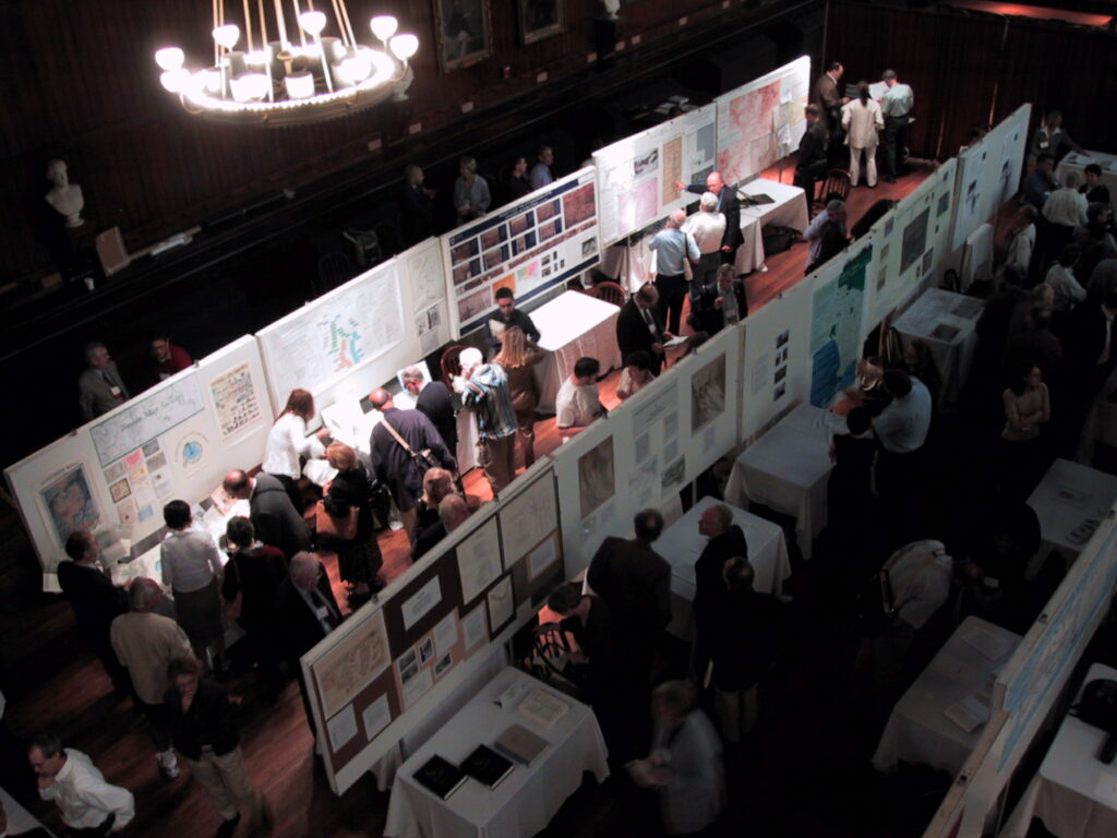
- Aliphat, Mario M., and Laura Caso Barrera. The Colonial Mapping of the Southern Maya Lowlands.
- Bobrik, Gustavo C. Mapping the Glaciers.
- Borges, Maria Eliza Linhares. L’Atlas de l’Empire du Brésil (1868): cartes, imagerie et conscience national.
- Boston Map Society. The Boston Map Society.
- Bracke, Wouter. Le projet du dictionnaire des arpenteurs aux Pays-Bas méridionaux (XIV-XVIII siècles).
- Brancaforte, Elio. The Representation of the Caspian Sea in Early Modern Cartography: The Case of Adam Olearius, 1647.
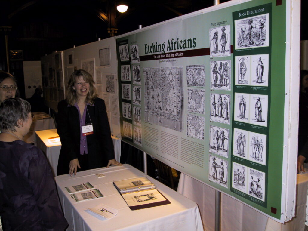
- Butler, Diane. Etching Africans: The 1608 Blaeu Wall Map of Africa.
- Clarke, Joyce E. A Window on to the New World: The Santa Cruz Map.
- Cormier, Marc A. Cartographie des îles Saint-Pierre et Miquelon du XVIe au XIXe siècle: toponymie et représentation variées d’une balise cartographique de la côte atlantique (was available on line link to archived version).
- Davies, Surekha. Commodities and Cornucopiae: Amerindians and Material Wealth in European Maps, ca. 1550-1700.
- Dulce de Faria, Maria. Maps from the Pedro de Angelis Collection in the National Library of Brazil.
- Explokart staff. EXPLOKART, University of Utrecht.
- Frumin, Mitia. Russian Mapping Activities in the Eastern Mediterranean in the Late Eighteenth Century.
- Fürst-Bjeliš, Borna, and Sanja Lozic. The Grimani Cadastral Survey (Eighteenth-Century): Tracing Environmental Change in Central Dalmatia, Croatia.
- Furtado, Júnia Ferreira. Gold and Diamond Cartography in Brazil in the Eighteenth and Nineteenth Centuries.
- Gogate, Prasad, and B. Arunachalam: Native Indian Antique Maps of Gujarat (The poster was presented by Prasad Gogate).
- Hasegawa Koji. Urbanization and Tourism Projected on Panoramic Maps in Modern Japan.
- History of Cartgraphy Project. The History of Cartography Project.
- Hutchinson, Gillian. A 1690 Manuscript Map of Nouvelle France in the Collection of the National Maritime Museum, UK.
- Irás, Krisztina. Linschoten’s India Orientalis and its Portuguese Cartographical Sources.
- Iuliano, Marco. Melchior Lorichs’s View of Constantinople (1559): Cartography and Urban History.
- Johnson, Jenny Marie, and Nicholas R. Chrisman. Demarcating Territorial Acquisitions: Examining the Changing Story of the History of the United States.
- Koepp, Donna P. and Vida Margaitis. Mapping a Nation.
- Krogt, Peter van der, and Ferjan Ormeling. A Map Use Manual from 1554.
- Lamb, Blaine P. Military Map Makers in a Land of Gold: California, 1848-1849.
- Macle, Jorge. Mariano Carlés y Casadevall and the Archetype of the Cartography of an Age.
- Mogel, Lize. Public Green.
- Mosher, Rosemary. Georeferencing Map States Using Plate Fingerprints and GIS Technologies.
- Parmentier, Jan, Ann Heirman, and Paolo De Troia. Sambiasi: A Missing Link in Western Map Making in China? (presented by Jan Parmentier and Paolo De Troia).
- Pflederer, Richard. The John Hunt Map and the Mystery of Popham Colony, Maine.
- Piribeck, Jan, Gary Green, and Chris Hoffmann. TRANSECT: The Back Cove Project.
- Pollitt, Frances.Mapping the Northeast Boundary of the United States, 1792-1843.
- Raleigh, James T., and Henry Walling. Maps of the Battle of Monmouth (New Jersey, North America), June 28th, 1778 and Roads through New Jersey and the Battle of Monmouth, June 1778.
- Rizzo, Gerald J. Lake Debo: An African Beacon Through the Ages.
- Romanova, Olga. The Image of Yakutia’s Territory on Drawings and Maps of the Seventeenth Century (presented by Liudmila Zinchuk).
- Shingiray, Irina. Imagining the Shadow Empire: The Early Abbasid Geographic Conceptualization of the Nomadic Khazar State.
- Solar, Renata, and Dalibor Radovan. Hyperlinked Promenade through the Historical Geolocation, Toponymy, and Appearance of Slovenian Towns.
- Török, Zsolt. The End of Geographical Dreams: Samuel Mikoviny (1700-1750) and the Beginnings of the Scientific Mapping of Hungary.
- Unverhau, Dagmar. The Cold War and its Impact on Cartography: One Example from the Former German Democratic Republic.
- Van Ee, Patricia Molen. Sellers and Van Ee 25 Years Later.
- Washington Map Society. The Washington Map Society
ISCEM meeting
Report not received.
ICA Session Teaching the History of Cartography VI
The ICA Commissions on the History of Cartography and on Education and Training had a joint session on Teaching the History of Cartography at Harvard University’s Memorial Hall on June 14, 2003. Thanks to the local organizers of the international Conference on the History of Cartography, David Cobb and Matthew Edney, this prestigious venue had been secured. With about 50 participants the session had the following contributions:
- Krogt, Peter van der. The making of the new Atlantes Neerlandici: guidelines for making an atlas bibliography.
- Moser, Robert. The contribution of Jaime Cortesão to teaching the history of cartography in Brazil and Beyond.
- Alkhoven, Patricia. Searching for images of cartography: a short overview of portals and types of image databases, based on Dutch examples (read by Paul van den Brink).
- Akerman, James. Historic maps in K12 classrooms, a resource for teaching the geographical dimensions of American history.
The common denominator of these contributions was their educational aspect: Peter van der Krogt also used volunteers for collecting the required bibliographical data and these volunteers needed to be trained first. Jaime Cortesão was the first to provide formal courses on the history of cartography in Latin America. Patricia Alkhoven presented the Dutch websites selected as an educational resource, and this was also the central theme of James Akerman. The educational programme developed by the Herman Dunlop Smith Centre for the History of Cartography at the Newberry Library in Chicago really got the audience excited, and its impact would not only boost interest in the history of cartography in high schools but in cartography at large as well.
Tony Campbell, retired curator of the Map Room at the British Library, had developed a website for teachers in the history of cartography (http://www.maphistory.info/courses.html ) and he shortly discussed its objectives during the session.
The session chair, Ferjan Ormeling, indicated that in 2005, probably on July 1, a similar session on Teaching the History of Cartography would be organized in Budapest, Hungary, at the Cartographic Institute of the Eötvös Lorand University
Note
There were five books distributed free among the participants:
- Alex Krieger and David Cobb with Amy Turner (ed.), Mapping Boston. Cambridge, Mass.: The MIT Press, 2001. 278 pp. A donation of Norman B. Leventhal, who signed each individual book.The Osher Library Associates donated:
- James E. Mooney, Maps, Globes, Atlases and Geographies Through The Year 1800: The Eleanor Houston and Lawrence M.C. Smith Cartographic Collection at the Smith Center for Cartographic Education, University of Southern Maine, Foreword by Kenneth Nebenzahl, Introduction by Philip Chadwick Foster Smith. Portland, Maine: University of Southern Maine, 1988. 145 pp.
- The Cartographic Collections: The Harold L. and Peggy L. Osher Collection [and] The Lawrence M.C. and Eleanor Houston Smith Collection. Portland, Maine: University of Southern Maine, 1993. 16 pp.
- Matthew H. Edney and Irwin D. Novak (ed.), Reading the World Map: Interdisciplinary Perspectives on Pieter van den Keere’s Map, Nova Totius Terrarum Orbis Geographica ac Hydrographica Tabula (Amsterdam, 1608/36). Portland, Maine: Osher Map Library and Smith Center for Cartographic Education, University of Southern Maine, 2001. (Osher Library Associates, Occasional Publication; No. 1). 41 pp.
- Donald S. Johnson, Charting Neptune’s Realm: From Classical Mythology to Satellite Imagery, Exhibition catalog. April 4, 2000 to January 11, 2001. Portland, Maine: Osher Map Library and Smith Center for Cartographic Education, University of Southern Maine, [2000]. (Osher Library Associates, Occasional Publication; No. 2). 56 pp.


References
Cartographica Helvetica 28 (Juli 2003): 42-43 (Hans-Uli Feldmann).
Imago Mundi 54,1 (2004): 87-93 (Karen S. Cook).