Stadscartografie
Urban Cartography
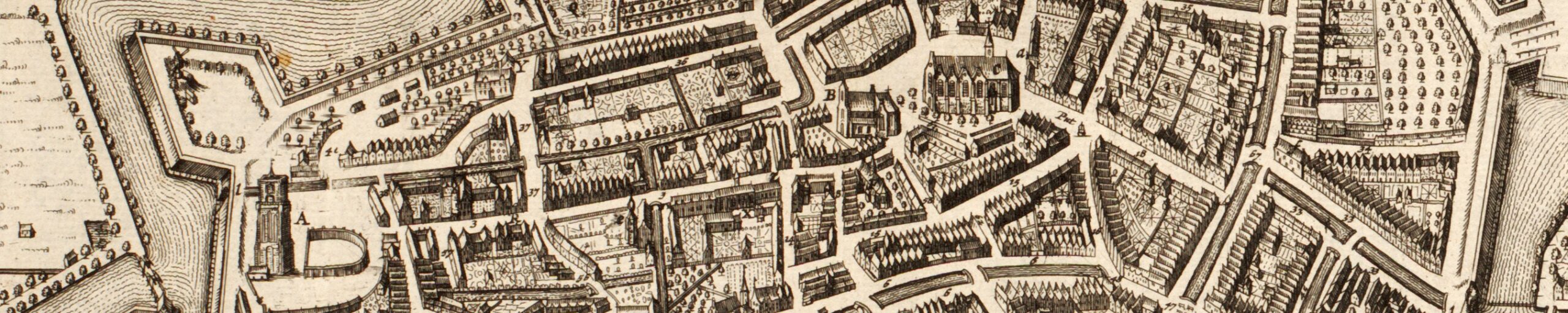
Steden worden al eeuwenlang in kaart gebracht en de stadscartografie is dan ook een van de belangrijke deelgebieden van de cartografie. Aangezien de Lage Landen sinds de late middeleeuwen één van de meest geürbaniseerde regio’s van Europa zijn, hoeft het niet te verbazen dat er heel wat stadsplattegronden van de Nederlandse en Belgische steden zijn gemaakt. Bovendien beleefde de productie van stedenatlassen er hoogtijdagen in de zestiende en zeventiende eeuw.
Voor verscheidene steden is de stadscartografische productie reeds bestudeerd. In een aantal gevallen leidde dat tot diepgaande en uitgebreide monografieën en kartobibliografieën; in andere gevallen blijven de publicaties beperkt tot korte artikels of tentoonstellingscatalogi. Naar de productie en samenstelling van de stedenatlassen is ook al het nodige onderzoekswerk verricht en sommige vroegere stedenatlassen zijn heruitgegeven, al dan niet als facsimile. Opvallend is wel dat er geen overzichtswerk over de stadscartografie van de Lage Landen bestaat, waarin de belangrijkste karakteristieken en evoluties van het genre worden toegelicht en verklaard.
Vroegere stadsplattegronden vormen één van de voornaamste bronnen voor de samenstelling van historische stedenatlassen en stadsmorfologisch onderzoek. In dat kader is halverwege de jaren 1950 in de schoot van de International Commission for the History of Towns een groot onderzoeksproject opgezet: het European Historic Towns Atlas Project.
Het had een dubbel doel: enerzijds de publicatie van historische stedenatlassen voor zoveel mogelijk steden en op zo uniform mogelijke wijze, anderzijds en daarop voortbouwend een groot comparatief onderzoek naar de stadsmorfologie en ruimtelijke ontwikkeling van de Europese steden. Betreurenswaardig is dat de productie van historische stedenatlassen in de – nochtans zeer geürbaniseerde – Lage Landen amper van de grond is gekomen. Voor Nederland en België samen verschenen slechts acht stedenatlassen volgens de officiële richtlijnen. Wel zagen de afgelopen drie decennia enkele aanverwante boeken het licht.
Vanuit de leerstoel historische cartografie zal een poging worden ondernomen om enerzijds het onderzoek naar de stadscartografische productie, zowel van individuele steden als in algemene zin, verder te zetten en anderzijds om het stilgevallen historische stedenatlassenproject voor de Lage Landen nieuw leven in te blazen. Wat dit laatste betreft, is samenwerking met andere partners noodzakelijk. De uitgave van de zeven Nederlandse historische stedenatlassen in de periode 1982-2003 was overigens het gevolg van een samenwerkingsverband tussen de Universiteit van Amsterdam en de TU Delft.
Referenties
- Bram Vannieuwenhuyze, ‘De Marcus Gerardskaart in haar 16de-eeuwse cartografische context’, in: Koen Goeminne (red.), De wereld van Marcus Gerards. Brugge in 1562, s.l., De Boekenmaker BV, 2024, pp. 61-77.
- Jan Trachet & Bram Vannieuwenhuyze, ‘Mapping apart together – Les cartes des artistes-cartographes à Bruges, 1557-1572 : des œuvres isolées ou collaboratives?’, in: Jean-Marc Besse, Catherine Hofmann, Emilie d’Orgeix & Emmanuelle Vagnon (éd.), Art(s) et cartographie(s). Cartes & Géomatique. Revue du Comité français de cartographie, 2024, 256, pp. 25-43.
- Reinout Rutte & Bram Vannieuwenhuyze, Stedenatlas Jacob van Deventer. 226 Stadsplattegronden uit 1545-1575 – Schakels tussen heden en verleden, Bussum – Tielt, Uitgeverij Thoth – Uitgeverij Lannoo, 2018.
- Bram Vannieuwenhuyze, ‘Stadsgeschiedenis en/in kaarten’, in: M. Hameleers, M. Carnier, P. Alkhoven & R. Kruk (red.), Cartografie. Visie op de kaart. s@p Jaarboek, dl. 15, ’s-Gravenhage, Stichting Archiefpublicaties, 2016, pp. 197-207.
- Bram Vannieuwenhuyze & Reinout Rutte, ‘Medieval Urban Form in the Low Countries: State of Research, Comparative Perspective and Symbolic Meaning’, in: A. Simms & H.B.-Clarke (Ed.), Lords and Towns in Medieval Europe. The European Historic Towns Atlas Project, Farnham – Burlington, Ashgate, 2015, pp. 375-398.
Cities have been mapped for centuries and urban cartography is therefore one of the important areas of cartography. As the Low Countries have been one of the most urbanized regions in Europe since the late Middle Ages, it is no surprise that many city maps of Dutch and Belgian cities have been made. Moreover, the production of city atlases experienced its heyday in the sixteenth and seventeenth centuries.
Urban cartographic production has already been studied for several cities. In a number of cases this led to in-depth and extensive monographs and carto-bibliographies; in other cases the publications are limited to short articles or exhibition catalogues. Necessary research work has also been done on the production and composition of the former city atlases; some have been re-issued, whether or not in facsimile. What is striking is that there is no overview work on the urban cartography of the Low Countries, in which the most important characteristics and evolutions of the genre are explained.
Former city maps are one of the main sources for the composition of historical city atlases and urban morphological research. In that context a large research project was set up in the mid-1950s within the framework of the International Commission for the History of Towns : the European Historic Towns Atlas Project
It had a dual purpose: on the one hand the publication of historical atlases for as many cities, and in the most uniform way, as possible; and on the other hand – and building on this – a large comparative study into the urban morphology and spatial development of European cities. It is regrettable that the production of historical city atlases in the – although highly urbanized – Low Countries has barely progressed. For the Netherlands and Belgium together, only eight have appeared according to the official guidelines. However, a number of related books have emerged in the last three decades.
From the Chair of Historical Cartography an attempt will be made to continue the research into urban cartographic production, both of individual cities and in a general sense; and to breathe new life into the halted historical urban atlas project for the Low Countries. With regard to the latter, cooperation with other partners is necessary. The publication of the seven Dutch atlases in the period 1982-2003 was, moreover, the result of collaboration between the University of Amsterdam and TU Delft.
References
- Bram Vannieuwenhuyze, ‘De Marcus Gerardskaart in haar 16de-eeuwse cartografische context’, in: Koen Goeminne (red.), De wereld van Marcus Gerards. Brugge in 1562, s.l., De Boekenmaker BV, 2024, pp. 61-77.
- Jan Trachet & Bram Vannieuwenhuyze, ‘Mapping apart together – Les cartes des artistes-cartographes à Bruges, 1557-1572 : des œuvres isolées ou collaboratives?’, in: Jean-Marc Besse, Catherine Hofmann, Emilie d’Orgeix & Emmanuelle Vagnon (éd.), Art(s) et cartographie(s). Cartes & Géomatique. Revue du Comité français de cartographie, 2024, 256, pp. 25-43.
- Reinout Rutte & Bram Vannieuwenhuyze, Stedenatlas Jacob van Deventer. 226 Stadsplattegronden uit 1545-1575 – Schakels tussen heden en verleden, Bussum – Tielt, Uitgeverij Thoth – Uitgeverij Lannoo, 2018.
- Bram Vannieuwenhuyze, ‘Stadsgeschiedenis en/in kaarten’, in: M. Hameleers, M. Carnier, P. Alkhoven & R. Kruk (red.), Cartografie. Visie op de kaart. s@p Jaarboek, dl. 15, ’s-Gravenhage, Stichting Archiefpublicaties, 2016, pp. 197-207.
- Bram Vannieuwenhuyze & Reinout Rutte, ‘Medieval Urban Form in the Low Countries: State of Research, Comparative Perspective and Symbolic Meaning’, in: A. Simms & H.B. Clarke (Ed.), Lords and Towns in Medieval Europe. The European Historic Towns Atlas Project, Farnham – Burlington, Ashgate, 2015, pp. 375-398.