Onderwijs aan de Universiteit van Amsterdam
Education at the University of Amsterdam
Onderwijs over historische cartografie wordt verzorgd door Bram Vannieuwenhuyze en is ondergebracht bij de Vakgroep Boekwetenschap, onderdeel van de Faculteit Geesteswetenschappen van de Universiteit van Amsterdam.
De volgende colleges worden aangeboden:
- Binnen de Master Boekwetenschap kunnen studenten kiezen voor het studiepad Kaarten & Atlassen. In het eerste semester volgen de studenten naast enkele algemene vakken het college Geschiedenis van de cartografie, in het tweede semester Kaartanalyse, waarbij enkele individuele opdrachten en collectieve onderzoeksprojecten rond historisch kaartmateriaal worden opgezet. In het tweede semester doen de studenten ook een stage bij een instelling met een (oude) kaartencollectie en voeren ze zelf kaarthistorisch onderzoek dat uitmondt in de masterscriptie.
- Het mastervak Geschiedenis van de cartografie biedt een algemene introductie op de belangrijkste evoluties die zich in de geschiedenis van de cartografie hebben voorgedaan, van de prehistorie tot nu. De focus ligt daarbij vooral op de Lage Landen. Studenten lezen een reeks artikels/hoofdstukken over de productie, verspreiding en consumptie van kaarten en atlassen in het verleden en over de belangrijkste tendensen in de geschiedenis van de cartografie. De lectuur van die artikels wordt geëvalueerd tijdens discussiecolleges. Tevens lezen en recenseren de studenten een niet-Nederlandstalig boek over een specifiek aspect van de geschiedenis van de cartografie.
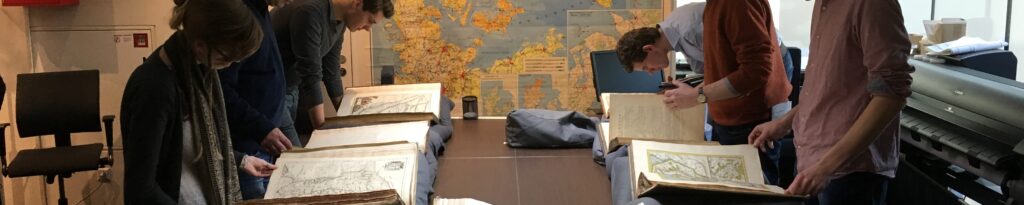
- Het mastervak Kaartanalyse leert studenten oude kaarten te ontleden, te interpeteren en op die basis zelf nieuwe kaarten te maken. Er wordt daarbij gebruik gemaakt van digitale technieken en programma’s zoals GIS (geografisch informatiesysteem), MapAnalyst en/of ESRI Story Maps. Het college schenkt ook uitvoerig aandacht aan uitgangspunten en methoden m.b.t. het onderzoek naar kaarten en atlassen als bron voor historisch, kunsthistorisch, boekhistorisch, landschapskundig en archeologisch onderzoek.
- Het vak World Views: Maps and Politics wordt gegeven door Bram Vannieuwenhuyze en Djoeke van Netten als onderdeel van de bachelor Global Arts, Culture and Politics (Cultural Studies) aan de Universiteit van Amsterdam.
Education about historical cartography is provided by Bram Vannieuwenhuyze and is part of the study programme of the MA Book Studies, affiliated with the Faculty of Humanities at the University of Amsterdam.
The following courses are offered:
- Within the MA Book Studies, students can choose the study path Maps & Atlases. In the first semester, besides some general subjects, students take the lecture History of Cartography. In the second semester, the course Map Analysis is taught, with some individual assignments and collective research projects on historical maps. In the second semester, students also do an internship at an institution with an (old) map collection and conduct their own map history research that culminates in the master’s thesis.
- The master’s course History of Cartography provides a general introduction to the main evolutions that have occurred in the history of cartography, from prehistory to the present. The main focus is on the Low Countries. Students read a series of articles/chapters on the production, distribution and consumption of maps and atlases in the past and on the main trends in the history of cartography. The reading of those articles is evaluated during discussion lectures. Students also read and review a non-Dutch-language book on a specific aspect of the history of cartography.
- The Master’s course Map Analysis teaches students to deconstruct and interpret old maps and, on that basis, create new maps themselves. Digital techniques and programmes such as GIS (geographic information system), MapAnalyst and/or ESRI Story Maps are used. The course also pays extensive attention to principles and methods relating to the study of maps and atlases as sources for historical, art-historical, book-historical, landscape and archaeological research.
- The course World Views: Maps and Politics is taught by Bram Vannieuwenhuyze and Djoeke van Netten as part of the bachelor’s programme Global Arts, Culture and Politics (Cultural Studies) at the University of Amsterdam.