The Atlas Blaeu-van der Hem
Explokart Research Project by Peter van der Krogt and Erlend de Groot
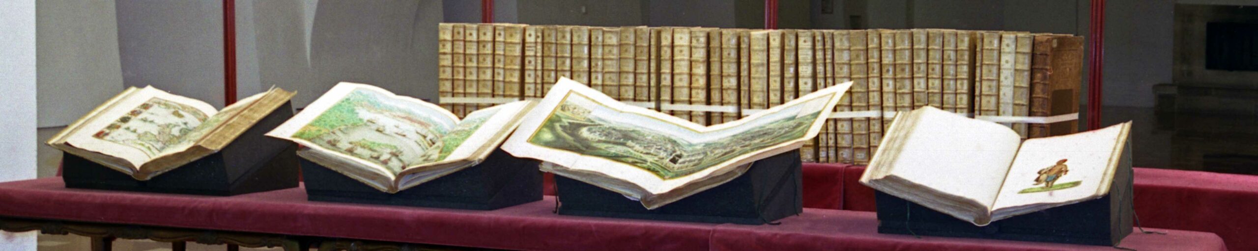
The Atlas Blaeu-Van der Hem can be considered the most beautiful and most remarkable atlas that has ever been composed. The atlas contains more than 2400 maps, prints, and drawings, distributed over 46 volumes. This collection, a show-piece of Dutch seventeenth-century cartographic and topographic art, is preserved fully intact in the Austrian National Library in Vienna.
Content of this page
Introduction
Between 1662 and 1672 Joan Blaeu published his famous Atlas Maior, or ‘Great Atlas’, in Amsterdam. The Atlas Maior was edited in Latin, French, Dutch, and Spanish, and, depending on the edition, bound in nine to twelve volumes. With almost 600 maps covering the entire known world, the Atlas Maior was the largest and most expensive book published in the seventeenth century. For over a hundred years, Blaeu’s Atlas Maior remained the standard world atlas and the premier product of the Dutch publishing industry, the most prestigious in the world. Collectors wealthy enough to acquire a copy of the Atlas Maior often treated the atlas as a portmanteau for other cartographical, topographical, historical, and ethnographical prints and drawings.
The most enterprising collector of this kind was the Amsterdam lawyer Laurens van der Hem (1621-1678). Van der Hem had begun collecting maps and topographical drawings as early as 1645. When the Latin edition of Blaeu’s Atlas Maior was published in 1662, he acquired a copy which he used as the base for an even more ambitious collection of maps and topographical drawings and prints. Van der Hem arranged the sheets in the Atlas according to his own ideas, amplifying the volumes with more than 1800 maps, charts, townscapes, architectural prints, portraits, etc., many of them beautifully coloured by the well-known specialist Dirck Jansz. van Santen and his colleagues. Besides prints, the atlas also contains a wealth of drawings: maps, town- and seascapes, renderings of foreign people etc. To enhance the harmony and untiy of the whole, all the sheets were adapted to the size of the Atlas Maior. If they were too wide, they were folded in; if they were too small, they were enlarged, and coloured in such a way that the transition from original print to enlargement became invisible; if the original sheets were too high, they were reduced in format, or cut into pieces, and separately pasted on blank leaves.
Among the most impressive of Van der Hem’s additions to the Atlas Maior, is the set of four volumes of manuscript-maps and topographical drawings, which were originally made for the VOC (the East Indies Company). These volumes are known as the ‘secret atlas of the VOC’. Van der Hem was one of the few private citizens to posses part of this confidential material. Other well-known additions to the Atlas Maior include the extensive series of topographical drawings, the majority of which was done by well-known artists such as Willem Schellinks, Lambert Doomer, Jan Hackaert, and Reinier Nooms called Zeeman. Thus Van der Hem created an atlas which far extended the scope of Blaeu’s original Atlas Maior.
The Atlas Blaeu-Van der Hem contains an inestimable treasure of information, not only in the fields of geography and topography, but also in those of archeology, architecture, sculpture, ethnography, folklore, heraldry, navigation, fortification and warfare, portraits of famous figures, technique, public works, and many other aspects of seventeenth-century history, culture, and customs. Moreover, all this information is conveniently arranged in a unified manner. As one scholar put it: “the Atlas is a mirror of the geographical and geopolitical knowledge, available in one of the major trading-nations of the world in those days” (R. Wagner, Die Überseeischen Gebiete im Atlas Blaeu-Van der Hem der Österreichische Nationalbibliothek, Wien 1976).
Although we do not know wether or not Van der Hem allowed scholars and amateurs a more or less free acces to his treasure, it is certian that he showed it to illustrious visitors from abroad. Among these was Prince Cosimo de’Medici who, on the 2nd of January 1668, noted in his diary that he had visited a “(…) gabinetto con grand’apparato di disegni di varie città, coste, e luoghi dell’Indie, eccelentemente miniati et altre carte di geografia, universali e particulari, fatte a mano con ogni sorte di squisitezza immaginabile” (a cabinet with a large number of illustrations, depicting various cities, coasts, and places of the Indies, excellently coloured, and other maps, geographical as well as universal and particular, all hand-made with all possible kinds of exquisiteness).
When the collector died, his children inherited the atlas. Van der Hem’s daughter Agatha kept the Atlas for many years with jealous care – or so it seems, for she turned down several offers to sell the whole collection, and also refused to sell back to the VOC the four volumes of confidential material. In 1711, she showed the Atlas to the great bibliophile and collector from Frankfurt am Main, Konrad Zacharias von Uffenbach (1683-1734), who wrote what amounts to the first comprehensive account of it in his Merkwürdige Reisen durch Niedersachsen, Holland und England. Uffenbach confessed that he did not understand at first why it was that a copy of the Blaeu atlas could be so highly valued. After his visit, though, he had to admit that his initial scepticism was unfounded, “(…) denn man kann ihn eigentlich keinen Blaeuischen, sondern man muss ihn einen recht königlichen Atlanten nennen” (for you cannot in fact call it a Blaeu-Atlas, but you should call it a truly royal atlas).
After Agatha’s death the atlas was auctioned by Adriaan Moetjens in The Hague in 1730. In the auction catalogue, a letter is included from the French geographer Bruzen de la Martiniere, stating that “(…) celui qui poss‚dra le tout, pourra se vanter d’avoir le plus bel assemblage de cartes qu’il ait au monde” (he who will posses it all, could claim to have the most beautiful collection of maps to be found in the world). The buyer was Prince Eugene of Savoie (1663-1736), the stadtholder-general of the Austrian Netherlands, who had become famous as a general in the wars against the Turcs. Prince Eugene was an art-lover and collector, who also showed great interest in the development of the sciences. Apart from collecting paintings, antiquities, and other objects of art, he built up a library of international standing, containing some 15.000 volumes. The acquisition of the Atlas Blaeu-Van der Hem certainly enriched this library, and the atlas was without a doubt considered one of the show-pieces of Eugene’s book-collection. It is said that Eugene paid 22.000 guilders for the atlas, an immense price, but never confirmed with certainty.
Eugene’s heir, his niece Victoria, sold the atlas in 1736 with the rest of Eugene’s library to the Imperial Library in Vienna (nowadays the Austrian National Library). The significance of this acquisition was underlined by the fact that the Bibliotheca Eugenia was placed in the Hall of State (Prunksaal) of the Imperial Library, built by Johann Bernhard Fischer von Erlach. When in 1905 the map-collection (Kartensammlung) within the Imperial Library was founded, the Atlas Blaeu-Van der Hem was transferred to this collection. The most beautiful and most prestigious Dutch atlas from the seventeenth century has remained there ever since, still fully preserved and in good condition.
Volume |
Territory |
|---|---|
| 1 | Spain and Portugal |
| 2-8 | France |
| 9-11 | Italy and Sicily |
| 12 | Malta |
| 13 | Switzerland |
| 14 | The Austrian Netherlands |
| 15-17 | The Dutch Republic |
| 18-20 | England |
| 21 | Scotland and Ireland |
| 22 | Denmark, Norway, and the Arctic regions |
| 23 | Sweden and Poland |
| 24 | Russia |
| 25-33 | Germany, Austria and Hungary |
| 34 | Greece, the Balkan, and Asia Minor |
| 35-37 | Africa |
| 38-41 | ‘Secret Atlas’ of the VOC |
| 42 | China |
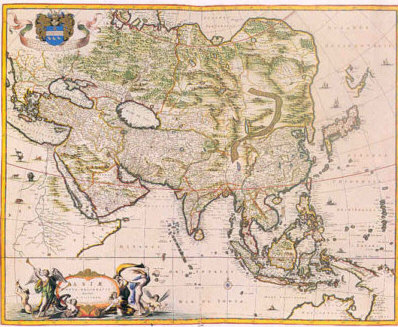
| 43 | Asia |
| 44-45 | America |
| 46 | Appendix |
| 47-50 | Ergänzungsbände (additional volumes) |
The Atlas Maior
Joan Blaeu’s Atlas Maior is the result of thirty years of competition in the production of atlases. Two editors were involved in this rivalry to produce the largest atlas in existence: Johannes Janssonius, son-in-law and successor of Jodocus Hondius, and Joan Blaeu. It all started in 1630 when Willem Jansz. Blaeu – probably urged by his son Joan Blaeu – published a modest Appendix to the atlas of Mercator. The publication of this appendix – a series of maps without explanatory texts – was the first infringement on the monopoly that the house of Hondius-Janssonius had held since the publication of the first Mercator-Hondius atlas in 1606.
The history of the original Mercator atlases started in 1585. Gerard Mercator published four parts of his Atlas in 1585 and 1589, and a fifth part was published in 1595 by his son Rumold. The Atlas was not yet complete, but Jodocus Hondius Sr., who had obtained the copperplates in 1604 completed the work. His edition, the Mercator-Hondius atlas, appeared in 1606. During the next 25 years Hondius, his sons and his son-in-law published several editions of the Atlas. The atlas didn’t change significantly in content though: only a few maps were slightly improved.
Blaeu’s Appendix of 1630 neccessitated, and resulted in, an extension and renewal of the Mercator-Hondius atlas. But also for Blaeu himself the Appendix was not yet enough. Already in 1631 an extended Appendix followed the first one – this time with explanatory texts to the maps. Some years later Willem Jansz. Blaeu and his son Joan completed their first atlas plans. In 1635 they had published an atlas of two volumes with over 200 maps in four different languages: German, Latin, French, and Dutch. They entitled their atlas Theatrum Orbis Terrarum sive Novus Atlas. An edition in three volumes with additional maps was planned, and appeared in 1640. In the meantime, in 1638, Janssonius and Hondius published their Novus Atlas, the successor to the Mercator-atlas in three volumes and four editions of different languages. The rivalry continued, and each couple of years both editors added a new volume to their Novus Atlas. In 1645 Blaeu published a fourth volume, containing maps of all English counties. The next year Janssonius’s copied edition appeared as an atlas of the British Islands: he had added maps of Scotland and Ireland. In 1650 a fifth volume of Janssonius Novus Atlas followed: a sea-atlas. For the time being Blaeu sticked to ‘land’-atlases and published his atlas of Scotland in 1653, followed by an atlas of China in 1655. Consequently from 1655 on Blaeu had an atlas in six volumes and Janssonius an atlas in five volumes. Between 1658 and 1662 Janssonius also produced a sixth volume, dedicated to history. In content Janssonius’s atlas in six volumes offered a better overview of the world than Blaeu’s atlas: not only the land, but also the sea and history were represented. Moreover, in 1660 Janssonius also added to his catalogue a celestial atlas, the Harmonia Macrocosmica by Cellarius. By now Janssonius had completed the cosmography, the Atlas as it was originally intended by Mercator: a description of the old and new geography, of the seas and of the heavens.
Joan Blaeu, realizing that his rival would take the lead, also announced a cosmography, far more ambitious in scope than Janssonius’s. This cosmography would be titled: Atlas Maior, sive Cosmographia Blaviana, qua solum, salum, coelum, accuratissime describuntur (Major Atlas or Blaeu’s Cosmography, in which are most accurately described earth, sea, and heaven). The project was never fully realized. Only the first part, the modern geography, was published, under the title Geographia, qu‘ est Cosmographi‘ Blavian‘ pars prima, qua orbis terr‘ tabulis ante oculos ponitur, et descriptionibus illustratur (Geography, first part of Blaeu’s Cosmography, in which maps of the world are presented before one’s eyes, elucidated with descriptions). This first published part is the Latin edition of the Atlas Maior in eleven volumes as we now know it (the Dutch and French editions had nine, respectively twelve volumes).
The Latin edition of the Atlas Maior contains 593 maps, of which many were specifically made for this edition. The other maps had already been used for previous atlasses by Blaeu. The content of the Atlas Maior is divided into five sections (pars): Arctica (1 book), Europe (17 books), Africa (1 book), Asia (2 books), and America (1 book). Each section contains one or more books (liber). The division in volumes (volumen) stands apart from the subdivision into sections and books. All the sections, books, and volumes are provided with distinct title-pages.
Atlas Maior |
Atlas Blaeu-Van der Hem |
|||
|---|---|---|---|---|
vol. |
section |
book |
region |
vol. (part) |
| I | 1 | – | Arctica | 22 (1) |
| 2 | 1 | Norway | 22 (2) | |
| 2 | Denmark | 22 (3) | ||
| II | 3 | Sweden | 23 (1) | |
| 4 | Russia | 24 | ||
| 5 | Poland | 23(2) | ||
| 6 | South-east Europe | 33 | ||
| 7 | Greece | 34 | ||
| III | 8 | Germany | 25-32 | |
| IV | 9 | Austrian Netherlands | 14 | |
| 10 | The Dutch Republic | 15 & 17 | ||
| V | 11 | England | 18 | |
| VI | 12 | Scotland | 21(1) | |
| 13 | Ireland | 21(2) | ||
| VII | 14 | France | 2-4 & 6 | |
| 15 | Switzerland | 13 | ||
| VIII | 16 | Italy | 9 | |
| IX | 17 | Spain | 1 | |
| 3 | – | Africa | 35 | |
| X | 4 | 1 | Asia general | 43 |
| 2 | China | 42 | ||
| XI | 5 | – | America | 44-45 |
No maps from Blaeu’s Atlas Maior are included in the volumes 5, 7-8, 10-12, 19-20, 36-41, and 46 of the Atlas Blaeu-Van der Hem.
Descriptive Catalogue
Up until now, a catalogue raisonné‚ which covers the whole atlas with its broad range of subjects in the atlas, was lacking. To meet the demands of many users from various disciplines, Günter Schilder and Peter van der Krogt then of the Faculty of Geographical Sciences of Utrecht University developed the plan for a complete inventory of the contents of the Atlas Blaeu-Van der Hem. The idea was to realize a catalogue in five volumes, fully illustrated and annotated, of all the sheets in the atlas. Considering the art-historical, and more broadly cultural, value of the Atlas Blaeu-Van der Hem, co-operation was sought with the Bernard Aikema of the Department of Art-History of Nijmegen University. The project received full support from the Austrian National Library.
The realization of this catalogue would not have been possible without the support of many institutions and individuals. The Editorial Committee is especially grateful to the general manager of the Austrian National Library for the permission to reproduce all the plates of the atlas; to Dr. Franz Wawrik, chief curator of the map-collection of the Austrian National Library, and his succesor Mag. Jan Mokre; to the Department of Geographical Sciences of Utrecht University for its substantial financial aid; to Gary Schwartz and Jan Peeters, who greatly stimulated the project in its initial phase; to Karen Lindsey for her corrections and advices; to Sebastiaan Hesselink, director of HES Publishers, whose enthousiasm has been a crucial factor for the succes of our ambitious project to make the Atlas Blaeu-Van der Hem accessible for future research.
Two additional volumes complete the set:
- The Atlas Blaeu – Van der Hem of the Austrian National Library: Descriptive catalogue, compiled by Peter van der Krogt and Erlend de Groot; Editorial committee: G. Schilder, B. Aikema and P. van der Krogt. 6 vols., 1996-2008.
- Vol. I. Spain, Portugal and France (vols 1-8). Published 1996.
- Vol. II. Italy, Malta, Switzerland and the Low Countries (vols 9-17). Published 2000.
- Vol. III. British Isles, northern and eastern Europe (vols 18-24). Published 2002.
- Vol. IV. Germania, Hungary and Greece, including Asia Minor (vols 25-34). Published 2004.
- Vol. V. Africa, Asia and America, including the “secret” atlas of the Dutch East-India Company (VOC) (vols 35-46). Published 2005.
- Vol. VI. Additional volumes (“Ergänzungsbände”) and general index. Published 2008.
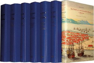
- The Atlas Blaeu-Van der Hem of the Austrian National Library: The World of a Seventeenth-Century Collector, By Erlend de Groot. Published 2006.
- The Atlas Blaeu-Van der Hem of the Austrian National Library: The History of the Atlas and the Making of the Facsimile, editor Koert van der Horst. Published 2011.
Available from:
Brill Publishers, Leiden
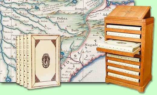
Facsimile edition
The facsimile edition of the volumes of the Atlas Blaeu-Van der Hem relating to Africa, America & Asia is the most prestigious and unique facsimile atlas ever made. The original Atlas Blaeu-Van der Hem is preserved in the Österreichische Nationalbibliothek (Austrian National Library) in Vienna. We have worked in the past years to prepare an exclusive facsimile edition of the volumes of this incredibly beautiful atlas that pertain to Africa, America & Asia, including the “secret” atlas of the Dutch East-India Company (VOC).
This fascimile includes nearly 500 views, maps, charts and drawings, bound in eight folio volumes:
- Volume 35: Africa
- Volume 36: Atlantic Coast of Africa & Volume 37: Morocco
- Volume 38: The “Secret” Atlas of the Dutch East-India Company (V.O.C. Part 1)
- Volume 39: The “Secret” Atlas of the Dutch East-India Company (V.O.C. Part 2)
- Volume 40: The “Secret” Atlas of the Dutch East-India Company (V.O.C. Part 3)
- Volume 41: The “Secret” Atlas of the Dutch East-India Company (V.O.C. Part 4)
- Volume 42: Martini’s Atlas of China & Volume 43: Asia
- Volume 44: America & Volume 45: Dutch Brazil
Available from:
Brill Publishers, Leiden
Information is also on the archived version of the former page of HES & De Graaf Publishers: www.blaeuvanderhem.com.