7th International Conference on the History of Cartography
7-11 August 1977 — Washington, D.C.
 Held at the Library of Congress, the Folger Shakespeare Library, the National Archives and Records Service and the Smithsonian Institution, with Walter W. Ristow the principal coordinator.Attendance estimates vary from about 200 to about 250, from 11 countries.
Thematic sections were “Map Production and Trade,” “The Science of Princes,” “Sea Charts,” “Cartography of Exploration,” “Asian Cartography,” “American Cartography,” “World View,” “Techniques and Symbols,” “Regional Cartography,” “Art and Cartography.”
There were three exhibitions:
- “Maps for an Emerging Nation:Commercial Cartography and Nineteenth-Century America,” at the Library of Congress;
- “Early Maps and Atlases” at the Folger Shakespeare Library;
- “Taking the Measure of the Land:Cartographic Images of the United States, 1804 to the Present.”
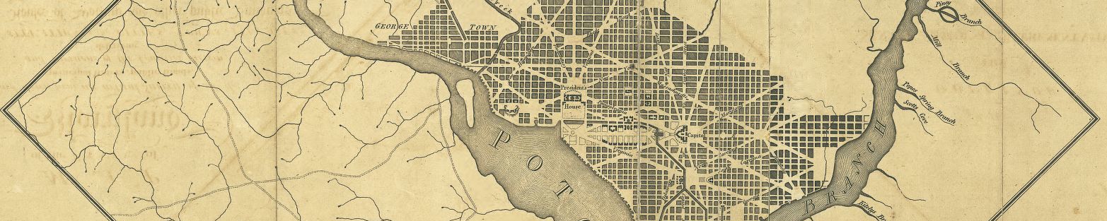
The conference also coincided with an exhibition “The Federal City:Plans and Realities,” There were several receptions.At this ICHC on August 7 took place a meeting of the History of Cartography Commission of the International Cartographic Association, apparently the first such gathering at one of the conferences.
There were 37 papers (Per Campbell (see below) there were 40, but if so, I have not succeeded in finding the other three.), and full copies of most texts were given out, as also was a book of abstracts (VIIth International Conference on the History of Cartography.Summaries of Papers . . .(Alexandria, Virginia, 1977) (35pp)).Of the papers, four were published full in Imago Mundi, 30 (1978) (Campbell, T., Harley & Walters, Vorsey, Welu).
Papers 7th ICHC
- Ayres, J. E. The Hydrographic Work of the United States Navy. (This paper was apparently actually presented by George Walker.)
- Barata, João da Gama Pimentel. The Portuguese Caravel and the Discovery of America:A Study in Naval Archaeology. (This was a special lecture presented at the end of the conference.)
- Boulind, Richard. Patronage of Mapmakers and Topographers at the Court of Spain. (2pp)
- Campbell, Tony The Woodcut Map as a Physical Object:A New Look at Erhard Etzlaub’s Rom Weg Map of 1500.
- Cumming, William Patterson. The Montresor-Ratzer-Sauthier Sequence of Maps of New York City, 1766-1776. (10pp)
- Dilke, Oswald A.W. The Original Ptolemy. (4pp)
- Dilke, M. S.; Dilke, O. A. W.; and Brancati, A. The Pesaro World Map. (5pp)
- Enterline, J. R. A Transport Mechanism for Accidental Pigments in an Ink Line.
- Guthorn, P. J. The Post-War Employment of Revolutionary War Map Makers.
- Harley, J. Brian; and Walters, G. British Map Collecting, 1790-1840:The Evidence of Sale Catalogues.
- Harvey, Paul D.A. Local Maps from Medieval Europe. (4pp)
- Hsu, Mei-Ling. The Han Maps of the Second Century B.C.:Their Quality and Historical Importance. (32pp)
- Istomina, E. G., and Postnikov, A. V. Maps and Plans of the Artificial Waterways of Russia in the Second Half of the 18th Century.
- Jarcho, Saul. Christopher Packe 1686-1749, Physician-Cartographer of Kent. (15pp)
- Kelley, James E., Jr. Non-Mediterranean Influences That Shaped the Atlantic in the Early Portolan Charts. (17pp)
- Koeman, Cornelis. Manuscript Charts of the West Coast of North America by Gerhard van Keulin, 1711-1712.
- Kusmiadi, Rachmat. A Brief History on Cartography in Indonesia. Special Cases:Topographic and Geological Mapping.
- Lang, Arend W. The Oldest Printed Sea-Map of Northern Europe in Existence, That of Cornelis Anthonisz’ “Caerte van Oostlant,” Amsterdam 1543. (4pp)
- Lee, C. Two Lines of Cartographic Development on the Map of Korea.
- McCune, S. Father Regis’ Map of Korea, 1710-1736.
- Olin, J. S., and Towe, K. The Vinland Map–Chemical Analysis of the Ink and Interpretations of the Analyses.
- Pastoureau, Mireille. Le premier atlas mondial francais:les cartes générales de toutes les parties du monde, de Nicolas Sanson d’Abbeville, 1658. (14pp)
- Pearson, Karen Severud. Germania Illustrata:The Discovery of the German Landscape by 16th Century Geographers, Cartographers and Artists. (11pp)
- Rose, Diane M. T. The Maps, Plans and Sketches of Herman Ehrenberg. (27pp)
- Scharfe, Wolfgang. Prussian Cartography in the Late Eighteenth Century.
- Schilder, G. A Wall Map of the World by W. J. Z. Blaeu-J. Hondius, 1624 (1605).
- Smith, Thomas R.. Cartographic Retrogression:Vaugondy and the Fonte Fantasy.
- Thrower, Norman J. W. The Royal Patrons of the Cartography of Edmond Halley, 1656-1742. (7pp)
- Trudel, Marcel. La carte de Champlain en 1632:ses sources et son originalité. (18pp)
- Vorsey, Louis de. American Indian Contributions to the History of Cartography.
- Unno, Kazutaka. The Origin of the Cartographical Symbol Representing Desert Areas. (4pp)
- Wallis, Helen. The Royal Map Collections of England. (12pp)
- Welu, James A. The Map in Vermeer’s “Art of Painting.”
- Wood, Dennis. Now and Then. Comparisons of Ordinary Americans’ Symbol Conventions with Those of Past Cartographers. (45pp)
- Woodward, David Wax-Engraving and the American Map Trade.
- Wray, Thomas. The Myth of Fiorini’s Projections.
References
Imago Mundi 30(1978): 101-02 (Lewis)
Geographical Journal 144(1978): 155-56 (E. Campbell)
Kartographische Nachrichten 28 (1978): 62 (Scharfe)
地図 Chizu [Map] 16(1978) 2: 27-35 (Kanazawa) (in Japanese)
Special Libraries Association. Geography and Map Division, Bulletin 110(Dec. 1977): 79 (anon) (little information)
See also Bibliographie d’histoire de la géographie et de géographie historique, 1978, pp. 7-8 (no. 5), with a full list of the abstracts.