15th International Conference on the History of Cartography
21-25 June 1993 — Chicago
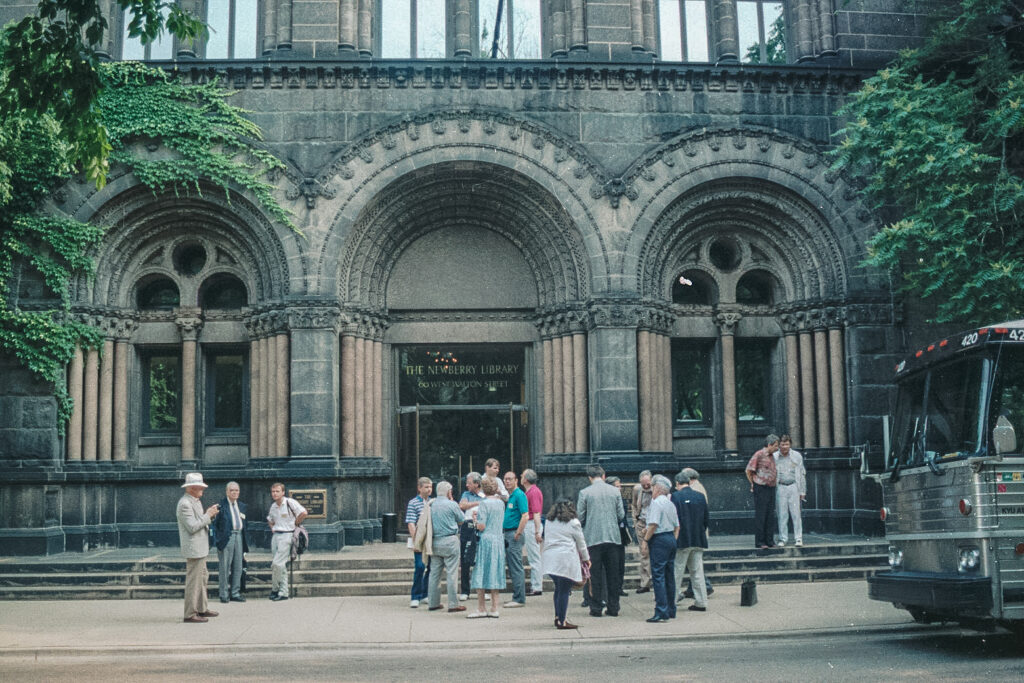
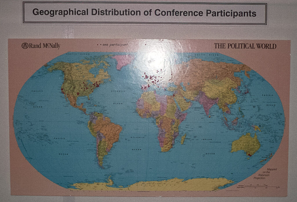
 Centered at the Newberry Libray, conference was dedicated to the memory of John Brian Harley, “who contributed so much to our field and who cherished the idea of convening this body in the American Middle West.” Principal coordinators were David Buisseret, James Akerman, David Woodward, Michael Conzen, Robert Karrow. Attendance was more than 260, and conference languages were English, French and Spanish.
The thematic sections were “Commercial and Philanthropic Cartography,” “Cartography and Religion,” “Cartography and Statecraft,” “Indigenous Cartography of America and Australia,” “The Mapping of America,” “Aesthetics and Cartography,” “Cartography as Representation.”
There were four exhibitions
- “Two by Two: Twenty-two Pairs of Maps from the Newberry Library Illustrating 500 Years of Western Cartographic History” (catalog, 48pp), at the Newberry Library;
- “Cartographic Encounters,” at the Newberry Library, designed to accompany the Nebenzahl Lectures, which followed the conference. A catalog for this exhibit was also issued, later, as Mapline, special no. 7 (Sept.1993).
- of celestial cartography at the Adler Planetarium, and
- on the Chicago architect and planner Daniel Burnham, at the University of Illinois at Chicago Library.
Excursions included a walking tour of Downtown Chicago, a bus tour of “Early Chicago,” and a lengthier trip to the American Geographical Society Collection, at the University of Wisconsin at Milwaukee.
There were 54 papers (and a luncheon paper by Norman Thrower) plus 19 poster presentations, and a booklet of abstracts was distributed (53pp). As with the 14th Conference, the proceedings of the seminar on teaching the history of cartography were published (Proceedings of the Seminar on Teaching the History of Cartography II Held at the Newberry Library, Chicago, June 23, 1993, eds. F. Ormeling and T. Bouma (Utrecht, International Cartographic Association, 1994). A selection of papers was included in Cartographica 35, Nos 3-4 (1998) – Monograph 52: James R. Akerman (ed.) ‘Cartography and Statecraft: Studies in Governmental Mapmaking in Modern Europe and its Colonies’.
Papers 15th ICHC
Session 1: Commercial and Philantropic Cartography
- Cain, Mead T. The Maps of the Society for the Diffusion of Useful Knowledge and the Promotion of Geographic Literacy in Early Victorian Britain.
- Saxon, Gerald D. “How the West was Taught”: School Geographies and their Treatment of Nineteenth-Century U.S. Expansionism.
- Case, Nat. Profit and the American Commercial Map Aesthetic.
- Feldmann, Hans-Uli. The Swiss Hill Shading Technique: A Pioneer Achievement of Commercial Mapping Agencies in the Nineteenth Century.
Session 2a: Cartography and Relegion
- Kupfer, Marcia. Medieval Mappaemundi in Context and as Context.
- Edson, Evelyn. Context and Content: Maps in Early Medieval Codices.
- Delano-Smith, Catherine. The Art of Explaining: Maps for Books.
- Zurawski, Simone. Map-Making in the Clos Saint-Lazare, Paris, ca. 1600 to 1792.
- Unno, Kazutaka. Maps of Japan Used in Prayer Rites or as Charms.
- Wajntraub, Eva, and Gimpel Wajntraub. The Influence of the Bible on the Cartography of Palestine on Medieval Maps.
Session 2b: Cartography and Statecraft I
- Kokkonen, Pallervo. State, Territorial Expansion and the Study of Meaning in the History of Cartography.
- Wihtol, Erik. Spycharts from the Nineteenth Century, Found in Danish, Russian and Swedish Archives, Concerning Swedish or Russian Fortifications.
- Scharfe, Wolfgang. President, King’s Jester and Cartographer: Jakob Paul v. Gundling and the First Prussian Map of Brandenburg.
- Podossinov, Alexander V. State Cartography in Antiquity?
- Taub, Liba. The Historical Function of the Forma Urbis Romae.
- Sherman, William H. The “British Seas” and Elizabethan Imperialism: John Dee’s Geographical Reformation.
Session 3: Cartography and Statecraft II
- Pelletier, Monique. French Scientific Cartography in its Relations with the World, Europe, France and its Provinces, 17th-18th Centuries. (In abstracts book as: Goals and Surroundings of French Scientific Cartography under the Reigns of Louis XIV and Louis XV.–same paper?)
- Petto, Christine M. Cartography and Statecraft: French Cartography and Scientific Patronage, 1667-1789.
- Godlewska, Anne. Cartography–Science to Statecraft: Cassini IV as Witness and Victim.
- Edney, Matthew H. Mathematical Cosmography and the Social Conditions of British Cartography, 1780-1820.
- Nadal, Francesc, Luis Orteaga, and Ignacio Muro. La labor cartográfica de la Junta General de Estadistica.
- Montaner, M. Carme. Topographic Cartography from a Regional Government: The Geografic Map of Catalonia, 1914-1941.
Session 4a: Cartography of America and Australia
- Lewis, G. Malcolm. Words into Maps: Sixteenth- and Seventeenth-Century Examples from Eastern North America.
- Pearce, Margaret. Promises to Connect: The Cartographic Exchange between the Nez Percé Nation and the Lewis and Clark Expedition at the Continental Divide.
- Davis, Lee. Sacred Geography and Geo-Polity in Native California.
- Davis, Stephen, and Dorothy Prescott. Symbolism of Traditional Aboriginal Geographic Knowledge of Australia.
Session 4b: The Mapping of America
- Francaviglia, Richard. Cartography and Landscape: Early Nineteenth-Century Texas Maps.
- Reinhartz, Dennis. Maps from Inspections of the Northern Frontier of New Spain in the Second Half of the Eighteenth Century.
- Boudreau, Claude. Le contrôle de la production de l’image cartographique du territoire québécois, 1760-1840.
- Kotelnikova, Natalia. Maps of Russian America.
Session 6a: Aesthetics and Cartography
- Aujac, Germaine. Pietro del Massaio, pientre et cartographe florentin.
- Sider, Sandra. Compass Roses and Wind Systems as Iconographic Elements in Portolan Charts.
- Marques, Alfredo Pinheiro. History of Art in Portuguese Cartography.
- Galera i Monegal, Montserrat. Dos vistas de Barcelona de 1535.
- Kark, Ruth, Rehav Rubin, and Haim Goren. Jerusalem in Three Dimensions: Relief Maps and Models of the Holy City, 1699-1900 (Not read.
- Schilder, Günter. The Development of Decorative Borders on Dutch Wall Maps, 1590-1650.
Session 6b: The Mapping of America II
- Scott, Ralph. A “Plausible” Explanation for the Provenance of the 1733 Mosely Maps.
- Raleigh, James T. Surveying to, and Mapping the Headspring of the Potomac River.
- Widder, Keith. Dietrich Brehm: British Cartographer of the Western Great Lakes, 1760-1762.
- Wallis, Helen. John Innys’s Collection of Early Maps of the Americas.
- Cook, Karen Severud. “Join or Die”: Benjamin Franklin’s Rattlesnake Map and its Progeny.
- Kretschmer, Ingrid. Austrian High Quality Mapping of Tropical Mountain Systems in South America (First Half of 20th Century).
- Schilder, Günter. The Development of Decorative Borders on Dutch Wall Maps, 1590-1650.
Plenary Session: Cartography as Representation
- Campbell, Tony. The Pasterot Atlas of 1587: A Remarkable Display of Cartographic Invention.
- Richardson, W. A. R. The American Components of Mercator’s Southern Continent.
- Schwarzberg, Joseph E. A 19th-Century Burmese Map Relating to French Colonial Expansion in Southeast Asia.
- Harvey, P. D. A. Board Games and Early Cartography.
- Conley, Tim. The Map-Dissolve: Cartography and Ideology in Hollywood Film, 1940-50.
- Robertson, Jean. Artists Explore the Map: 1950 to 1993.
Speaker at the Closing Luncheon
- Thrower, Norman J. W. Columbus, Commemoration, and Cartography: Retrospect and Prospect.
Closing Plenary Session: Cartography and Statecraft III
- Prescott, Victor. The Role of Maps in the Establishment of International Boundaries before 1914.
- Stone, Jeffrey. The Cartography of the Colonial State in Africa.
- Hopkins, Daniel. Maps, Diplomatic Dealings, and the Danish Enclave on the Gold Coast of Africa in the Nineteenth Century.
- Zandvliet, Kees. Dutch Surveyors on Taiwan: Their Part in the Creation of a Dutch Colony and a Chinese State.
- Hu, Bangbo. Cultural Image: Reflections of Political Power in the Maps of Chinese Gazeteers of the Song Dynasty (960-1279 A.D.).

Session 5a Poster Session
- Abeydeera, Ananda. From a “mare clausum” to a “mare liberum”: The History of the Cartography of the Indian Ocean: A Trajectory of 1500 Years.
- Alexandrowicz, Stanislaw. Commerce as a Factor in the Development of East European Cartography in the Fifteenth-Seventeenth Centuries.
- Babicz, Józef, and Alexei Postnikov. The First Thematic Atlas of the Kingdom of Poland.(apparently were unable to attend)
- Ballendorf, Dirk Anthony. Some Cartographical Aspects of Magellan’s Elusive Marianas Landfall in 1521.
- Bremner, R. W. Cartography and the “Introduction of the Principles of Mathematics.” (In abstracts book as: The Arithmetical Basis of Many Ideas About the Size of the Earth.–same?)
- Brodsky, Harold. Maps Based on the Prophecy of Ezekiel.
- Colin, Susi. Ethnographic Illumination on Fifteenth- and Sixteenth-Century Maps.
- Gasque, Thomas J. Mapping the Mysterious Black Hills.
- Gole, Susan. Maps of the Eastern Mediterranean Published in British Parliamentary Papers, 1801-1921.
- Kupcík, Ivan. The Contribution of Karel Koristka (1825-1906) to the Aesthetic Appreciation of Maps.
- Lindgren, Uta. The Role of Mathematics in Renaissance Mapping: Peter Apian, Rainer Gemma Frisius and Gerhard Mercator.
- McCorkle, Barbara. The Long Shadow of Theodore DeBry’s America.
- McIntosh, Gregory C. Columbus and the Piri Reis Map of 1513.
- Okhuizen, Edwin. Exploration and Mapping of the Northeast Passage and Northern Eurasia, 15th-19th Centuries: Between Commercial and State Commissioned Cartography.
- Polevoi, B. P., and O. A. Krasnikova. Dutch Traces in the Cartography of the North Pacific in the Seventeenth and Eighteenth Centuries (in Commemoration of the 350th Anniversary of the Maarten Gerritsz Vries Expedition.) (Polevoi was evidently unable to attend.)
- Salgaro, Silvino. La “Carta del Navegare Universalissima et Diligentissima, 1525” (le planisphère Castiglioni).
- Schilder, Günter, and Peter van der Krogt. The Recent Work of the “Explokart” Research Program.
- Varanka, Dalia. Epistemological Foundations of Early English World Atlases.
- Vasiliev, Irina. Time, Technology, and Maps.
References
Special Libraries Association. Geography and Map Division, Bulletin 174(1993): 25-29 (Hudson)
Geographische Gesellschaft in München, Mitteilungen 77 (1972): 155-57
Freundeskreis für Cartographica, Mitteilungsblatt 7 (1993): 32-35 (Kupcík)
Kartographische Nachrichten 44 (1994): 17-19 (Scharfe)
The Map Collector 65 (Winter 1993): 46 (Scott)
Cartographica Helvetica 8(1993): 54 (Feldmann)
Mapline 69/70 (Spring/Summer 1993): 1-3 (a pre-conference communication).