11nd International Conference on the History of Cartography
8-12 July 1985 — Ottawa
 Held in the auditorium of the Public (now National) Archives of Canada, Ottawa, with principal coordinator Edward Dahl. Attendance was 150; conference languages were English and French, with simultaneous translation of all papers and discussions..
The thematic sessions were "Teaching the History of Cartography," "Colonial Cartography," "History of Canadian Cartography," "Cartobibliography," "Aspects of European Cartography," "Portolan Charts and Early Rutters," and various papers on North American themes.
There were four exhibitions in the Public Archives of Canada and the National Library of Canada:
- Treasures of the National Map Collection: A Selection
- Some Recent Cartographic Posters
- Early Maps Showing Canada, Published in Accounts and Voyages
- Dust Jackets and Early Maps
Furthermore, there was the exhibition "The Discovery of the World–Maps of the Earth and the Cosmos," in the David M. Stewart Museum in Montreal.
Three excursions were offered, including a cruise and dinner on the Ottawa River, a trip to Upper Canada Village and the Rideau Canal System, and a visit to Montreal, including the Stewart Museum.
It was at this ICHC that the forum on the teaching of the history of cartography was first introduced, which was well received, and which has remained an important adjunct to all conferences since. There was also a special meeting on cartobibliography, with a working group being formed, as well as one on "cartochronology."
There were about 60 papers and hand-outs; full copies of virtually all papers were distributed before the conference. There was also a full-day preconference meeting of the International Society of Curators of Early Maps (ISCEM), hosted by Dahl, where four papers were presented (See below.). It was the second such meeting at an ICHC, and was attended by about 45 people.
Papers 11th ICHC
- Akerman, James R. National Geographical Consciousness and the Structure of Early World Atlases. (23pp)
- Barkham, Selma Huxley. The Fishermen’s Contribution to the Early Cartography of Eastern Canada. (19pp,12 ill.)
- Beattie, Judith Hudson. The Indian Maps Recorded by Peter Fidler, 1801-1810) (21pp, 9 ill.)
- Beech, Geraldine. Sources for the History of Canadian Cartography in the Public Record Office: The Alaska Boundary (8pp)
- Boudreau, Claude. Joseph Bouchette’s Cartography, Especially his 1831 Map of Lower Canada.
- Bremner, Robert W. An Analysis of a Portolan Chart by Freduci d’Ancone. (15pp, 3 ill.)
- Campbell, Tony. A Proposed "Chronology for the Dating of Early Maps." (1p)
- Conzen, Michael P. The Influence of Firm Lineage on Design in American and Canadian County Mapmaking. (4pp, 3 ill.)
- Cook, Andrew S. Analyzing Engraving Techniques on Dalrymple’s Sea Charts. (4pp)
- Cook, Andrew S. "More by Accident than by Design": The Development of Topographical Mapping in India in the Nineteenth Century. (8pp)
- Danckaert, Lisette. L’exploration du Canada et les mappemondes belges du XIXe siècle. (4pp)
- Dean, William G. Remapping History: A Review of Maps from the War of 1812. (31pp, 34 ill.)
- Dempsey, Patrick E. An Index to Irish Maps: A Catalog of the Maps, Atlases, and Charts of Ireland in the Geography and Map Division of the Library of Congress. (1p)
- Edney, Matthew H. Politics, Science and Cartography: Nineteenth-Century Government Mapping in the U.S. (13pp)
- Gavish, Dov. An Account of an Unrealized Aerial Cadastral Survey in British Mandatorial Palestine. (8pp)
- Godlewska, Anne. Preliminary Study of the First Forty Years of the French Mapping of Algeria.
- Goodrich, Thomas D. Sixteenth- and Seventeenth-Century Ottoman Manuscript Maps.
- Grim, Ronald E. Cartobibliographies in the Library of Congress and the U.S. National Archives: A Bibliographical Survey. (4pp)
- Grim, Ronald E. Cartobibliographies Published by the Library of Congress and the U.S. National Archives since World War II. (6pp)
- Harley, John Brian. Imago Mundi: The First Fifty Years and the Next Ten. (25pp)
- Harvey, Paul D. A. Estate Surveyors and the Spread of the Scale-Map in England, 1550-80. (8pp)
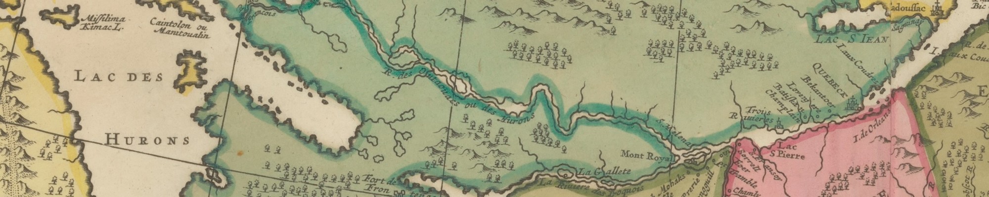
- Heidenreich, Conrad E. The Mapping of Canada, 1500-1760. (21pp,6ill)
- Herbert, Francis. The "London Atlas of Universal Geography" from John Arrowsmith to Edward Stanford: Origin, Deveopment, and Dissolution of a British World Atlas from the 1830s to the 1930s. (11pp)
- Karrow, Robert W. The Role of Cartobibliography in the History of Cartography. (14pp,7ill)
- Konvitz, Josef W. D’Arçon’s Maps of the Rhine, 1786-87: The Cartographic and Written Evidence. (14pp)
- Kretschmer, Ingrid. The Austrian School of Relief Colouring in the Second Half of the 19th and Early 20th Century. (6pp)
- Lanman, Jonathan T. On the Origin of Portolan Charts. (27pp,5ill,1tab)
- Lewis, G. Malcolm. Euroamerican Misinterpretation of Amerindian Maps. (17pp)
- McCorkle, Barbara. Methods and Standards of Uniformity in Cartobibliographical Description.
- McCorkle, Barbara B. Preparing a Carto-bibliography of Eighteenth Century Geographies. (4pp)
- McCune, Shannon. Mapping of the Thousand Islands. (2pp)
- Milanesi, Marica. Quelques considerations sur la cartographie de la Mer Rouge au XVIe siècle. (7pp)
- Monmonier, Mark S. The Rise of Map Use by Elite Newspapers in England, Canada, and the United States. (22pp)
- Moore, Patricia A. The Publications of the Joseph Hutchins Colton Firm and Its Successors, ca. 1830-1900. (7pp)
- Mumford, Ian; and Clark, Peter K. Tomorrow the World: Sir Henry James’ Map of the World at Ten Miles to an Inch. (16pp,6ill,1tab)
- Neumann, Joachim. Usual Map Scales in the 17th and 18th Centuries. (2pp)
- Pelletier, Monique. Photographie et représentation du relief: l’exemple des Vallot dans le massif du Mont-Blanc. (9pp)
- Reinhartz, Dennis. Rhigas Pheraios and Anthimos Gazis: The Cartographers of Early Greek Nationalism. (6pp)
- Robinson, Arthur H. A Classification of Maps for the History of Cartography. (6pp)
- Ruggles, Richard I. The Company that Became a Country: The Mapping Experience of a Chartered Trading Monopoly, 1670-1870; The Hudson’s Bay Company. (16pp)
- Scharfe, Wolfgang. Max Eckert’s Kartenwissenschaft–The Turning-point in German Cartography. (9pp)
- Schilder, Günter. The Hydrographic Office of the Dutch East India Company in the 18th Century. (6pp)
- Schlesinger, Roger. Place-nomenclature and Cartography in André Thevet’s Grand Insulaire. (10pp)
- Solnick, Bruce B. Seminar on Colonial Cartography: The British Caribbean. (10pp)
- Stephenson, Richard W. Maps for the General Public: Commercial Cartography of the American Civil War. (16pp)
- Stochdorph, Otto. Computer-Aided Distortion Analysis of Old Maps. (3pp)
- Stone, Jeffrey C. Topographic Mapping in British Colonial Africa, with Particular Reference to Zambia. (22pp)
- Stuart, Elizabeth. A Catalogue of Maps of Plymouth to 1801. (1p)
- Terrell, Christopher. The Copperplates of the Atlantic Neptuner–A Complex and Continuing History. (7pp) (Also in connection with this was the two-page paper: Atlantic Neptune Copperplates Preserved in the Public Archives of Canada.)
- Vries, Dirk de. Report of Carto-bibliographical Activities in The Netherlands, 1982-84. (3pp)
- Wilde, Gerald J.S. The QU-Code: A Simple System for Small-Computer Coding of Antique Maps. (18pp)
- Winearls, Joan. Maps of Upper Canada [Ontario], 1780-1867: An Annotated Bibliography of Manuscript and Printed Maps; A Report on Progress. (5pp)
- Wolf, Armin. What Can the History of Historical Atlases Teach? 100 Editions of Putzger’s Historischer Schul-Atlas Reflecting 100 Years of German History. (3pp)
- Woodward, David. Analytical Cartobibliography of Sixteenth-Century Maps Printed in Italy. (7pp)
Papers 2nd ISCEM Meeting
- Dahl, Edward H. The Early Canadian Cartography Section of the Canadian National Map Collection
- Kidd, Betty. The History and Structure of the National Map Collection
- Langelier, Gilles. The Services Section of the Canadian National Map Collection
- Stibbe, Hugo. The Documentation Section of the Canadian National Map Collection
Note
There were also, among the papers distributed, a 24-page "Tour of the Rideau Canal System and Visit to Upper Canada Village," by Lou M. Sebert, for consultation during the Upper Canada excursion, a 19-page document connected with the forum on teaching the history of cartography, titled "Course outline," and even a 5-page "Offical Song Sheet / Chansons Officielles."
References
Imago Mundi 39(1987): 82-87 (E. Campbell et al.) (This report includes a resumé of each paper.)
Association of Canadian Map Libraries, Bulletin 56 (1985): 21-24 (Wood)
Geographische Gesellschaft in München, Mitteilungen 70 (1985): 121-22 (Kupcík)
Kartographische Nachrichten 35 (1985): 225-26 (Scharfe)
The Map Collector 33 (1985): 38-39 (anon.)
The Hydrographic Journal 38 (1985): 71-72 (Ritchie)
Mapline 39 (1985): 7 (anon.)
Internationale Coronelli-Gesellschaft für Globen- und Instrumentenkunde, Information 10 (1985): 7-10 (Kretschmer).
Canadian Cartographic Association, Newsletter 11, 3 (Sept. 1985): 11-12 (anon.)
Caert-Thresoor 5 (1986), 1: 17-18 (Clement-van Alkemade)