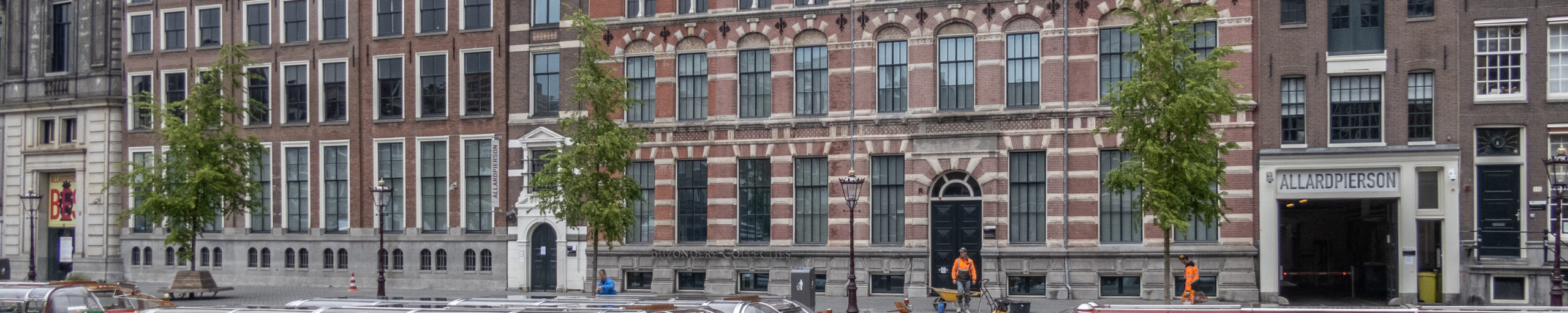
Tentoonstelling Explokart Website, deel 2 ICHC banners
Vrijwel elke pagina van de Explokart website heeft een toepasselijk fragment van een kaart aan het begin van de pagina. Op een enkele uitzondering na komen al deze kaarten uit de collectie van het Allard Pierson, de Collecties van de Universiteit van Amsterdam. In deze digitale tentoonstelling worden deze kaarten in hun geheel vertoond en van informatie voorzien.
De volgorde van de kaarten volgt de menustructuur. Klik op de paginatitel om naar de betreffende pagina te gaan.
Klik op de thumbnail voor een schermgrote versie. Het plaatsnummer is een permalink naar de catalogus van de Universiteit van Amsterdam. KAN = Koeman’s Atlantes Neerlandici (waarvan deel V in 2020 of begin 2021 zal verschijnen).
Exhibition Explokart Website, part 2 ICHC banners
Almost every page of the Explokart website has an appropriate fragment of a map at the head of the page. With a few exceptions, all these maps are from the Allard Pierson, the collections of the University of Amsterdam. In this digital exhibition these maps are shown in their entirety and provided with information.
The order of the maps follows the menu structure. Click on the page title to go to the relevant page.
Click on the thumbnail for a screensized version. The place number is a permalink to the catalogue of the University of Amsterdam. KAN = Koeman’s Atlantes Neerlandici (of which part V will appear in 2020 or early 2021).
Banners of the ICHC-pages
Pagina / Page: ICHC List
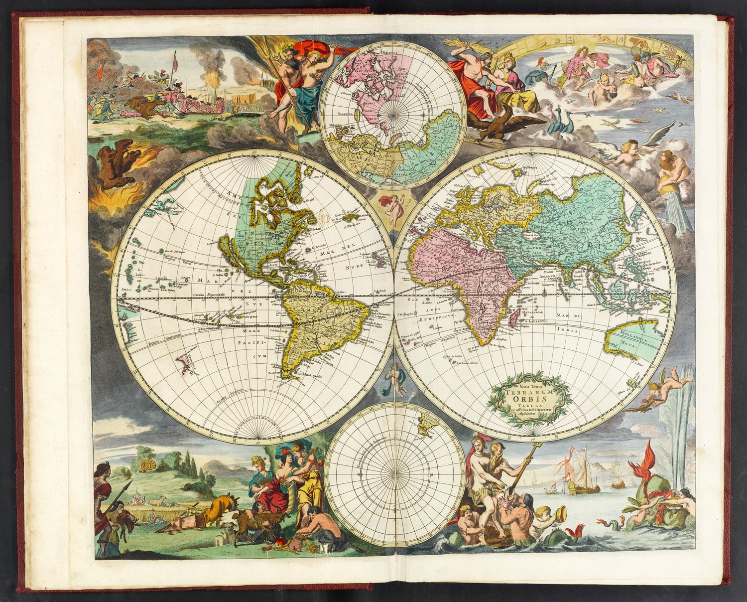
Nova totius Terrarum Orbis tabula
ex officina Iusti Danckerts Amstelodami, [1682-83].
56 x 48 cm.
Uit / From: Atlas factice of c. 1705-06.
Allard Pierson KF 61-2110 (complete atlas on-line at Allard Pierson’s beeldbank).
KAN 0001:533A.1
Pagina / Page: Numbers of participants and papers at the conferences
Nova totius Terrarum Orbis tabula
ex officina G. a Schagen [Gerrit van Schagen] Amstelodami, [c. 1706].
43 x 54 cm.
Uit / From: Gerard van Schagen, Atlas of c. 1706.
Allard Pierson HB-KZL 1806 A 19.
KAN 0001:582.2

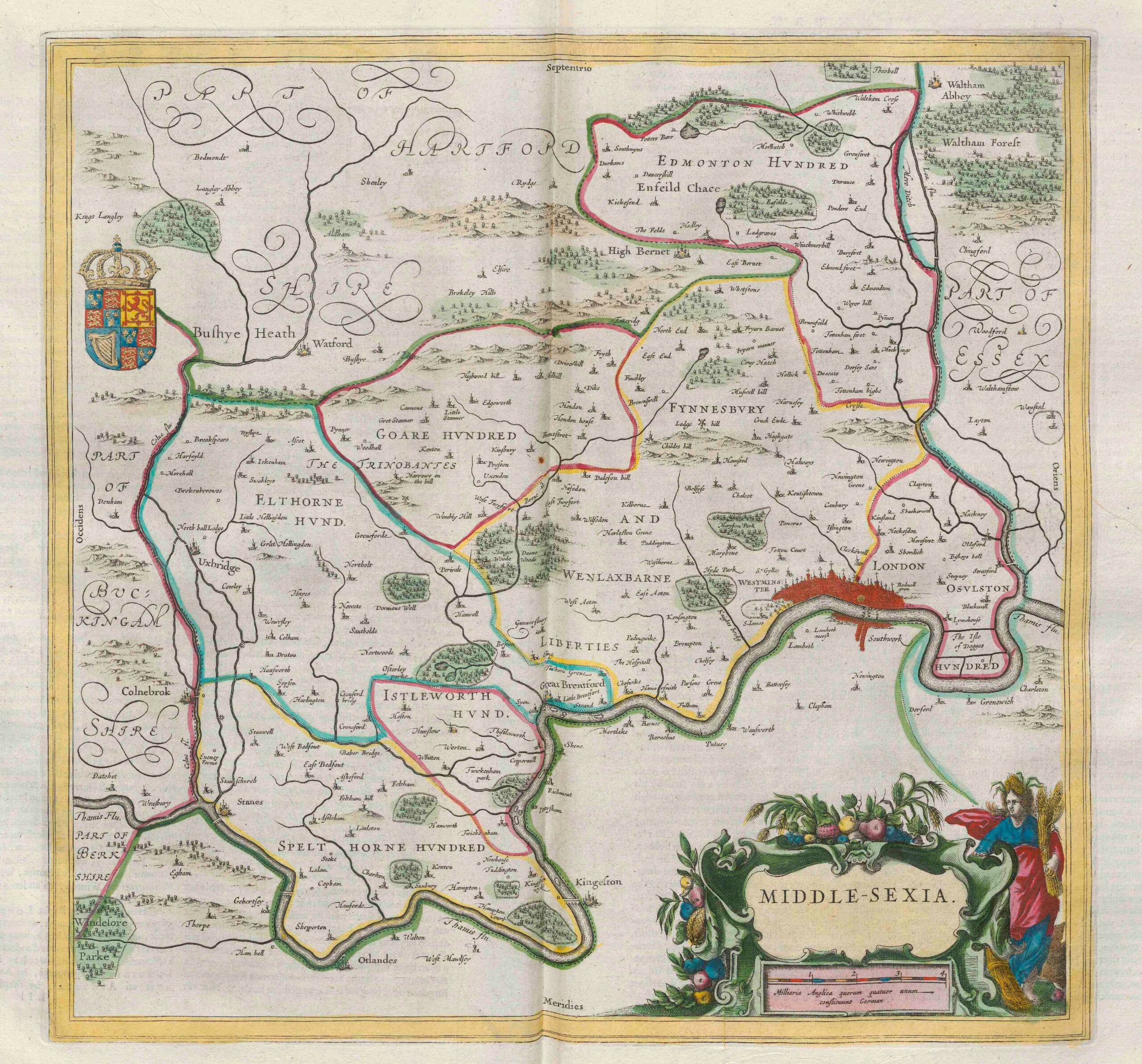
Pagina / Page: London 1964
Middle-sexia
[Amsterdam: Joan Blaeu, 1645].38 x 40.5 cm.
Uit / From: Joan Blaeu, Nuevo Atlas del Reyno de Inglaterra, 1662
Allard Pierson HB-KZL 1807 A 5 (banner) and Utrecht University Library, AB:AC 65 (complete map from the Dutch edition 1664),
KAN 5281:2
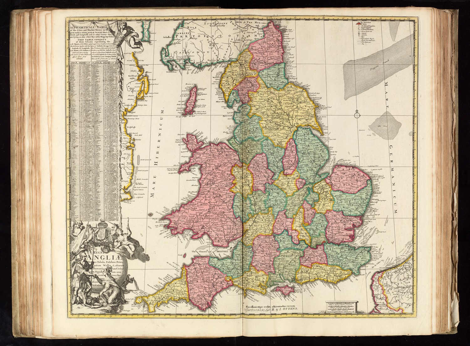
Pagina / Page: London 1967
Regni Angliae nova tabula
Amstelodami apud R. & I. Ottens, [c. 1730] (eerste staat/first state by Johannes de Ram, c. 1689).
50 x 59 cm.
Uit / From: Reinier & Josua Ottens, Atlas, c. 1740.
Allard Pierson HB-KZL I 2 A 10
KAN 5100:585.3
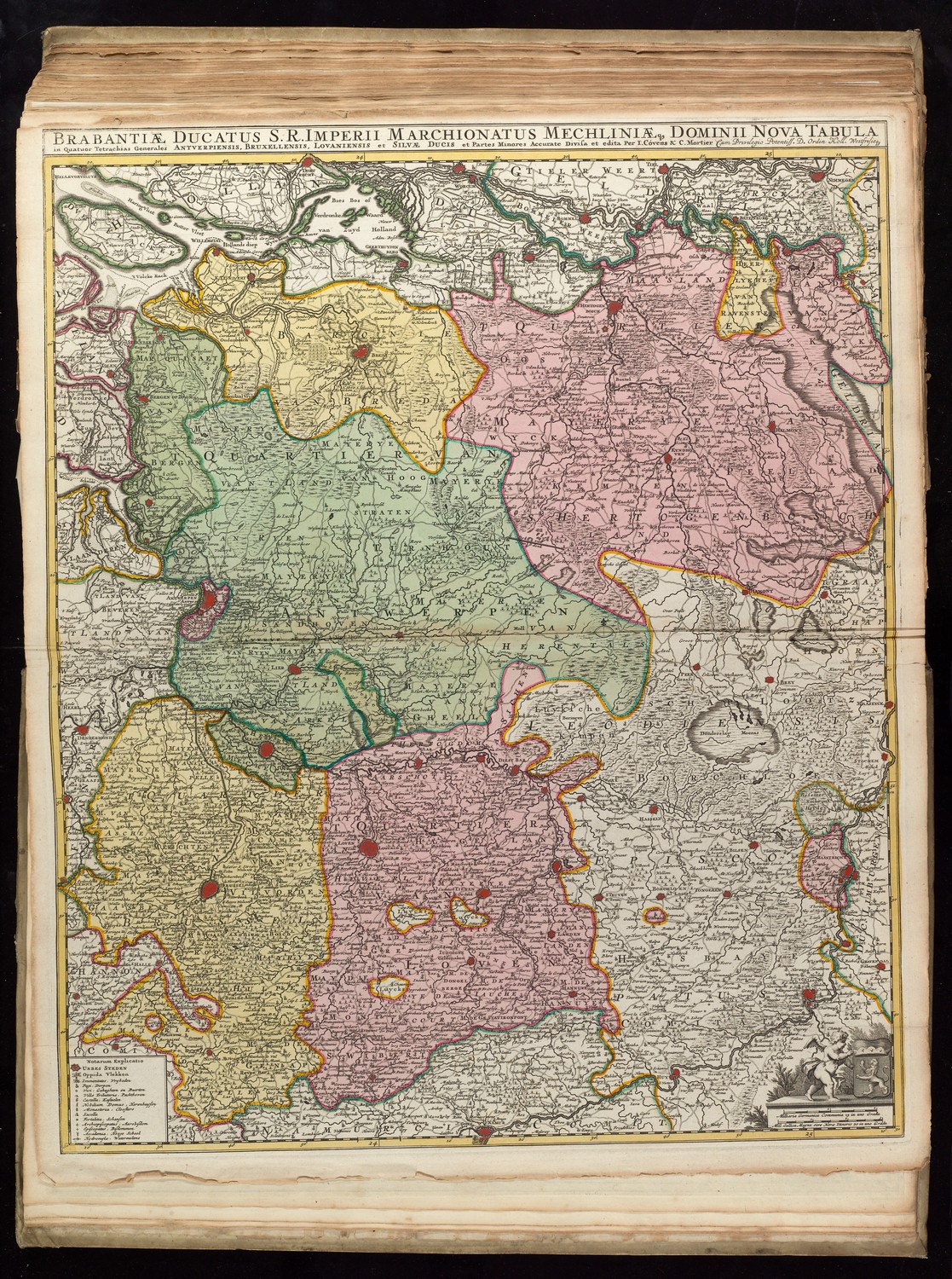
Pagina / Page: Brussel 1969
Brabantiæ Ducatus S R Imperii Marchionatus Mechliniæq Dominii nova tabula….
Accurate divisa et edita Per F. de Witt Amstelodami edita Per Cóvens & C. Mortier [c. 1730; eerste uitgave 1707].
61.5 x 50.5 cm.
Uit / From: Reinier en Josua Ottens, Atlas, ca. 1740
Allard Pierson HB-KZL I 2 A 10
KAN 3100:52B.4
George Carhart, Frederick de Wit and the first concise reference atlas (Explokartreeks 16, 2016), map 146.
Mario Dorigo & Mathieu Franssen, Brabantia Ducatus (Explokartreeks 18, 2018), map 75.
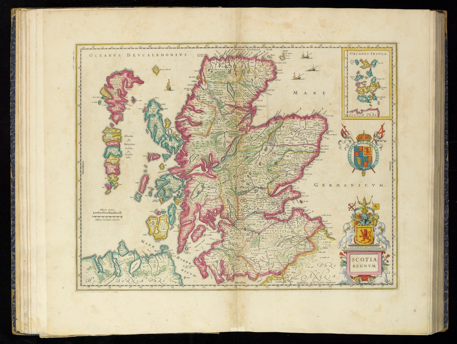
Pagina / Page: Edinburgh 1971
Scotia Regnvm
Amstelodami, Apud Ioannem Ianßonium, [1636].
38 x 50 cm.
Uit / From: Nicolaus Visscher II, Atlas of the Netherlands and the World, c. 1680.
Allard Pierson KF 61-2105
KAN 5800:1B
Pagina / Page: Warszawa 1973
Regni Poloniæ Ducatus Mazoviæ et Province Cujaviæ, descriptio
A. Schut Schulpsit.
Emendata per R. & I. Ottens Amstelodami, [c. 1730] (eerste staat/first state by Cornelis Danckerts, c. 1710)
50 x 58 cm.
Allard Pierson HB-KZL 31.09.11
KAN 1905:535

Pagina / Page: Greenwich 1975
Les environs de Londres
A Amsterdam Chez I. Covens et C. Mortier, [1730].
49 x 55.5 cm.
Uit / From: Reinier en Josua Ottens, Atlas Maior, ca. 1740.
Allard Pierson HB-KZL 1808 A 6
KAN 5125:564.2

Pagina / Page: Washington 1977
Map of the State of Maryland
by Dennis Griffith.
Philadelphia, J. Vallance, 1795.
75 x 132 cm.
Library of Congress G3840 1794 .G72 [te vervangen door Allard Pierson HB-KZL VI 13 G 2 (2)]

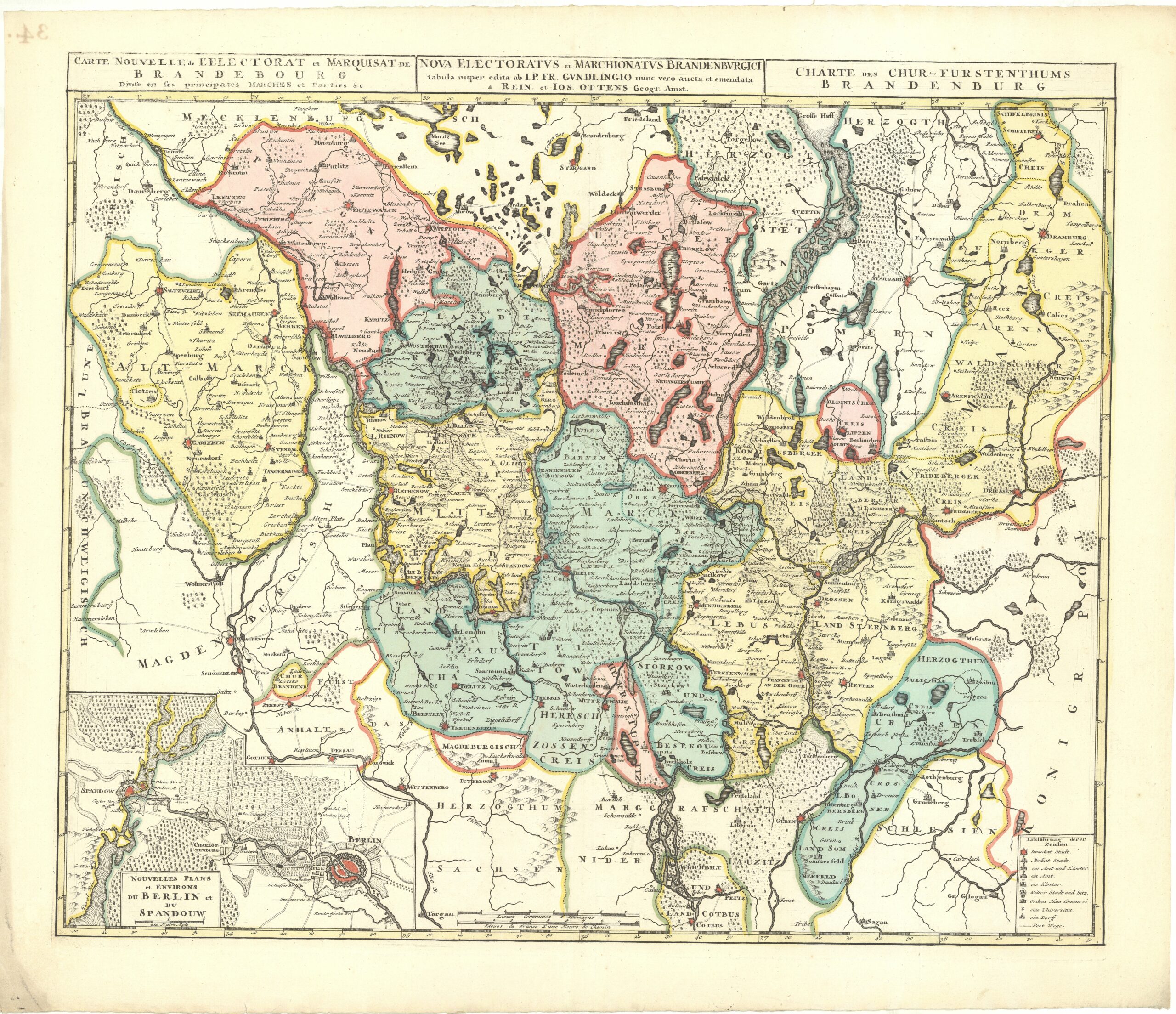
Pagina / Page: Berlin 1979
Carte nouvelle de l’Electorat et Marquisat de Brandebourg
a Rein. et Ios. Ottens Geogr. Amst., [c. 1743].
49.5 x 59 cm.
Allard Pierson HB-KZL 31.25.08
KAN 2170:57
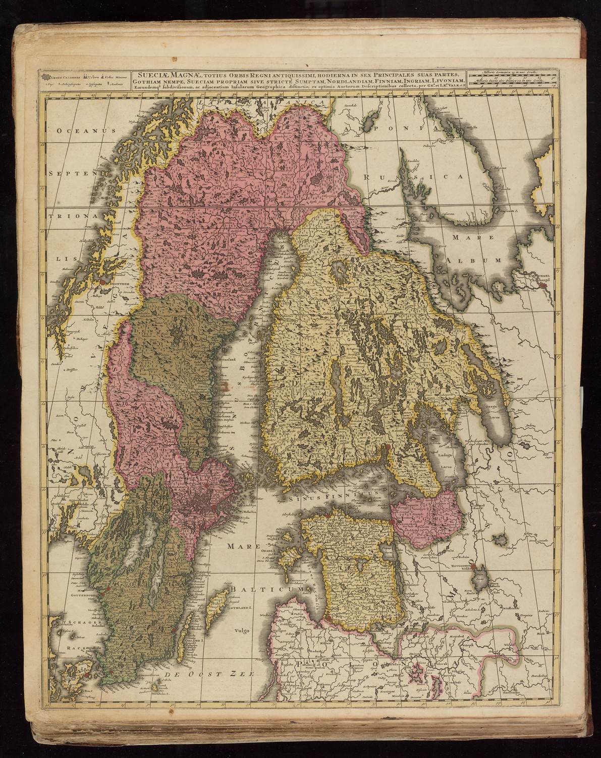
Pagina / Page: Uppsala & Stockholm 1991
Sueciae Magnae, totius orbis regni antiquissimi
[Amsterdam: Gerard & Leonard Valk, c. 1709].60 x 49 cm.
Uit / From: Gerard & Leonard Valk, Atlantis sylloge compendiosa, 1714.
Allard Pierson HB-KZL 1809 A 1
KAN 1400:555.2
Pagina / Page: Chicago 1993
Carte de la Nouvelle France ou se voit le cours des Grandes Rivieres
J. Kyser sculp.
A Amsterdam, Chez la Veuve de Jo. van Keulen & Fils, [c. 1720].
2 sheets, 58 x 99 cm.
Uit / From: Hubert Jaillot [= Pieter Mortier], Atlas Nouveau, 1692.
Allard Pierson HB-KZL 109.03.08 (left sheet only)
KAN 9250:592.2

Pagina / Page: Wien 1995
Plan de la ville de Vienne et ses environs
Chez H. Jaillot, 1692 [= Amsterdam: Pieter Mortier, 1692].
48 x 64.5 cm.
Uit / From: Hubert Jaillot [= Pieter Mortier], Atlas Nouveau, 1692.
Allard Pierson HB-KZL V 9 X 15
KAN 2715:561.1

Pagina / Page: Lisboa 1997
Carte des Ports de Lisbonne, de Setuval, et de leurs Environs
Bijkaart op/Inset on: Carte des costes de Portugal et de partie d’Espagne
[Amsterdam: Pieter Mortier, 1693].
58.5 x 86 cm.
Uit / From: Pieter Mortier, Fransche Neptunus & Zee-Atlas, 1693-94.
Allard Pierson HB-KZL V 9 X 20
KAN C4435:562

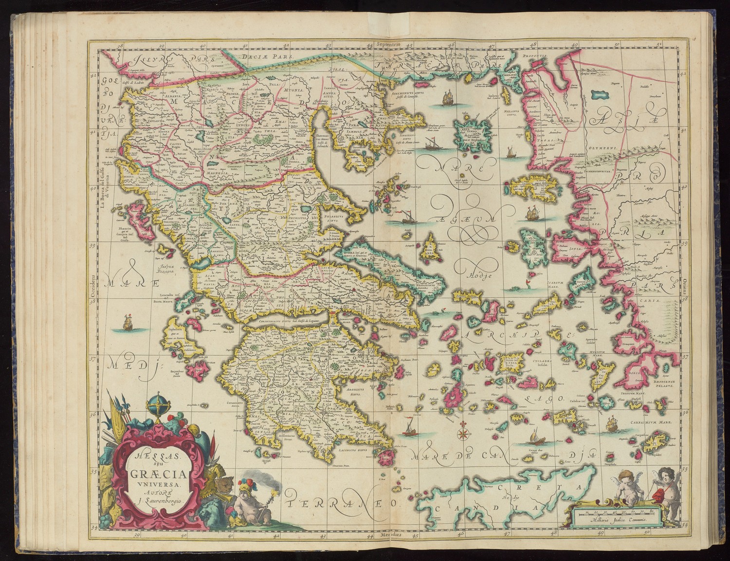
Pagina / Page: Αθήνα (Athens) 1999
Hellas seu Græcia Vniversa
autore J. Laurenbergio.
[Amsterdam: Nicolaas Visscher II, c. 1680].
47 x 57 cm.
Uit / From: Nicolaus Visscher II, Atlas of the Netherlands and the World, c. 1680.
Allard Pierson KF 61-2104
KAN 7800:1B
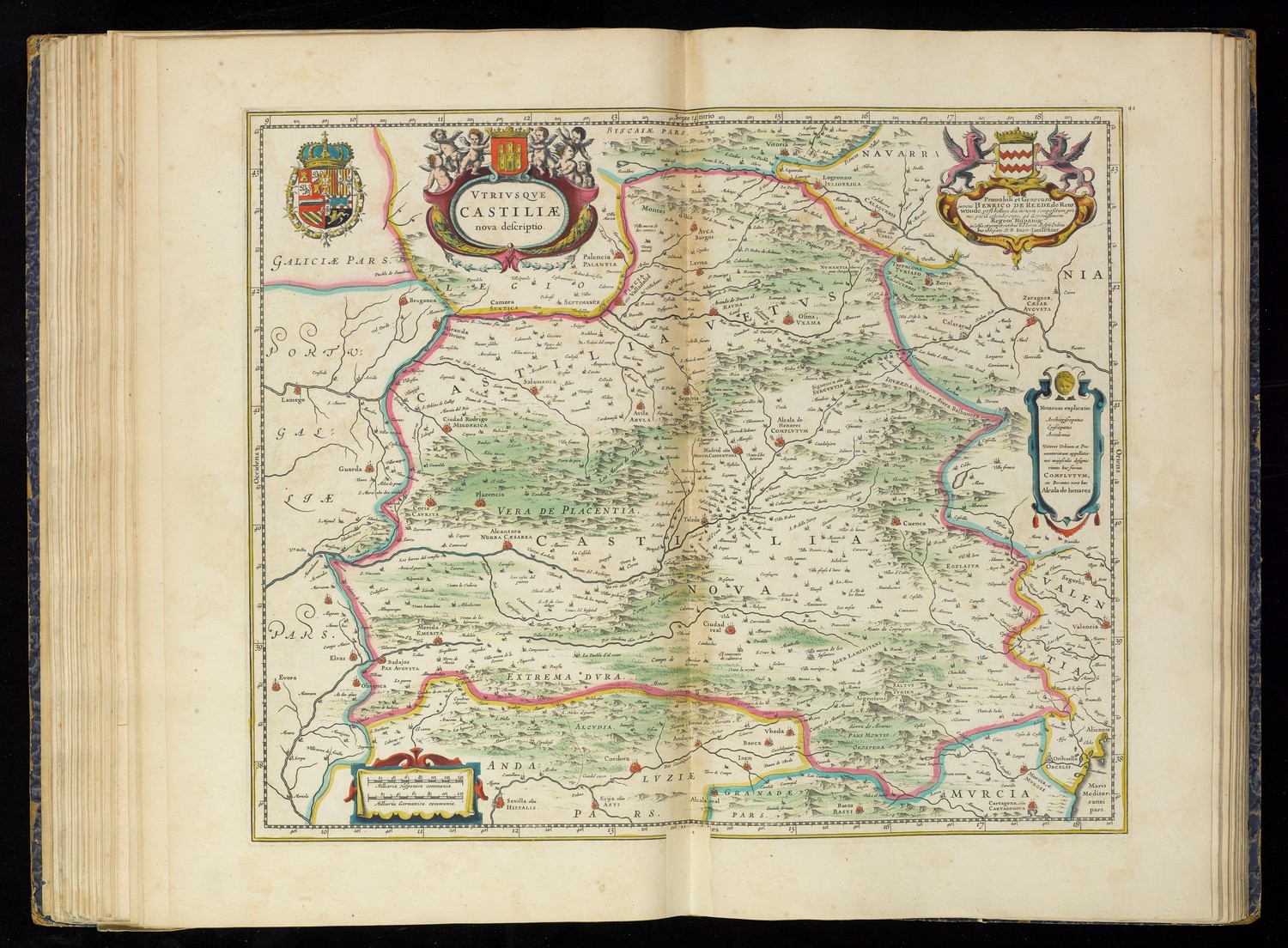
Pagina / Page: Madrid 2001
Utriusque Castiliae nova descriptio
[Amsterdam: Johannes Janssonius, 1666].41 x 50 cm.
Uit / From: Nicolaus Visscher II, Atlas of the Netherlands and the World, c. 1680.
Allard Pierson KF 61-2105
KAN 6055:1B.2
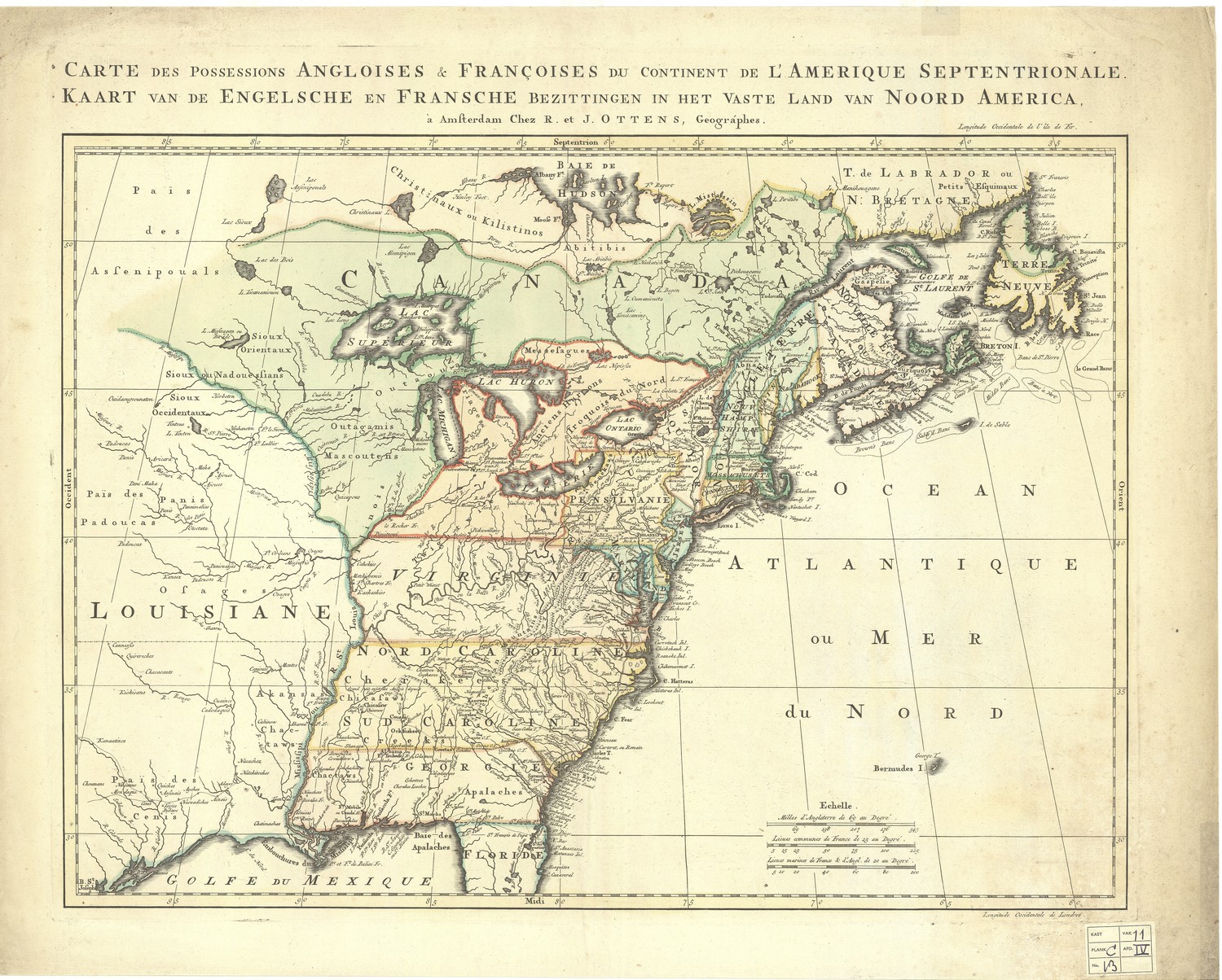
Pagina / Page: Cambridge & Portland 2003
Carte des possessions angloises & françoises du continent de l’Amerique Septentrionale.
à Amsterdam Chez R. et J. Ottens, Geographes, 1755 (2de staat/2nd state c. 1776).
46 x 57 cm.
Allard Pierson HB-KZL 107.11.47
KAN 9250:57.2
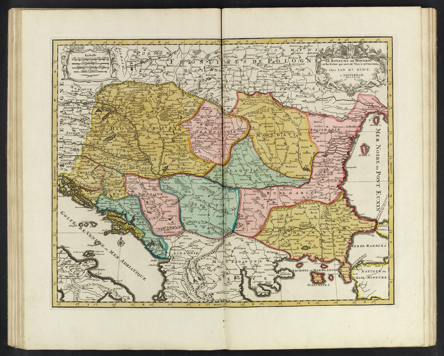
Pagina / Page: Budapest 2005
Le Royaume de Hongrie et les estats qui ont esté vnis à sa couronne.
Chez Jan Bt. Elwe a Amsterdam MDCCXCII [1792].
44 x 54.5 cm.
Eerste staat uitgegeven door Pieter Mortier in 1696 / First state published 1696 by Pieter Mortier
Uit / From: Jan Barent Elwe, Atlas, Amsterdam 1792.
Allard Pierson HB-KZL 1805 A 8
KAN 2801:563.3
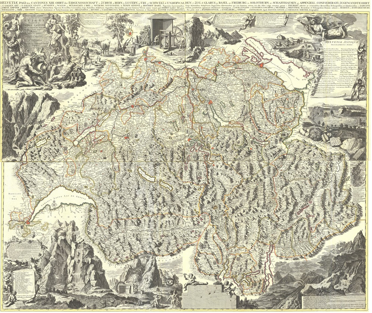
Pagina / Page: Bern 2007
Nouvelle Carte de la Suisse.
Par Jean Jacob Scheuchzer.
A Amsterdam chez Jean Cóvens et Corneille Mortier, [1727].
4 bladen/sheets, elk/each 49.5 x 60.5 cm.
Allard Pierson HB-KZL 107.17.31A-D
KAN 4900:566
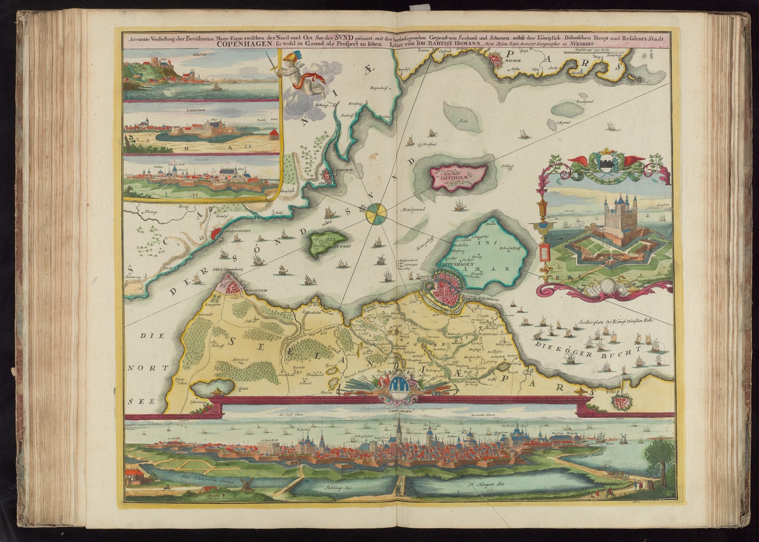
Pagina / Page: København 2009
Accurate Vorstellung der Berühmten Meer-Enge… der Svnd genant, nebst der… Stadt Copenhagen.
Nürnberg: Johann Baptist Homann, [1720].
49 x 58 cm.
Uit / From: Reinier en Josua Ottens, Atlas Maior, ca. 1740.
Allard Pierson HB-KZL 1808 A 6
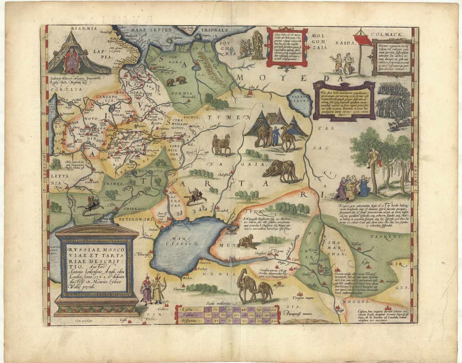
Pagina / Page: Москва (Moscow) 2011
Rvssiae, Moscoviae Et Tartariae Descriptio.
Auctore Antonio Ienkensono Anglo.
[Antwerpen: Abraham Ortelius, 1570].
35.5 x 45 cm.
Allard Pierson HB-KZL 31.05.67
KAN 1800:31
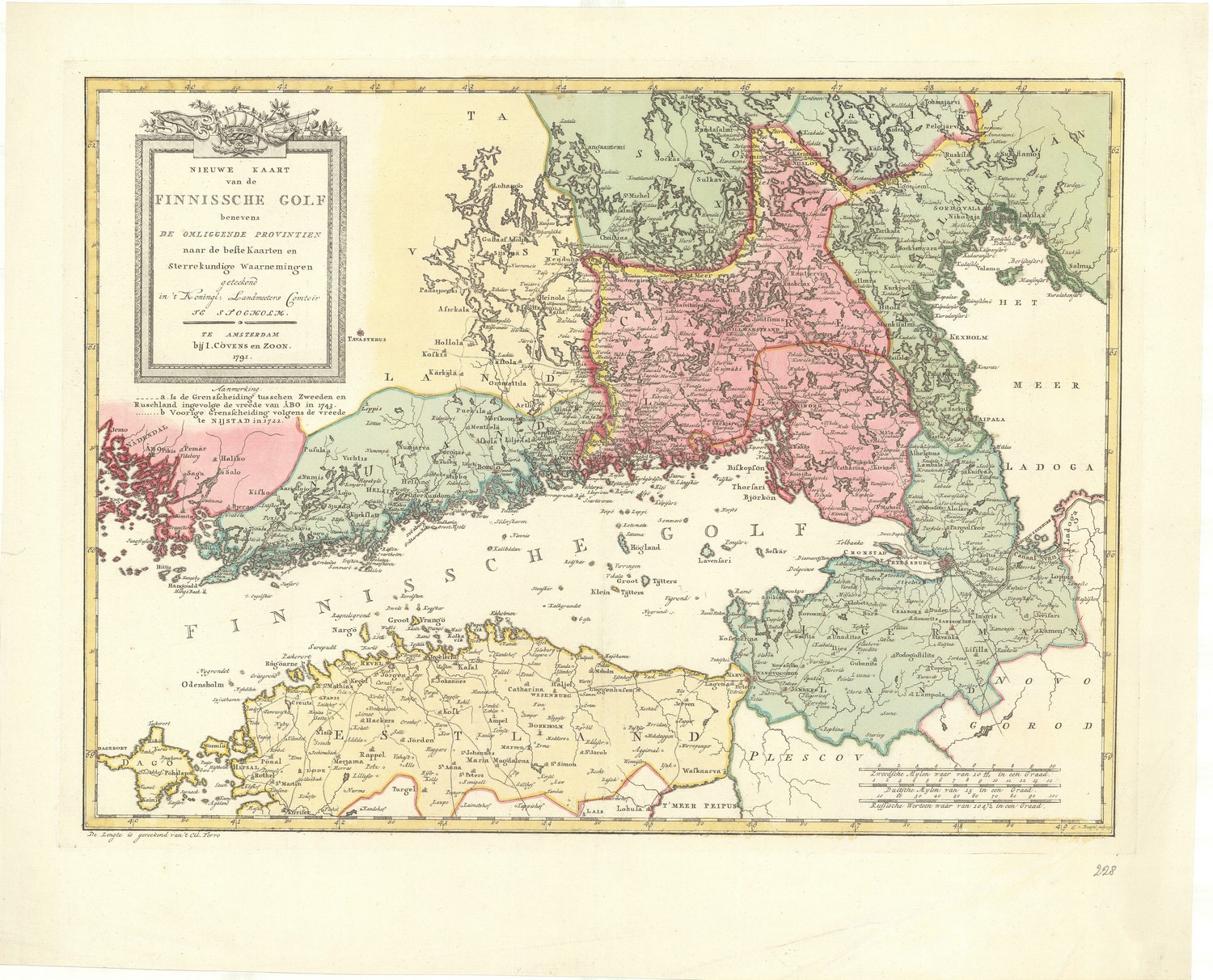
Pagina / Page: Helsinki 2013
Nieuwe Kaart van de Finnissche Golf.
C. v. Baarsel, sculp. 1791.
Amsterdam bij I. Cóvens en Zoon, 1791.
37.5 x 51 cm.
Allard Pierson HB-KZL 31.07.05
KAN 1800:31
Pagina / Page: Antwerpen 2015
S.R.I. Sive Antverpiæ Marchionatus, et Dominium Mechliniæ.
Auctore Carolo Allard Amstelo-Batavo.
A Allard Integrum fecit acu.
50 x 58.5 cm.
Allard Pierson HB-KZL 33.31.29
KAN 3112:542.1

Pagina / Page: Belo Horizonte 2017
Estados Unidos do Brazil. Carte économique du Brésil.
Organisée par la Mission de Propagande et d’Expansion Économique, 1908.
A. da Cunha dess.
60,5 x 68,5 cm.
Allard Pierson HB-KZL 107.21.17

Pagina / Page: Amsterdam 2019
Platte grond van Amsterdam in 1875.
door A. Braakensiek.
Amsterdam: G.L. Funke, [1875].
37 x 48 cm.
Allard Pierson HB-KZL 101.05.VI E 25 (56).

Pagina / Page: Bucureşti 2021
Principatus Valachiæ Moldaviæ et Transylvaniæ.
per Gerardum et Leonardum Valk, [c. 1718 – first state c. 1708].
50 x 60.5 cm.
Allard Pierson HB-KZL 32.05.38.
KAN 7700:555.2
