Dissertaties Historische Kartografie / Theses History of Cartography
Peter van der Krogt
Globi Neerlandici
Globi Neerlandici: De globeproduktie in de Nederlanden
Diss. Utrecht 17 februari 1989
Terug naar overzicht dissertaties / Back to overview PhD-theses


English Summary
Globi Neerlandici: The Production of Globes in the Low Countries
Introduction
A globe is a small-scale model, either of a celestial body or of the heavens, covered with a map. One can differentiate between 1) the world-, or terrestrial globe 2) the moon-globe of lunar globe 3) the celestial sphere, celestial globe, or star-globe. The commercial production of globes only began after it was possible to use the printed image of a map.
This study concerns terrestrial and celestial globes with printed maps, made in the Low Countries. World-maps, including maps of the two hemispheres sometimes referred to as ‘globe-maps’, and three-dimensional maps of parts of the globe (‘gebulte paskaarten’ spherical charts) fall outwith the terms of this study. Lunar globes and globes of other planets are likewise not included. This sort of globe first appeared in the nineteenth century, and as far as is known was never made in the Low Countries.
By the Low Countries, we mean those provinces which in the middle of the sixteenth century were ruled by Charles V and were then known as the Seventeen Provinces. During the nineteenth century, this region became divided into the separate kingdoms of Belgium and the Netherlands.
The manufacture of globes in the Low Countries began in the early sixteenth century, and continued to the end of the nineteenth century. Globe production in the Low Countries can be divided into five phases:
- Sixteenth century production in the Southern Low Countries,
- Production in the Northern Low Countries, from about 1580-1640,
- The second half of the seventeenth century, with no new products,
- Eighteenth century production in the Northern Netherlands,
- Globe production in nineteenth century Belgium.
The emphasis of this study falls on the second phase. To quote the words of Edward Luther Stevenson: ‘It is especially interesting to note how a certain superiority in globe making exhibited itself, now in one country, now in another, with a lingering favor exhibited in Italy for the manuscript or the metal globe, while in the North, globes with copper engraved gore maps found increasing favor from the first, with a certain climax reached in the Netherlands in the days of Hondius and Blaeu’. What was the origin of this sudden blossoming in globe-production in the Amsterdam of around 1600, Stevenson’s ‘climax’? This hey-day coincides with a general prosperity in commercial cartography. According to the handbooks published to accompany the globes, and the requests for patents, the globes were made for use in sailing. On board ship, at sea, they were meant to be used to assist navigation. In this work on the history of globe production in the Low Countries, the question is raised why were the globe made, and how and by whom were they used? Some attention is also paid to the question as to who made the globes – a subject which is primarily of bibliographical interest – but which is approached largely with a view to answering the question as to why these people undertook to make globes.
Before one can answer these questions, one must be clear as to what was made in the Low Countries, or to put it another way: which globes were made in the Low Countries?
Early history
Terrestrial and celestial globes were not invented in the Low Countries. They were instruments already known in Classical Antiquity. The celestial globe served as an aid to astronomy, the terrestrial globe as a demonstration of mathematico-geographical hypotheses. Via Arab astronomers, familiarity with the use and manufacture of celestial globes reached Western Europe, where they appear to have been in use towards the end of the tenth century. Arab scholars were not interested in the terrestrial globe. Knowledge of its manufacture was rediscovered in Western Europe towards the end of the fifteenth century when a new edition of Claudius Ptolemaeus’ Geographia was printed. The period of the great discoveries produced a tremendous upsurge of interest in geography, which went hand in hand with making globes. Terrestrial globes and world-maps with accompanying descriptions were the means of making the results of these discoveries known.
Those most interested in information concerning the new discoveries were statesmen and diplomats, who were interested in the new balance of power following the Treaty of Tordesillas (1494); the clergy, who envisaged new regions for propagating the gospel; and merchants who calculated on extending their commerce. The fact that the majority of the Latin accounts were rapidly translated into the vernacular, emphasizes that the latter group required practical information from reports on travel: generally speaking, merchants knew no Latin.
Celestial globes were aids put to use by astronomers in making observations, recording the results they had observed, and in simplifying calculations. They bore no relation to terrestrial globes.
The method of reproducing the map for a globe by means of printing, originated in South Germany and Lorraine. Martin Waldseemüller was (as far as is known) the first to use it in 1507. The method first achieved widespread popularity thanks to Johann Schöner, who simultaneaously combined the ‘newly discovered’ terrestrial globe and the age-old celestial globe which had been in use for centuries, to give a pair of globes, a product that provided the basis for a complete field of study, namely cosmography.
Which globes were made in the Low Countries?
Increasing interest in the world beyond Europe in the beginning of the sixteenth century, provided the impulse for producing globes in the Low Countries, as well. Cooperation between a commercial publisher and scientists led to the first printed globes (Roeland Bollaert and Franciscus Monachus 1526/27; Gemma Frisius 1529). Gerard Mercator who combined in his own person the functions of scientific cartographer, skillful engraver and commercial publisher, made terrestrial and celestial globes (1541 and 1551) which, sold as a pair, achieved a popularity and renown throughout Europe, of a kind hitherto quite unknown. The popularity of Mercator’s globes was principally due to the high quality of the printing and to the texts. His revision of geography (particularly that of Southern Asia) was not fully appreciated. It was not copied, and was rapidly superseded by new discoveries.
The production of Mercator’s pair of globes in Louvain ended the first phase in the history of globe production in the Low Countries. During it, the globe changed from an expensive item, made by the learned themselves in order to make known the newly discovered regions and their own concepts of geography, to an object that was sold on a commercial basis and that with the addition of rhumb-lines (loxodromes) could be made readily usable as an aid to navigation at sea. Great popularity was the result. When Mercator’s globes became out of date, some half a century later, and were more difficult to obtain, there was widespread interest in new globes. In this way, Mercator laid the basis for a huge growth in globe production in Amsterdam in the early seventeenth century.
Globe production in Amsterdam began with the appearance in 1586 of pairs of globes made by Jacob Floris van Langren. Jodocus Hondius also quickly started making globes in Amsterdam, which led in 1597 to a conflict concerning patents for their production . In Hondius’ defence, and Van Langren’s request for patents, it is repeatedly and clearly stated that globes were useful and necessary instruments for navigation at sea. Although globes were brought onto the market as an aid to sailing, there was hardly any interest in them among such circles – at least in the Low Countries – until the middle of the 1590’s. In that period, new cartographic aids for setting courses were actively sought. Terrestrial globes received much adverse criticism at the time, both concerning their specific geographical content and their general usefulness. Celestial globes are not mentioned in connection with sailing during this period, but they aroused much interest in the astronomical world. That is really nothing new: form early Antiquity a celestial globe formed part of the normal equipment of an astronomer. The most important development in globe production in the Low Countries was the judgement in the dispute between Jacob Floris van Langren and Jodocus Hondius. According to this, a patent could neither be given on the globe as an instrument, nor on the general content and execution of it, but could only refer to specific innovations made by the person requesting the patent. By the terms of this judgement, everyone after 1597 was free to make globes, and a patent only protected against flagrant plagiarism.
The early years after 1597 show and unrivalled increase in the production of globes. During the second phase in the production of globes in Amsterdam, in a brief period of just six years no less than seventeen different globes appeared on the market, eight terrestrial and nine celestial. The judgement of the States General was
really not the only origin of the rapid increase in globe production, at most it was the proximate cause. A multiplicity of other factors also played a role:
- With voyages to India, the sphere of influence of the Low Countries was extended to the entire world. In 1597, the first ships from Holland returned from India. In 1598 alone, 22 ships left for the East Indies, while between 1598 and 1603 a total of 89 ships sailed for this same destination. The vain attempts to find a Northeast passage to India (1594-97) improved knowledge of the Northern coasts of Europe and of islands in the Arctic Ocean. The first Dutchman to complete a voyage round the world was Olivier van Noort (1598-1601). All of this ensured a lively interest on the home front for the world beyond Europe. Not just the production of globes benefited from this, the production of travel-reports and cartographic documents such as wall-maps and atlases also flourished. To a smaller extent, the same factors play their part as at the end of the fifteenth century, when the geographiscal renaissance received added impetus from Portuguese and Spanish discoveries.
- The voyages to India made alterations to navigational aids acutely necessary. One could no longer simply work with rutters or coastal maps. Whether or not to comply with written sailing instructions, one needed to be able to set a course on the high sea. Among the various means of doing this, globes to an increasing degree took their place beside Mercator charts or spherical charts.
- During the First Voyage (‘Eerste Schipvaart’, 1595-97) the stars in the Southern hemisphere, which cannot be seen in Europe, were observed and their positions determined. After the details of 200 stars were given to Petrus Plancius in 1597, this resulted in the recognition of twelve new constellations and their publication on a celestial globe. This was the first important extension of astronomical knowledge since Antiquity.
- Due to the judgement of the States General in 1597, a globe was no longer regarded as an invention, for which one could obtain a patent, as in the time of Gemma Frisius and Gerard Mercator. Terrestrial and celestial globes were, from this time on, accepted as quite ordinary objects, like books or maps. The specific information they contained was the work of an author, and might be protected by means of a copyright or patent.
- The seventeen globes which were produced in the first six or seven years after 1597 are, with just two exceptions, all from the workshops of Jodocus Hondius and Willem Jansz. Blaeu. A bitter competition between these two was a not insignificant reason for the appearance in rapid succession, of new and improved globes.
Globe production in Amsterdam was in this period in the hands of three independent publishers, each with an entirely different background and scientific upbringing, with other skills and different motives for producing globes.
In the first place there were the brothers Arnold and Hendrik Floris van Langren, sons of the pioneer in the field of globe manufacture in Amsterdam. After their father had retired, following the law suit he had lost against Jodocus Hondius, the sons were unable to face the competition. On the one hand this was partly a consequence of their lack of originality. On the other hand, it was also due to a lack of business acumen. Due to the latter, they ran up huge debts, which ultimately led to the precipitate flight of Arnold. The scientific assistance which they had received from Adriaen Veen, had not helped, as among other things, Veen had lost the battle with his spherical charts to his competitors.
In the second place, there was Jodocus Hondius, a Calvinist emigrÆ from Flanders. After he had settled as an independent engraver and publisher in Amsterdam, he produced maps and atlases on his own account, while he also worked for others with an eye to profit. Making terrestrial globes for the rapidly expanding merchant-marine in Holland offered a good source of income. Through his collaboration with the Calvinist preacher Petrus Plancius, likewise an emigrÆ from Flanders, he was able to produce a scientifically accurate celestial globe in addition to his terrestrial globe.
Finally, Willem Jansz. Blaeu worked on the production of globes. At the suggestion of Adriaen Anthonisz., he was encouraged to make a celestial globe as a practical aid to astronomy. A period of study with Tycho Brahe gave Blaeu himself the necessary scientific training. Soon after the completion of his celestial globe. Blaeu brought out a terrestrial globe. By contrast with Hondius, Blaeu was not obliged by financial necessity to produce globes. As the son of a merchant, working in the counting-house of a relation, his future in commerce was assured. Because of his scientific bent, he abandoned this future.
The fiercest competition was between Hondius and Blaeu. In 1603, at the end of the second phase of globe production in Amsterdam, both competitors had produced a large pair of globes of at least a foot in diameter (about 35 cms), a small pair of globes of 8 to 9 inches (21-23 cms) as well as a pair of miniature globes. Both the terrestrial and celestial globes included the latest discoveries, the celestial globes were in fact drawn in a completely new manner. After the following disquieting interval of a few years during which the production of globes developed rapidly, and resulted in an astonishing diversity of different varieties, a period of relative tranquillity commenced for the various competitors. Competition from abroad was not to be feared.
The years between 1605 and 1612 were peaceful enough for cartographic publishers with regard to the production of new globes. Both Hondius and Blaeu extended their cartographic collection . However, they developed in different directions. Hondius hurled himself into the production of atlases, after he managed to purchase the copper plates for printing Mercator’s Atlas. Blaeu specialized in printing maps, and publishing charts and pilot-guides and in making instruments for navigation. Both of them published larged composite wall-maps put together from a number of individual sheets.
The third phase of globe production in Amsterdam began with a provisional completion of the range of globes that could be supplied. Both Hondius and Blaeu could offer three types of globes. Between 1605 and 1612, just two pairs of globes appeared on the market: these had a diameter of just under half a foot (6 inches, or 13½ cms) for those made by Blaeu; and 4½ inches (11 cms) for those made by Hondius. In 1613 a renewed period of intense competion produced a variety of special new globes, whose size was of particular importance. In that year Jodocus Hondius jr., with the collaboration of Adriaen Veen, completed a pair of globes with a diameter of 21 inches (52½ cms), which Jodocus sr. had begun. Shortly hereafter, a yet larger pair of globes was made by Willem Jansz. Blaeu, the famous pair with a diameter of 26 inches (68 cms).
Globe manufacture in the period after 1597 is characterized by and interaction between Hondius and Blaeu. If one of them produced something new, then the other produced something even better, in order to be a step ahead of his competitor. The production of the pair of globes 26 inches in diameter gave Blaeu a distinct advantage, which Hondius could neither better nor equal. It was another 70 years before Vincenzo Coronelli produced an even larger globe, which a diameter of 110 cms. After the production of Blaeu’s pair in 1616, the Hondius firm (now in hands of Jodocus jr. and Henricus) initially reacted only by ensuring that their globes were up-to-date. In the case of their celestial globes they made no alterations except to change the date or imprint of a ‘new edition’.
In 1623, Jodocus Hondius jr. brought a new pair of globes onto the market in collaboration with his brother-in-law Johannes Janssonius. This pair of globes with a diameter of 17½ inches (44 cms.), can be seen as a reaction against the largest pair by Blaeu, of which a new series appeared in 1622. Besides those of Hondius and Blaeu, globes were also produced in the period between about 1610 and 1640 by Pieter van den Keere (with his scientific advizer Petrus Plancius), and by Jacob Aertsz. Colom.
The third phase in globe manufacture in Amsterdam finished with the appearance of globes with a revised cartography, in 1640 (Hondius’ 21 inch globes) and in about 1645/48 (Blaeu’s 26 inch globes). Hereafter there follows a period of at least 50 years during which only unaltered reprints of old globes appear.
During the first quarter of the eighteenth century, a minor national revival of Dutch globe production took place, with globes made by Gerard Valk and his son Leonard. Soon the same thing happened with their globes as had already taken place with those of their predecessors. Their successors in the firm, among them Cornelis Covens, published these original globes unaltered or with just minor alterations, until well into the nineteenth century.
The production of globes in the Southern Low Countries was limited after 1580 to three independent individuals. Cornelis de Jode, about whom only a few printed references are known plus a set of gores attributed to him. Arnold Floris van Langren (and his son Michael), also made globes in the South which were highly esteemed for their up to date information. The elimination of useless rhumb-lines and the addition of the date-line might have signified a revival in globe production. The contribution of Franciscus Haraeus to globe-making with his thematic terrestrial globes might also have ushered in a comparable revival. Only some two centuries later were globes again produced in the Southern Low Countries, which had by this time become Belgium. In this field, the ‘Établissement Géographiqe de Bruxelles’ of Philippe Vandermaelen, and the ‘Institut National de Géographie’ of Théodore Falk-Fabian were by then active.
Why and for whom were globes made?
The initial impetus for developing the manufacture of globes as a commercial enterprise, was provided by a thirst for geographical information in the period of the great discoveries. Subsequently, periods of increased activity in globe production almost always accompany an increased interest in geography and astronomy. When, at the end of the sixteenth century, trade routes from the Northern Low Countries were extended to the furthest continents, globe production started in Amsterdam. A general increase in interest in the natural sciences, including astronomy and mathematical geography, provided the map-seller Gerard Valk with the stimulus for producing new globes in about 1700. The revival of interest in geography provided by the exploration of the Congo towards the end of the nineteenth century, supplied the reason for a renewed home production of globes in Belgium. Less readily understandable is Vandermaelen’s activity in the 1830’s. He only began making globes after it became clear that there was a definite demand for geographical information. This demand was apparent from the huge success of Vandermaelen’s Atlas Universel.
Elsewhere, too, there appears to be a similar connection. When, towards the end of the sixteenth century, the English became very active in their search for a Northerly passage to East Asia, Molyneux brought his globes onto the market. The second half of the eighteenth century also saw a remarkable flowering in globe production in England and France. During this period the great voyages of discovery in the Pacific, made by De Bougainville, Cook (three voyages), La Pérouse and others, took place. Many English and French globes show the routes of these discoverers.
In 1921, Stevenson concluded: ‘Primarily we may say that globes were constructed for the useful purpose of promoting geographical and astronomical studies, generally recording the latest and best geographical and astronomical information and in form superior to that which could be set down on the plane map, but they also had a place of importance, secondary we may call it, on account of their decorative value’. His conclusion attributes to a globe an excessively large up to date scientific worth. The geographic information on globes was hardly revized. From a commercial point of view, it was not always possible to alter globes once they had been made. The correction of engraved copper plates was an expensive operation, while in many cases the supply of printed gores was sufficient to last for a goodly number of years. Globes generally show a geographical picture that was up-to-date at the time the plates were engraved. But globes were subsequently produced for a long time from prints made with the same copper plates, which were hardly if at all altered. The majority of globes was quite out-of-date at the moment of sale. Stevenson’s assertion that globes in general give the best and most recent geographical and astronomical information is therefore incorrect.
Commercial manufacturers of globes tried to attribute greater value to their products. Among other things, they advertised their globes as a scientific aid for the solution of mathematico-geographical and astronomical problems. Especially in the sixteenth and early seventeenth centuries, people tried to get the globe accepted as a navigational instrument, by means of which it should be possible to determine the shortest distance between two points on the earth’s surface quite accurately, and so set a course accordingly. Van Langren and Hondius both gave this as a reason for making globes. Experienced seamen rejected globes in practice, partly because of their impracticality on board ship and partly due to the difficulties involved in making accurate measurements round a curved surface.
Other globe-makers, like Blaeu and Plancius, wanted to serve the interests of astronomy by producing a new celestial globe, with which observations of the stars could be made more accurately.
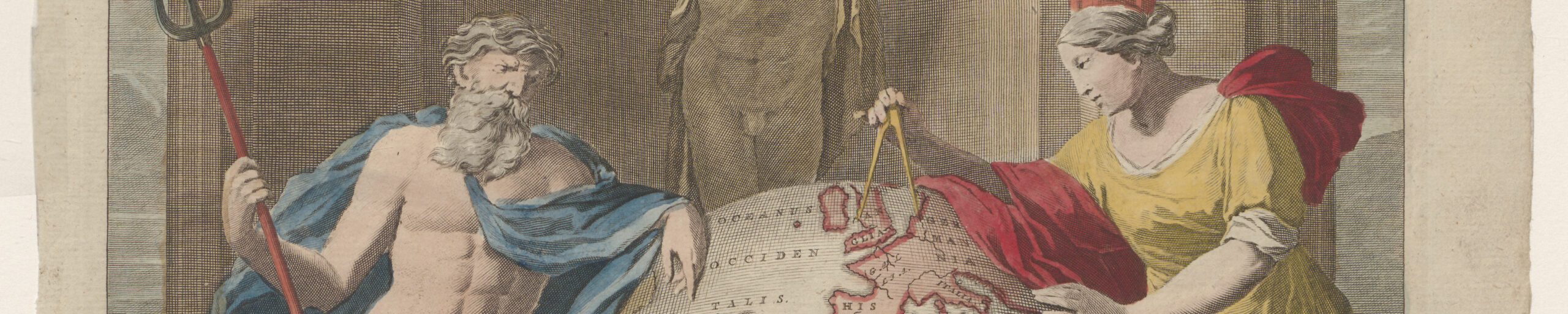
The consistent singing of the praises of the great value of the globe for navigation, by both scholars and globe-makers and its frequent use in iconography with a nautical connection (the title-pages of sea-atlases, prints of mariners giving instruction in seafaring, and in portraits of navigators), had an important side-effect. The globe became a symbol of navigation, and therefore a desirable object among Dutch merchants.
This ‘side-effect’ is of fundamental importance: not only did it produce an unequalled blossoming and expansion in the production of globes in early seventeenth century Amsterdam. It also made it possible to sell out-of-date globes. Those who purchased globes for their symbolic value, were not so concerned about having a scientifically accurate globe with all the most recent geographical and astronomical information. Its decorative aspect was of prime importance. It sometimes happened that globes a full century out of date were sold. Blaeu’s globes continued to be sold throughout the eighteenth century, at first new ones, but later as second-hand objects. During the same period, the modern globes of Valk could be bought, but these were less ornamental than those of Blaeu.
How and by whom were globes used?
Globes contributed in large measure to spreading knowledge of the new discoveries among interested members of the general public. In this, there is no real distinction between the globe and other cartographical aids such as wall-maps and atlases. But because of its three-dimensional form and its mobility, a globe had a greater appeal than mere maps and atlases.
During the course of the centuries, nothing has changed with respect to practical uses. There is merely a change in scale. Before the invention of the printing techniques necessary for reproducing the map of a globe (c. 1500) globes remained the costly possessions of just a few wealthy scholars, who (apart from their own private requirements) used them for teaching. After about 1500, individual aficionados could also afford to purchase a pair of globes with their accompanying handbook. Improved techniques of gravure ensured larger editions and greater familiarity with the globe. Ultimately, the use of lithography ensured that every stratum of society could make the acquaintance of a globe. In the course of two centuries the ‘editions’ of printed globes increased in size from some tens of hundreds to several thousands. The price of a single globe dropped dramatically, so that while in the sixteenth century globes remained the prerogative of an educational elite, by the nineteenth century they had become a familiar object in schools and private houses. Large publishing firms made globes specifically for the school classroom (Vandermaelen) or to be put into children’s bedrooms (Klinger).
Were the globes really ever used? In the case of globes bought by private individuals to be put into their drawing-rooms, libraries or studies, the answer to this question is no. When the globe was newly purchased, one tried out all its uses. Once the novelty had gone, the globe remained where it was, as an ornamental object. Consider the situation of the reading-circle at Cadzand, where the pair of globes, after they had been lent out to each member of the group for a month, remained entirely unused. Vandermaelen himself wrote without exaggeration in his catalogue that his ‘Globes de Cabinet’ were elegant pieces of drawing-room furniture. The reader of this study should ask himself, if he is the owner of a modern globe, how often he makes use of it. His case will probably be the same as that of the author, who had a 33 cm Political globe made by Paul Räth in 1968, which is a virtually never used obstruction in his study.
The only real use of globes is in connection with teaching, both in the past and in the present. The convex surface of the earth, together with the system of coordinates defined by latitude and longitude, the cycle of day and night, the seasons and so on, can readily be demonstrated using a terrestrial globe. Because the terrestrial globe has a cartographic image which faithfully retains surface, angular and distance relationships (that cannot be reproduced in a mere two-dimensional map), it is pre-eminently suitable for comparisons of size, geographical arrangement and distances, or for measuring them.
The best use of the globe is hindered by the fact that it can only be used in one-to-one tuition or within a very small group. In a classical context, every pupil should have his own globe. In the 1930’s Robert Haardt developed a small globe, the ‘Rollglobus’, for just this purpose. In Austria this globe was used in large numbers by schools: by 1978 some 5,000 had been sold. In the Netherlands there is still no question of such a thing. The use of the globe in Dutch education was explained by Ormeling in the following terms: ‘The beginning of the Dutch school year brings unavoidably with it the following familiar picture in many a geography class: the teacher climbs onto a wobby chair, fetches the globe carefully from the cupboard, and amid general laughter blows away a layer of dust (to the accompaniment of the annual joke: “that represents the snowstorms at the North Pole”) and then goes on to explain to the first or second formers the meaning of lines of latitude and longitude. Once he considers that he had achieved his intentions, after a lesson or two (or maybe even three), the globe disappears again to resume its exalted position until the end of August in the following year’.
Celestial globes served as an aid in learning to recognize the movement of the heavens and the constellations, and as such were used in teaching astronomy. Astronomers used celestial globes to mark-in their new observations. Modern methods of observation and calculation make the use of a celestial globe superfluous. Since the nineteenth century, ever fewer celestial globes have been made. Astronomy is no longer taught in elementary of intermediate education. The construction of the celestial globe, based in an outmoded theory (with an inverted image of the sky), is too complex for most ordinary individuals to understand.
The ultimate answer to the question by whom and how globes were used can be stated as follows. Globes which in the course of the centuries have been made in ever-increasing numbers, have a primarily decorative function. Their usefulness as demonstration aids was exploited to only a limited extent. The ‘users’ of globes were, and still are, those who could afford them and because of their interest, ostentation or for aesthetic reasons wanted a (pair of) globe(s); then, secondly, those who received instruction using a globe (at school). Due to more rapid methods of manufacture and the concomitant reduction in price, the group of potential owners has become increasingly larger during the course of the centuries.
Old globes now have a high scientific and decorative value. Their scientific value lies principally in the fact that, although they were put to little use, they served to spread new ideas about geography and astronomy among the general public. One also finds globes beyond a specifically geographical or astronomical context. The mapping of the terrestrial globe shows the modern viewer what the concept of the world was like in the past, what ideas people had about unknown regions, and which areas were then of principal interest. Old celestial globes show in a direct manner the progress in our understanding of the stars. Their art-historical value (for example the pictures of the different constellations in celestial globes) although it has barely been touched on there, might also be taken into consideration.
The combination of scientific and decorative value has meant that a globe or a pair of globes forms an essential part of most exhibitions in the field of the history of science and the history of voyages of discovery.
Translation from the Dutch by dr. C.M.H. Harrison