MAPPÆ ANTIQUÆ
 Liber Amicorum Günter Schilder
Vriendenboek ter gelegenheid van zijn 65ste verjaardag
Essays on the occasion of his 65th birthday
Festschrift zur Vollendung seines 65. Lebensjahres
Mélanges offerts pour son 65ième anniversaire
Edited by Paula van Gestel-van het Schip and Peter van der Krogt with the collaboration of Marco van Egmond, Peter H. Meurer, Paul van den Brink and Edward H. Dahl
Utrechtse Historisch-Cartografische Studies, Utrecht Studies in the History of Cartography, vol. 6
Published by HES & De Graaf Publishers, ’t Goy-Houten
44 contributions by the major map historians of the world (see Table of Contents) in English, Dutch, German and French, all with English summaries. With full size facsimiles of the bird’s-eye views of Vienna by Jacob Hoefnagel (1640, 2nd state, six sheets + three text sheets) and by Folbert van Ouden-Allen (1686, six sheets).
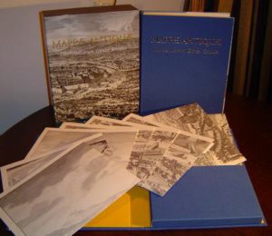
Folio (32 x 28 cm). Clothbound. 696 pp. with numerous illustrations in colour + two facsimiles (15 sheets).
ISBN 978 90 6194 479 9
Published by:
HES & DE GRAAF Publishers BV
Tuurdijk 16
3997 MS ’t Goy-Houten
The Netherlands
Content of this page
Editorial Foreword
Mappæ Antiquæ.. Oude Kaarten.. Early Maps.. Alte Karten..: Günter Schilder
This book about old maps is a Liber Amicorum that came about especially for a man who travelled to the farthest corners of the world to study those historic documents with love and passion throughout his entire life, then describing and analysing them down to the smallest detail. It was presented to him on 16 February 2007 by the editorial staff and all the others who worked on this publication to mark the occasion of his 65th birthday as well as the fact that he has been the holder for over 25 years of the only chair in the history of cartography in the world. The MAPPÆ ANTIQUÆ was presented to him during a study day organised especially for that purpose at the Marine Kazerne in Amsterdam.
Putting together this Liber Amicorum for Günter Schilder was an extraordinarily enjoyable task. A task that commenced during a flight from Madrid to Amsterdam on Sunday the 8th of July 2001. On the return flight from the International Conference on the History of Cartography in Madrid Paula van Gestel, Peter van der Krogt and Marco van Egmond were sitting side by side discussing the experiences of the previous days. Somewhere above Paris, some 10 kilometres up in the sky, the conversation was about Günter, his career and the top position that he had already held for over thirty years in historic cartography. And thus came about the idea of putting together a book of friends on the occasion of his 65th birthday, also his retirement age and probably the end of his official scholarly career. The list of participants in the programme of the conference in Madrid was a first guideline on the basis of which to approach some possible authors. Already in the aeroplane on the 8th of July 2001 some fifty scholars were selected and a provisional programme was prepared. A time schedule was established bearing in mind that potential authors would have to be given the opportunity to carry out new research on behalf of this special publication and to write an article about historic cartography that would not be published before that time. In the subsequent months, the plan was elaborated further. The first contacts with possible authors were established during the ICHC in Boston in July of 2003. Paula approached all the envisaged authors that were present and requested that they write their articles, at the latest by August 2005, in Dutch, German, English or French, whichever one they preferred. All of this had to remain, of course, strictly top-secret. After the conference in Boston the remaining authors, those not in that city, were contacted in writing. The reactions were overwhelming and extraordinarily enthusiastic. The demonstrated willingness to cooperate in this project was unprecedentedly great. Only some authors were unable to make their contributions, these for a variety of personal reasons. To balance this, however, by way of recommendations among the group a number of authors who had not yet been contacted ear-lier were added to the list of contributors.
The articles as these were written by the authors demonstrate a great variety of cartographic subjects and are sometimes very personal in nature. In addition, at the request of the editors the authors also wrote quite personal messages to or about Günter, placed before each article followed by the photo and signature of the relevant author. Thanks to the decision to invite as many colleagues from around the world as possible to collaborate on this publication, the editors observed that a very high scholarly level was realized. In view of the professional status of Günter Schilder himself this fact was a significant objective from the very beginning.
The editorial staff did not become involved in the scientific content of the articles. Final editing concer-ned only making notes and literature lists uniform, organizing the illustrations and having the necessary translations carried out. The editors have accepted a differentiation between British English and American English and in the Dutch spelling of cartography: cartografie or kartografie – to name just a few occasions where the author’s choice prevailed. The articles are classified according to topic. The editors strove to achieve a logical organisation of themes with the greatest emphasis being placed on the subject of the contribution and not the nationality of the author or the order of his name in the alphabet.
Unfortunately a number of authors that the editors would have liked to have participated do not appear in this publication. In 2001 the plan was that Günter’s ‘cartographic father’, Nico Israel, would write the foreword. Lord Wardington was originally also to be one of the authors. Alas both gentlemen died a few years ago. The contribution of Professor Cornelis Koeman, Günter’s illustrious predecessor, is also lacking in this publication, because his health no longer permitted participation. He died in June of 2006. Two authors, however, do indeed appear posthumously in this book. Klaus Stopp, who also died in the sum-mer of 2006, also made a contribution to this work thanks to the help of Peter Meurer. David Woodward, one of Günter’s most prominent colleagues, wrote his article in draft form before he died in 2004. Matthew Edney completed his contribution. The editors consider it a great honour that these two good friends of Günter were able to be part of his Liber Amicorum posthumously.
The realisation of a publication such as this would not have been possible without the assistance of many people. First of all we would like to thank the authors themselves. It is impossible to publish a book without authors. They spent many hours writing their articles. The editing of the English language con-tributions would not have been possible for the Dutch speaking editors without the aid of Ed Dahl, ‘EDitor’ par excellence. The expertise of Peter Meurer was vital when it came to editing the articles in German. Our thanks also go to Tony Campbell for writing a magnificent foreword. The result is now complete. A remarkably impressive publication with a portfolio with two facsimiles, together in a splendid cassette, all of this the joint result of the labours of a total of 54 authors from sixteen countries, six editors and a great number of sponsors. For this latter aspect the editors are very grate-ful to Hans Kok, whose tremendous efforts were of extraordinarily great importance. This publication can certainly be called unique, not last of all due to the definitely unique and very special collaboration between the two cartographic publishers who played and continue to play a great role in the publication of the works of Günter Schilder himself. Publishing house Canaletto/Repro-Holland, responsible for the production and publication of Günter’s magnum opus Monumenta Cartographica Neerlandica, generous-ly assumed responsibility for the production of facsimiles of two multi-sheet town views of Vienna. HES & DE GRAAF Publishers, responsible for the production and publication of the Utrecht Studies in the History of Cartography of the research programme Explokart, was magnanimous with its work on behalf of the production of this Liber Amicorum.
Now, after six years of preparation, intensive contact with dozens of authors, after a few thousand e-mails, letters and telephone calls, the Liber Amicorum Günter Schilder, (code name LAGS), is ready. The edito-rial staff and the authors wish to direct a personal word to Günter:
Foreword by Tony Campbell
Professor Günter Schilder has transformed the study of sixteenth and seventeenth century Dutch printed maps. Indeed, through his efforts it has become the best-documented chapter in what – given the Dutch dominance in that period – is a history we all share. He has done this first by identifying the corpus of relevant maps, and then by describing and displaying them.
The ‘Mapfinder Extraordinary’ – and I am disappointed that so fitting a term, proposed 20 years ago, has yet to be adopted – has unearthed more maps ‘flushed out of an obscure archive and exposed to the light of scholarship’ (in Robert Karrow’s neat phrase), than almost all the rest of us combined. I do hope he has intentionally left a few for later generations to find.
Günter’s greatest discovery, surely, was finding the 1636 Visscher wall-map, already immortalised in Vermeer’s ‘The Art of Painting’. Volume 1 of his Monumenta Cartographica Neerlandica (MCN) described the bald facts of how this had been rolled up ‘in a chest (erroneously thought to be the wood-en bottom of a large cupboard’. Yet the fuller story, as described by Marco van Egmond, was far more of a ‘Dan Brown’ moment: ‘No one believed me when I first suspected that the crate had a double bottom. But when a cabinetmaker was called in to help, with many creaks and groans a second drawer was indeed uncovered full of old maps’. Who holds the paperback rights to the memoirs of this ‘excellent detective’ (as Catherine Delano Smith called him), the cartographic Hercule Poirot?
Günter has a marvellous memory. His head is less a map than a combined cartobibliography and loca-tion list. Mention any map to him and he will tell you the location of the other seven known copies. Peter Barber and I ‘discovered’ (even though it had been in the British Museum/Library since 1753) a map of Portugal that Jodocus Hondius had produced in 1592, during his time in London. Günter told me it was only the second copy known to him. The other, he told us, was also in the British Library and, again, uncatalogued.
I was delighted to read that Günter always referred to MCN as ‘my Monuments’, since for me, from the time Volume 1 appeared in 1986, the series could only be ‘Monumenta Guenteriana’. Robert Karrow ended his review of the latest MCN volume (in Imago Mundi, 58:1) in pure admiration:
‘Gazing at the seven sturdy blue volumes, each with its accompanying portfolio, one is faced with one of the most ambitious and useful publications ever to grace the history of cartography, and one that will still be consulted a century from now… Contemplating the series as a whole, and the even more ambitious ‘Explokart’ programme, of which MCN is just a part, one simply stands in awe of the single-mind-ed vision, scholarship, dedication, management and mentoring skills of the indefatigable Dr Schilder.’
In his contribution to this volume, Peter Barber has asked, ‘has any author believed more fervently in his work – and with more justification?’. At the British Library we saw that determination at first hand when he persuaded the Reprographics department to alter the way they always filmed uncoloured engravings. They had been taught to value tonal balance, not clarity. As a result, the BL material in future MCN volumes was of much higher quality. I hope other scholars and their publishers will have benefited from Günter’s insistence.
A professor is both a scholar and a teacher. When Günter was appointed in 1981 to the history of cartography chair at the University of Utrecht – the first such post in the world – he set about training up others in what was then an unstructured field. These included doctoral students and some 50 ‘volun-teers’ in the amazing ‘Explokart’ project. The results can be seen in this volume, whose contributors include – taking their rightful place in a roll-call of the leading members in this field – the following: Paul van den Brink, Marco van Egmond, Marc Hameleers, Elger Heere, Peter van der Krogt and Martijn Storms. Those, and others, write of his genuine engagement with their projects, his kindliness and sensitivity.
Sowing seeds for others to reap is another mark of a good teacher. Agustín Hernando’s chapter is inspired by a discussion he had with Günter in 1991, while Philip Burden’s is the result of the ‘inspira-tion’ of a talk they had in Antwerp in 1994 – examples of desert flowers blooming.
Günter and I must have met at the 1971 International Conference on the History of Cartography in Edinburgh, where each of us gave our first ICHC papers, both on Dutch subjects. In the 35 years since, he has become a ’towering figure in the field of historical cartography’ (the accolade is from Kazimierz Kozica, who has yet to meet him face to face) and undeniably one of the giants in our field. When he suggested that he should resign as a Director of Imago Mundi Ltd, because he had served for twenty years and was now ‘retired’, there was an outcry of protest at our annual meeting. We needed him for our status as the coordinating body of the ICHC meetings. Happily, he has remained to provide us with further sound advice and independent opinions.
At that same 1971 conference, Eila Campbell or Helen Wallis (which was it?; they always seemed insep-arable) described Günter as ‘an Austrian gift to the Netherlands’. I never dared disagree with either Eila or Helen but I think that now they would perhaps rephrase that as an Austrian gift to the world. The internationality of the subject, and Günter’s part in it, are emphasised repeatedly in this volume: by the range of nationalities represented and subjects tackled, and by the frequent mentions in the ‘personal note’ sections of meetings in different cities. Günter has written almost exclusively about Dutch maps, i.e. those produced in the Netherlands, but these maps cover the world. And, significantly, the most recent volume of MCN is entirely in English. Even if its sub-title’ (‘Stimulator and driving force of Dutch cartography’) referred there to the book’s subject, Cornelis Claesz., it applies equally to the book’s author.
Henrik Dupont, of the Royal Library in Copenhagen, describes finding a special drawer labelled ‘Schilder – rarities’. I do hope that is still there because Professor Schilder is, surely, the greatest rarity of us all. Finally, on a personal note, may I welcome you, Günter, to the ranks of those who have reached the age of full maturity, and wish you every success in what will surely be a thoroughly productive period of your ‘full-time’ retirement.
Table of Contents
Foreword by Tony Campbell 11
Editorial Foreword by Paula van Gestel-van het Schip 13
Alphabetical list of contributors 15
Congratulations
Edward H. Dahl Congratulations 17
Thomas Niewodniczanski Epistola gratulatoria für Günter Schilder 18
Hans Kok My life is a copperplate 22
Henk Deys Günter kept us off the streets 24
Life and work
Marco van Egmond Habsburger on the Dutch historical-cartographic throne: A bio-bibliography on Günter Schilder 27
Cartobibliographies
Peter van der Krogt ‘Dits ’t oogh van Oostenrijck, het trots en machtich Weenen’: Nederlandse stadsgezichten en plattegronden van Wenen 51
Hans-Uli Feldmann and Thomas Klöti Bernese maps as a symbol of state and religious independen ce 103
Albert Ganado The Maltese Islands in Flemish cartography 117
Matthew H. Edney Printed but not published: Limited-circulation maps of territorial disputes in eighteenth-century New England 147
Dennis Reinhartz The Dutch mapping of Saint Martin 159
Kenneth Nebenzahl Mapping Korea, a challenge to early mapmakers 167
Mapmakers
Robert Karrow Cartographers in Alba Amicorum 177
Rodney Shirley Netherlanders in Elizabethan England 187
Ivan Kupcík Die kartographische Tätigkeit von Augustin Herman (ca. 1621- 1686) – Realität und Fiktion 203
Peter H. Meurer Der Straßburger Kartenverlag Jacob van der Heyden 221
Rudolf Schmidt War Coronelli in Wien? 245
Dirk de Vries Jacob Mogge, gezworen landmeter van het Vrije van Sluis (ca. 1613-1669) 251
Carmen Líter Mayayo The cartographer Tomás López and his map of the route of Don Quixote and the places of his adventures 267
Klaus Stopp Drei Karten von Francesco Sabatini 281
Maps
Ulla Ehrensvärd Eine schwedische Karte von 1533 in der Universitätsbibliothek Leiden 289
Leena Miekkavaara Which is which? Which is where? How to identify the two original copies of Olaus Magnus’ Carta marina of 1539 297
Marc Hameleers Het Von Reider-exemplaar: de oudste uitgave van de kaart van Amsterdam door Cornelis Anthonisz. (1544) 309
Peter Barber Putting Musselburgh on the map: Two recently-discovered cartographic documents from the ‘Rough Wooing’ 327
Egon Klemp Tilemann Stellas Karte vom Heiligen Land 339
Kazimierz Kozica Martin Helwig’s map of Silesia from 1561 – an unknown edition from 1612 345
Frans Depuydt en Joost Depuydt De metrische nauwkeurigheid van Ortelius’ Hispania Nova-kaart (1579) 359
Martijn Storms ‘Op ieder particuliere caart zal een compas moeten geteikent werden’: De kompasroos op prekadastrale kaarten in Nederland 373
Agustín Hernando The making of a highly persuasive and influential image: The first wall map of Catalonia (Vrients, 1606) 385
Jan Werner Joan Blaeus worsteling met de Waterlandse steden 399
Henrik Dupont Jens Sørensen’s two ‘lost’ maps of Denmark found 417
Willem Mörzer Bruyns Franse bronnen voor twee zeekaarten van Johannes van Keulen 429
S.J. de Groot en A.H. Huussen Jr. Cartografische en militaire aspecten van de geallieerde veldtocht in 1743 tijdens de Oostenrijkse Successieoorlog 439
Mary Sponberg Pedley A new and accurate map of the English empire in North America by a society of Anti-Gallicans (London, 1755) 449
David Cobb Two maps in one: A correct map of the United States with the West Indies by Samuel Lewis, 1813 459
Vladimiro Valerio Landscapes and Charting in the Nineteenth Century: Neapolitan-Austrian and English Cooperation in the Adriatic Sea 465
Alexey V. Postnikov L.A. Zagoskin’s expedition 1842-1844: On a history of Alaska’s mainland’s exploration and mapping 479
Atlases
Philip Burden The origins of the ‘miniature’ Speed atlas: The first atlas of the British Isles 497
Ferjan Ormeling De inhoud van de kaarten in de Atlas Isaak de Graaf 509
Lisette Danckaert Klein, fraai, onjuist: Een Franse atlas uit het midden van de achttiende eeuw 523
Paul van den Brink De voorgeschiedenis van de Atlas van Tropisch Nederland, 1905-1938: ‘Het atlas-drama van begin tot einde’ 533
Map Collections
David Buisseret Cardinal Mazarin’s supply of manuscript maps about 1650 555
Monique Pelletier Buache et le Dépôt des cartes, plans et journaux de la Marine: Les débuts d’une institution, le départ d’une carrière, 1721-1737 563
Kees Zandvliet The display of power and religion in the Dutch Governor’s house in Taiwan 579
Sjoerd de Meer en Irene Jacobs De collectie Bichon in het Maritiem Museum Rotterdam 595
Jan Mokre Das neue Globenmuseum der Österreichischen Nationalbibliothek im Palais Mollard 609
Map Use
Elger Heere Het lokaliseren van perceelkaarten: Methode voor een systematische benadering 617
Catherine Delano-Smith For whom the map speaks: Recognising the reader 627
David Woodward Did John Donne have a map in mind in Hymne to God, my God, in my sicknesse? 637
Summaries and Index
Summaries in English 647
General Index 667
Portfolio
To this publication belongs a portfolio with two facsimiles of bird’s-eye views of Vienna:
- Jacob Hoefnagel, bird’s-eye view of Vienna from the north, published by Claes Jansz. Visscher, Amsterdam, 1640 (second state) (nr. II in cartobibliography on p. 61) Six sheets: total size 72,5 x 150 cm, with three text sheets.
- Folbert van Ouden-Allen, bird’s-eye view of Vienna from the west, engraved by Joseph Mulder, 1686 (second state) (nr. VI in cartobibliography on p. 91-92) Six sheets: total size 74 x 150 cm.