12th International Conference on the History of Cartography
12e Congrès international d’histoire de la cartographie
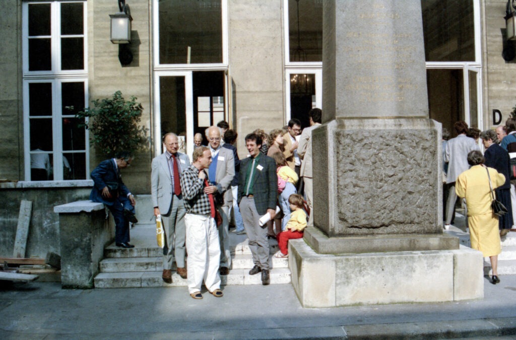
7-11 September 1987 — Paris
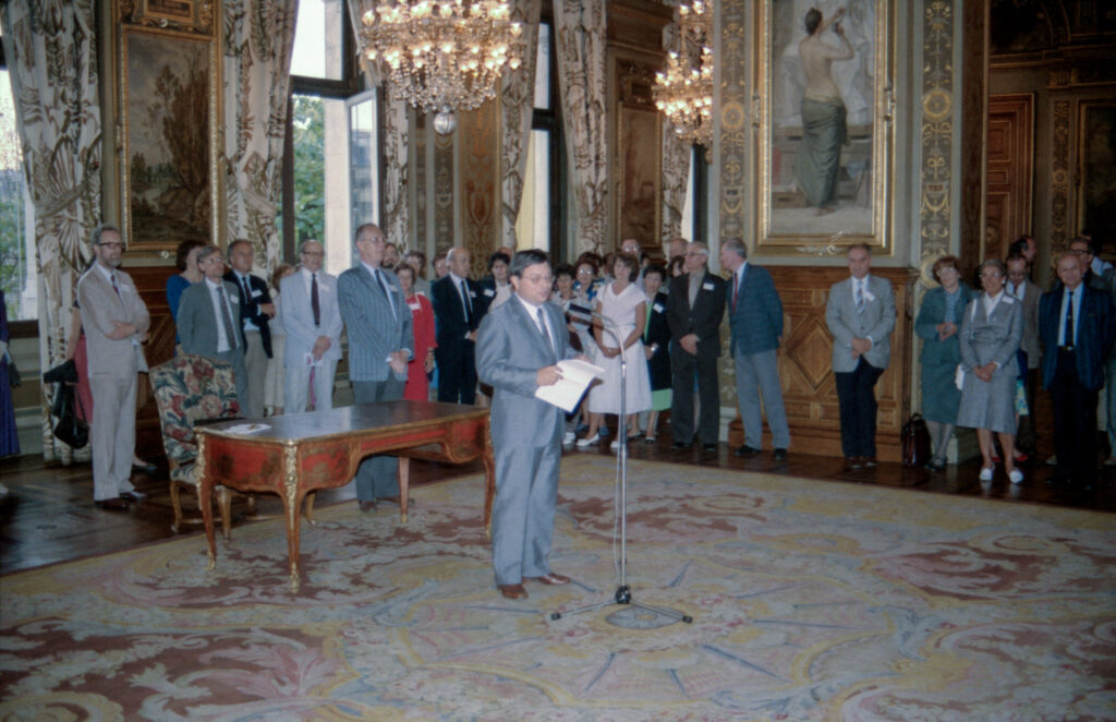
 Held at the Bibliothèque Nationale and the Ecole Nationale des Ponts et Chaussées, with main coordinators Monique Pelletier, Philippe Pinchemel, and Mirielle Pastoureau. Attendance was more than 200, from 24 countries. Conference languages were French and English, and simultaneous translation was provided for about half the sessions.
The thematic sections were:
- Medieval World Maps, co-ordinator: David Woodward
- Cartographic Methods in the Age of Great Discoveries, co-ordinators: (1) W.G.L. Randles and (2) Helen Wallis
- State and Cartography, with sub-sections:
- A. Cartography, War and Peace, co-ordinator: David Buisseret
- B. Cartography, Structures of the State, National Identity, co-ordinator: Daniel Nordman
- C. Frontiers and Creation of Territory, co-ordinator: J. Brian Harley
- D. Cadastral Mapping and Social History, co-ordinator: O.A.W. Dilke
- E. Cartography and the History of Science, co-ordinator: Ingrid Kretschmer
- Urban Historical Cartography, co-ordinator: Bruno Fortier
- Island Cartography, co-ordinator: Frank Lestringant
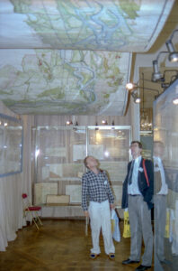 Four exhibitions were held,
- “Espace francais. Vision et aménagement, XVIe-XIXe siècle,” at the Archives Nationales (catalog (192pp));
- “La mesure du ciel,” at the Paris Observatory (catalog (67pp));
- “Océans des hommes,” at the Musee de la Marine (catalog (94pp));
- and one on 17th to 19th century plans of fortifications and towns, at the Hotel des Invalides.
There were 83 papers, full texts of most of which were distributed. This was the last ICHC where full texts of all, or most, papers were provided at the outset. There were several simultaneous sections, and even a triple one, so that no one person could hear all lectures, and this was a prime consideration in the establishment of a poster session beginning with the 13th ICHC.
Papers 12th ICHC
The sessions were not numbered. Each day there was in the morning and in the afternoon a set of parallel sessions.
* Papers published as Géographie du Monde au Moyen Age et à la Renaissance, ed. Monique Pelletier. (Comité des Travaux Historiques et Scientifiques, Mémoires de la section de géographie, 15) (Paris, 1989)
7 Sept. Opening session. Chair: Wolfgang Scharfe
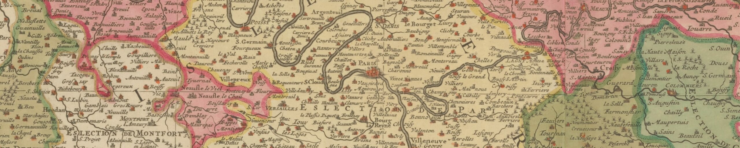
- Broc, Numa. La France de la Guillotière (1613). (8pp)
- Akerman, James; and Buisseret, David. L’etat comme patron invisible: Étude sur les cartes générales de toutes les provinces de France par Christophe Tassin. (7pp)
- Taylor, Kenneth L. New Light on Geological Mapping in Auvergne during the Eighteenth Century: The Pasumet-Desmarest Collaboration. (8pp)
- Jacob, Christian. Présentation des résultats de la Table ronde sur la cartographie antique (Paris, 2-4 septembre 1987).(The results of a round table before the conference.)
8 Sept. AM Session A: Theme 2, Cartographic Methods in the Age of Great Discoveries, 1st session. Chair: Luis G.M. de Albuquerque
- Michea, Hubert. Les marteloires et la coception des premières cartes marines 1290-1547, ou la projection d’un itinéraire à routes magnétiques succésives. (8pp)
- Mesenburg, Peter. Les portulans–geométrie et affinité. (7pp)
- *Hollander, Raymond d’. Méthodes de la cartographie des grandes découvertes. Historique de la loxodromie. (8pp)
- Hirsch, Bertrand. Les sources de la cartographie occidentale de l’Ethiopie (1450-1600): l’exemple des régions du lac Tana. (8pp)
- *Cerezo Martínez, Ricardo. Apport à l’étude de la carte de Juan de la Cosa. (8pp)
- Lagarde, Lucie. Guillaume Delisle et la Mer de l’Ouest: quelques précisions sur ses conceptions, tirées du Procès Delisle-Nolin et de ses relations avec le P. Jean Bobe. (2pp)
8 Sept. AM Session B: Theme 3A, State and Cartography: Cartography, War and Peace. Chair: Numa Broc
- Dilke, Oswald A. W., and Dilke, Margaret S. Marin Sanudo the Elder, Venetian Propagandist, and His Use of Maps. (6pp)
- Mikós, Michael J. Les rois polonais et la cartographie. (9pp)
- Brunner, Hans. Otto von Odeleben, ses rapports avec Napoléan et la cartographie saxonne. (7pp)
- Watelet, Marcel. La cartographie du nord et du nord-est de la France realisée entre 1816 et 1818 par les armées de la coalition. (6pp)
- Herb, G. Henrik. A Concern for Justice or Aspirations for Expansion? The German Cartographic Response to the Versailles Treaty Provisions for the Eastern Borders of Germany. (8pp)
8 Sept. PM Session A: Cartobibliography. Chair: Edward H. Dahl
- McCorkle, Barbara B. Problems of Cartobibliographical Description: The Example of a Work in Progress (9pp).
- Niewodniczanski, Tomasz. Imago Poloniae–Some Comments on the Methodology and Arrangements. (5pp,13pp,ill)
8 Sept. PM Session B: Theme 2, Cartographic Methods in the Age of Great Discoveries, 2nd session. Chair: Günter Schilder
- *Randles, W. G. L. From the Mediterranean Portulan Chart to the Marine World Chart of the Great Discoveries: The Crisis in Cartography in the 16th Century. (6pp)
- Marques, Alfredo Pinheiro. The Dating of the Oldest Portuguese Charts. (12pp)
- Richardson, W. A. R. Piloting a Toponymic Course through 16th-Century South-East Asian Waters. (8pp)
- Bye, John A. T. On the Inversion of the Waldseemüller (1507) Coastline of Eastern Asia as the Primogenitor of the Eastern Coastline of the Java-la-Grande on the Dieppe Maps. (8pp)
- McGuirk, Donald L. Ruysch World Map Census. (8pp)
- Hsu, Mei-Ling. Chinese Marine Cartography: An Analysis of the Sea Charts of the 15th-17th Centuries. (8pp)
9 Sept. AM Session A: Theme 3B, State and Cartography: Cartography, Structures of the State, National Identity, 1st session. Chair: Georges Reverdy
- Harley, John Brian. Secrecy and “Silences”: The Hidden Agenda of Cartography in Early Modern Europe. (15pp)
- Unno, Kazutaka. Government Cartography in Sixteenth Century Japan.
- Lindgren, Uta. Les frontières de l’Allemagne (le vieux Reich) dans la cartographie d’avant 1800. (8pp)
- Scharfe, Wolfgang. L’etat prussien et la cartographie prussiene au XVIIIe siècle. (9pp)
- Neumann, Joachim. The Beginning of Official Cartography in the Margraviates of Baden. (8pp)
9 Sept. AM Session B: Theme 1, Medieval World Maps, 1st session. Chair: Abbé Roger Desreumaux
- Woodward, David. Roger Bacon’s “Map” and Concepts of Coordinates in the Middle Ages. (7pp).
- *Lecoq, Danielle. La “Mappemonde” du De Arca Noe Mystica d’Hugues de Saint Victor (1125-1130). (14pp)
- *Wolf, Armin. News on the Ebstorf World Map (13th century). (1p)
- *Lindemann, Rolf. A New Dating of the Ebstorf Mappamundi. (7pp)
- *Haslam, Graham. The Duchy of Cornwall Map Fragment. (8pp)
- *Barber, Peter. Old Encounters New: The Aslake World Map. (8pp)
9 Sept. PM Session A: Theme 3C, State and Cartography: Frontiers and Creation of Territory. Chair: Eila Campbell
- Godlewska, Anne. Geography and Cartography in the Conquests of Egypt and Algeria: A Critical Exemplar Shift. (17pp)
- Boudreau, Claude. La carte du Bas-Canada de 1831: Reflet d’une realité et temoin des aspirations de l’Etat. (1p)
- Bosse, David. Cartography and Policy: The Proposed Town of Dartmouth, 1774. (7pp)
- Falk, Marvin W. Mapping Russian America, 1790-1867. (6pp)
9 Sept. PM Session B: Theme 5, Island Cartography, 1st session. Chair: André Roubertou
- Abeydeera, Ananda. Aspects mythiques de la cartographie de la Ceylon de l’Antiquité à la Renaissance. (8pp)
- *Gambin, Marie-Thérèse. L’Ile de Taprobane: problemes de cartographie dans l’Ocean Indien. (6pp)
- *Aujac, Germaine. L’Ile de Thule, de Pythéas à Ptolémée. (8pp)
- *Prontera, Francesco. La cartographie des îles: mythe et réalité dans l’Antiquité. (8pp)
- *Turner, Hilary Louise. Christopher Buondelmonti: Adventurer, Explorer and Cartographer. (8pp)
- Tajoli, Luciano. Atlantic Isles in the Maps of Andrea Bianco 1436. (8pp)
10 Sept. AM Session A: Theme 3D, State and Cartography: Cadastral Mapping and Social History. Chair: George Kish
- Kain, Roger J. P. The State and Cadastral Mapping: The English Government’s Mid-Nineteenth-Century Tithe Surveys. (9pp)
- Branca, Lodovico. La collection de l’Archive “Capitani di Parte Guelfa” nommée “Popoli e Strade” come exemple de réproduction systematique du territoire autour de Florence à la fin du 16e siècle. (6pp)
- Vivoli, Carlo. Cartographie et institutions: les plans des fiefs de la Toscane du XVIIIe siècle. (8pp)
- Beech, Geraldine. Cartography and the State: The British Land Registry Experience. (8pp)
- Baptiste, Gérard. Aux origines du cadastre napoléonien: le bureau du cadastre (1791-1802). (6pp)
10 Sept. AM Session B: Theme 4, Urban Historical Cartography, 1st session. Chair: Bernard Rouleau
- Salgaro, Silvino. La cartographie en tant que methode de gestion territoriale/le cas de la Republique de Venise. (9pp)
- Stochdorph, Otto. Some Cartographical Data on the Circular “Puerschgerichtskarte” (1564) of Rottweil on the Neckar (Southern Germany). (5pp,1ill)
- Colletta, Teresa. La cartographie historique des villes aux seizième et dix-septième siècle: les techniques diverses des représentation: le cas de Naples. (8pp)
- Greiner, Piotr. Problems in the Study of the History of the Urban Cartography of the Upper Silesia. (2pp)
- Scurfield, Judith M., and Scurfield, G. The Cartographic Record of Urban Development in Victoria, Australia. (8pp)
10 Sept. PM Session A: The Teaching of the History of Cartography: essentials of the curriculum. Chair: Dennis Reinhartz
- Campbell, Eila M. Core Training for Historians of Cartography.
- Harley, John Brian. The Role of Theory in the History of Cartography.
- Kretschmer, Ingrid. Integrating the History of Surveying into the History of Cartography.
- Solnick, Bruce B. History of Discovery and Exploration.
- Wolter, John A. The Development of Map Collections.
10 Sept. PM Session B: Theme 3D, State and Cartography: Cadastral Mapping and Social History, 2nd session Chair: O.A.W. Dilke
- Kawamura, Hirotada. Kuni-ezu (Provincial Maps) Compiled by the Tokugawa Shogunate in Japan. (7pp)
- Postnikov, Aleksei V. On the History of Cartographic Studies of Forest and Land Resources of the Non-Chernozem Area in the First Half of the 19th Century. (5pp)
10 Sept. PM Session C: Theme 3B, State and Cartography: Cartography, Structures of the State, National Identity, 2nd session. Chair: Daniel Nordman
- Babicz, Józef. Le Cardinal Guillaume Fillastre (1347-1428) rédacteur présumé de la carte utiliseé pendant le procès polono-teutonique. (8pp)
- Kish, George. Spoken Language and Nationality as Shown on Lipszky’s Map of Hungary (1806). (7pp)
- Danckaert, Lisette. Symbiose Etat-privé dans la cartographie belge du 19e siècle. (5pp)
10 Sept. PM Session D: Theme 4, Urban Historical Cartography, 2nd session. Chair: Teresa Colletta
- Kinniburgh, Ian A. G. David Reid’s Plan of Greenoch 1818. (8pp)
- Faucherre, Nicolas, and Prost, Philippe. Les plans relief: une source pour l’histoire urbaine.
- Fortier, Bruno. Paris, un atlas des formes urbaines.
- Rouleau, Bernard. Lecture et aménagement d’un espace urbain a partier des plans parcellaires anciens. (4pp)
11 Sept. AM Session A: Theme 3E, State and Cartography: Cartography and the History of Science. Chair: Jean Carré
- Cook, Karen S. Design Sources of the First Ordnance Geological Survey Map: Henry T. de la Beche and the Geological Society of London. (7pp)
- Bressolier, Cathérine; and Menanteau, Loîc. La carte mémoire d’une époque: les littoraux de la Basse Andalousie (Espagne) et du Bassin d’Arcachon (France) du milieu du 17e siècle au debut du 19e. (7pp)
- Kretschmer, Ingrid. Austrian Innovations in 19th Century Cartography. (10pp)
- Monmonier, Mark S. Telegraphy, Iconography, and the Weather Map: Cartographic Weather Reports by the United States Weather Bureau, 1870-1935. (8pp)
- Karrow, Robert W. Star Time and Telegraph: The United States Coast and Geodetic Survey and the Development of a World-Wide Telegraphic Longitude Network, 1846-1904. (8pp)
11 Sept. AM Session B: Theme 1, Medieval World Maps, 2nd session. Chair: Danielle Lecoq
- McCune, Shannon. The Chouha-Do–a Korean World Map. (7pp)
- *Szykula, Krystyna. Pseudo-Medieval Fabulous French Wall Map of the World. (8pp)
11 Sept. AM Session C: Theme 5, Island Cartography, 2nd session. Chair: Frank Lestringant
- *Washburn, Wilcomb E. The Form of Islands in Fifteenth, Sixteenth and Seventeenth Century Cartography. (8pp)
- *Ozanne, Henriette. La découverte cartographique des Moluques. (8pp)
- Reinhartz, Dennis. Additions to the Gulf and Indies Maps of Herman Moll. (8pp)
- Solnick, Bruce B. West Indian Islands: Maps and Descriptions, Especially the Eighteenth Century. (11pp)
Not listed in the program book
- Birkenmajer-Borowiejska, Maria. Deux cartes anciennes de Cracovie–exemple de l’action cartographique in Pologne dans la deuxieme moitié du 18. siècle. (6pp)
- Bourgoin, Jean. L’hydrographie française.
- Pelletier, Monique. Département des cartes et plans [Bibliotheque Nationale, Paris]. (7pp)
- Pelletier, Monique. Evolution de la carte de France.
- Stoksik, Janina. Les plans connus et inconnus de la ville de Cracovie du XVIIe et du XVIIIe siècles et leur rapport à l’Université Jagellonne. (7pp)
- Traczewska-Białek, Zofia. Sur les fondaments géodésiques et sur la valeur cartométrique des anciennes cartes à grande échelle de la ville de Cracovie du XVIIe siècle jusqu’au XIXe siècle. (7pp)
References
Imago Mundi 40 (1988): 131-33 (Dörflinger)
Mapline 48(1987): 1-7 (Godlewska), which I have not been able to consult.
Kartographische Nachrichten 37(1987) 6: 237-39 (Scharfe)
Österreichische Geographische Gesellschaft, Mitteilungen 129(1987): 176-79 (Kretschmer)
Geographische Gesellschaft in München, Mitteilungen 73 (1988): 205-07 (Kupcík)
Acta geographica 73 (1988) 1: 45-48 (Pelletier)
Società Geografica Italians, Bollettino ser. 11, vol. 4(1987): 560-62 (Gasti Moreschi)
The Map Collector 41(Winter,1987): 44 (anon.)
Geographische Berichte 33(1988) 2: 141 (Brunner).